Airport runways
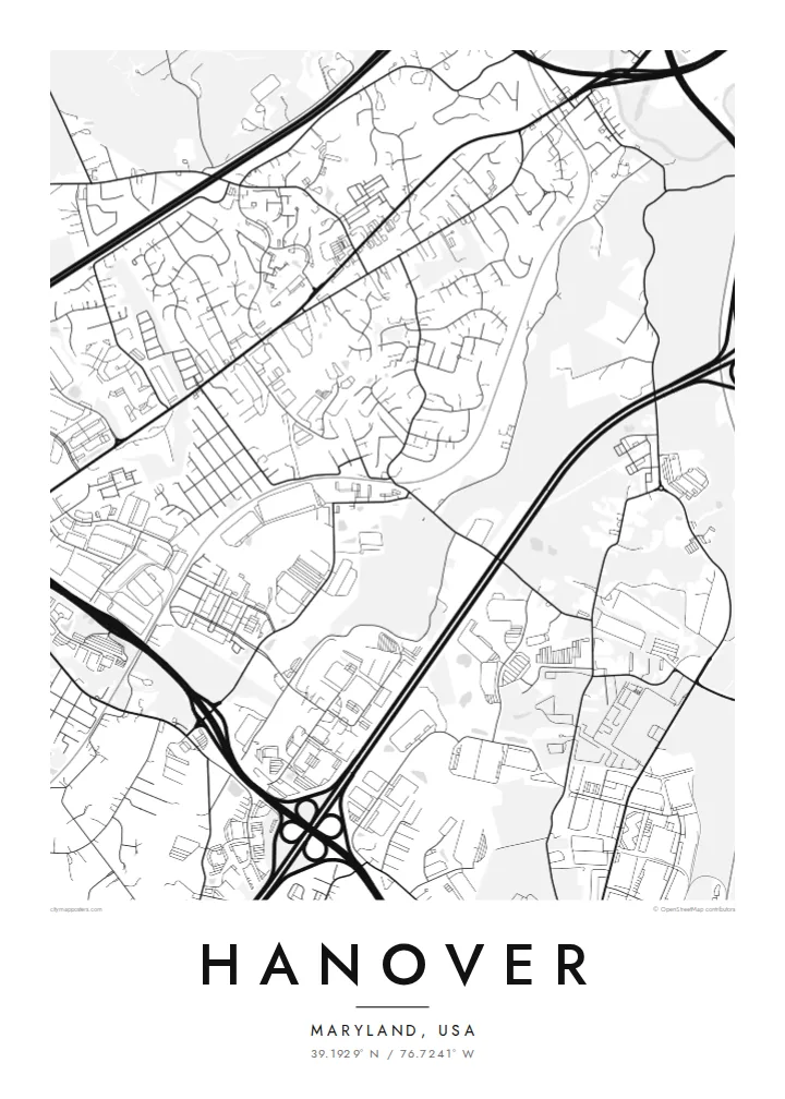
The long straight runways of BWI Airport lie just east of Hanover. They form bold geometric strokes that contrast with the curving residential streets.
Minimalist map poster · United States
39.1929° N / 76.7241° W
A Maryland suburb of curving streets and business parks, bounded by highways and BWI Airport's runways.
One city, five moods
Tap a style to see it on the wall. Every style costs the same — printed, framed or as HD files.
 Actual pixels · 24 × 36″ print file
Print-sharp
This is a 100% crop of the real print file. Every poster — printed, framed or downloaded — is rendered on our servers at 300 DPI, up to 7,200 × 10,800 pixels, so even the smallest lanes stay crisp on a 24 × 36″ print.
On the wall


The map
Hanover is an unincorporated community in central Maryland, spread across the border between Anne Arundel and Howard counties, between Baltimore and Washington. Its map is a portrait of modern American suburbia: few straight grids and many curving residential streets, cul-de-sacs and loops, with large commercial parcels in between.
Major roads define the area. Highways and parkways cross it and meet at big interchanges, and Baltimore/Washington International Airport lies just to the east, where its runways form some of the boldest shapes on the map. Arundel Mills, a large shopping and entertainment complex that includes a casino, occupies a wide block near the highways.
A Hanover map poster turns this landscape into something unexpectedly graphic. Looping subdivision streets, the straight lines of runways and the curves of interchanges together form an interesting pattern. It suits people who live here or who worked near the airport and Fort Meade, and anyone who likes the look of a suburban plan.
The long straight runways of BWI Airport lie just east of Hanover. They form bold geometric strokes that contrast with the curving residential streets.
The large Arundel Mills complex fills a broad block near the highways. Its big footprint and parking areas stand out on the map.
Residential neighbourhoods are built around curving streets and cul-de-sacs, creating the organic, branching pattern typical of late twentieth-century American suburbs.
Make it yours
Add a date, a name or a line of your own, switch style, size or orientation.
The free preview is low-resolution with a watermark. Prints and HD files are rendered at 300 DPI, up to 7,200 × 10,800 px, without a watermark.
Why Hanover
Hanover is a place people move to for work, family and commuting convenience, and a map of the first home or the neighbourhood where the kids grew up is a personal way to mark that chapter.
Add your street name or family name to the title, include a move-in date and adjust the coordinates line. Choose Classic black & white, Noir, Paper, Blueprint or Sand. The 18×24″ and 24×36″ sizes fit standard US frames.
Order the Hanover poster| Print size | Resolution | Files |
|---|---|---|
| 30 × 40 cm11.8 × 15.7″ | 3,543 × 4,724 px | PNG · PDF |
| 29.7 × 42 cm (A3)11.7 × 16.5″ | 3,508 × 4,961 px | PNG · PDF |
| 42 × 59.4 cm (A2)16.5 × 23.4″ | 4,961 × 7,016 px | PNG · PDF |
| 45.7 × 61 cm18 × 24″ | 5,400 × 7,200 px | PNG · PDF |
| 50 × 70 cm19.7 × 27.6″ | 5,906 × 8,268 px | PNG · PDF |
| 61 × 91.4 cm24 × 36″ | 7,200 × 10,800 px | PNG · PDF |
For comparison, the free preview is 900 px wide, watermarked and meant for screens. The HD files have up to 8× the resolution in each direction and print cleanly at full poster size.
Pick a style at the top of the page, then choose Printed Poster — a size and, if you like, a frame — or Digital HD Files. Checkout takes one step, and your order page updates as soon as the payment goes through.
It is printed on premium 200 gsm matte paper in one of six sizes, from 30 × 40 cm to 24 × 36″. Printed posters start at $39, shipping included.
Yes. Choose a solid wood frame in black, white, natural oak or dark wood. It comes with shatterproof glazing and is ready to hang. Framed posters start at $99, shipping included.
Shipping is free to 60+ countries. Each poster is printed by the nearest of our print partners in 30+ countries and usually arrives in 3–7 business days. You can follow the status and tracking under My Orders. A few countries take 2–5 weeks, and where we don't ship yet, the site tells you before you pay.
Send us a photo within 14 days of delivery and we will reprint it for free or refund you.
Yes. In the editor on this page, change the title, the subtitle and the coordinates line to anything you like, and pick a style and size. Printed, framed and digital orders all use exactly your design.
For $9 you get 300 DPI PNG and print-ready PDF files in all six sizes, without a watermark, to print anywhere. Not sure yet? Download a free watermarked preview first.
Nearby
