Planned centre
The town centre shows the straight streets and regular blocks of a place that grew quickly in the nineteenth century. It reads as a clean, orderly core on the map.
Minimalist map poster · Denmark
56.1362° N / 8.9766° E
A Jutland town that grew from the heath into a planned grid, ringed by roads, arenas and open countryside

One city, five moods
Tap a style to see it on the wall. Every style costs the same — printed, framed or as HD files.
 Actual pixels · 24 × 36″ print file
Print-sharp
This is a 100% crop of the real print file. Every poster — printed, framed or downloaded — is rendered on our servers at 300 DPI, up to 7,200 × 10,800 pixels, so even the smallest lanes stay crisp on a 24 × 36″ print.
On the wall
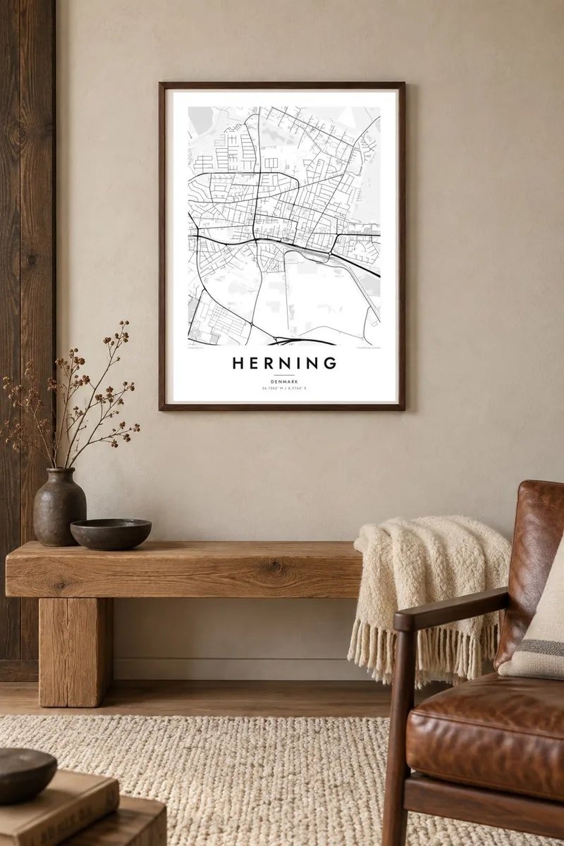


The map
Herning is a relatively young town in Central Jutland. It grew in the nineteenth century on what had been open heathland, and textile manufacturing drove much of its growth. On a map, the centre shows straight streets and regular blocks. Ring roads and newer districts spread out in wide arcs, and fields and scattered plantations fill the land beyond.
The town has become known for large events and modern art. MCH, one of the largest exhibition centres in Denmark, and the Jyske Bank Boxen arena sit on the edge of town and appear on the map as broad, open shapes. HEART, the Herning Museum of Contemporary Art, and the Carl Henning Pedersen and Else Alfelt Museum carry on a long local link between industry and art.
Near the motorway stands Elia, a large sculpture by Ingvar Cronhammar, a domed structure visible from far off. A Herning map poster shows the town's clear structure. It has a planned centre, circling ring roads and large venues at the edges, all set in the flat, open land of mid-Jutland.
The town centre shows the straight streets and regular blocks of a place that grew quickly in the nineteenth century. It reads as a clean, orderly core on the map.
Roads loop around the town in wide curves and separate the centre from outer neighbourhoods. They give the composition a clear, circular structure.
The exhibition centre and arena lie on the town's edge. On the map they appear as large, open shapes surrounded by parking and access roads.
Make it yours
Add a date, a name or a line of your own, switch style, size or orientation.
The free preview is low-resolution with a watermark. Prints and HD files are rendered at 300 DPI, up to 7,200 × 10,800 px, without a watermark.
Why Herning
For people from Herning, visitors to its trade fairs and concerts, and fans of its art museums, this map shows a town that has made much of flat land. The clear structure looks good in a minimalist setting.
You can customise the title, subtitle and coordinates line with a family name, an event date or a personal message. Five styles are available: Classic black & white, Noir, Paper, Blueprint and Sand.
Order the Herning poster| Print size | Resolution | Files |
|---|---|---|
| 30 × 40 cm11.8 × 15.7″ | 3,543 × 4,724 px | PNG · PDF |
| 29.7 × 42 cm (A3)11.7 × 16.5″ | 3,508 × 4,961 px | PNG · PDF |
| 42 × 59.4 cm (A2)16.5 × 23.4″ | 4,961 × 7,016 px | PNG · PDF |
| 45.7 × 61 cm18 × 24″ | 5,400 × 7,200 px | PNG · PDF |
| 50 × 70 cm19.7 × 27.6″ | 5,906 × 8,268 px | PNG · PDF |
| 61 × 91.4 cm24 × 36″ | 7,200 × 10,800 px | PNG · PDF |
For comparison, the free preview is 900 px wide, watermarked and meant for screens. The HD files have up to 8× the resolution in each direction and print cleanly at full poster size.
Pick a style at the top of the page, then choose Printed Poster — a size and, if you like, a frame — or Digital HD Files. Checkout takes one step, and your order page updates as soon as the payment goes through.
It is printed on premium 200 gsm matte paper in one of six sizes, from 30 × 40 cm to 24 × 36″. Printed posters start at $39, shipping included.
Yes. Choose a solid wood frame in black, white, natural oak or dark wood. It comes with shatterproof glazing and is ready to hang. Framed posters start at $99, shipping included.
Shipping is free to 60+ countries. Each poster is printed by the nearest of our print partners in 30+ countries and usually arrives in 3–7 business days. You can follow the status and tracking under My Orders. A few countries take 2–5 weeks, and where we don't ship yet, the site tells you before you pay.
Send us a photo within 14 days of delivery and we will reprint it for free or refund you.
Yes. In the editor on this page, change the title, the subtitle and the coordinates line to anything you like, and pick a style and size. Printed, framed and digital orders all use exactly your design.
For $9 you get 300 DPI PNG and print-ready PDF files in all six sizes, without a watermark, to print anywhere. Not sure yet? Download a free watermarked preview first.
Nearby
