BR-010 highway
The Belém–Brasília highway passes the town and is its main link to the rest of Brazil. It forms the strongest, straightest line on the map.
Minimalist map poster · Brazil
2.5578° S / 47.4950° W
A frontier town on the Belém–Brasília highway, set in a large Amazonian municipality of rivers, pasture and remaining forest

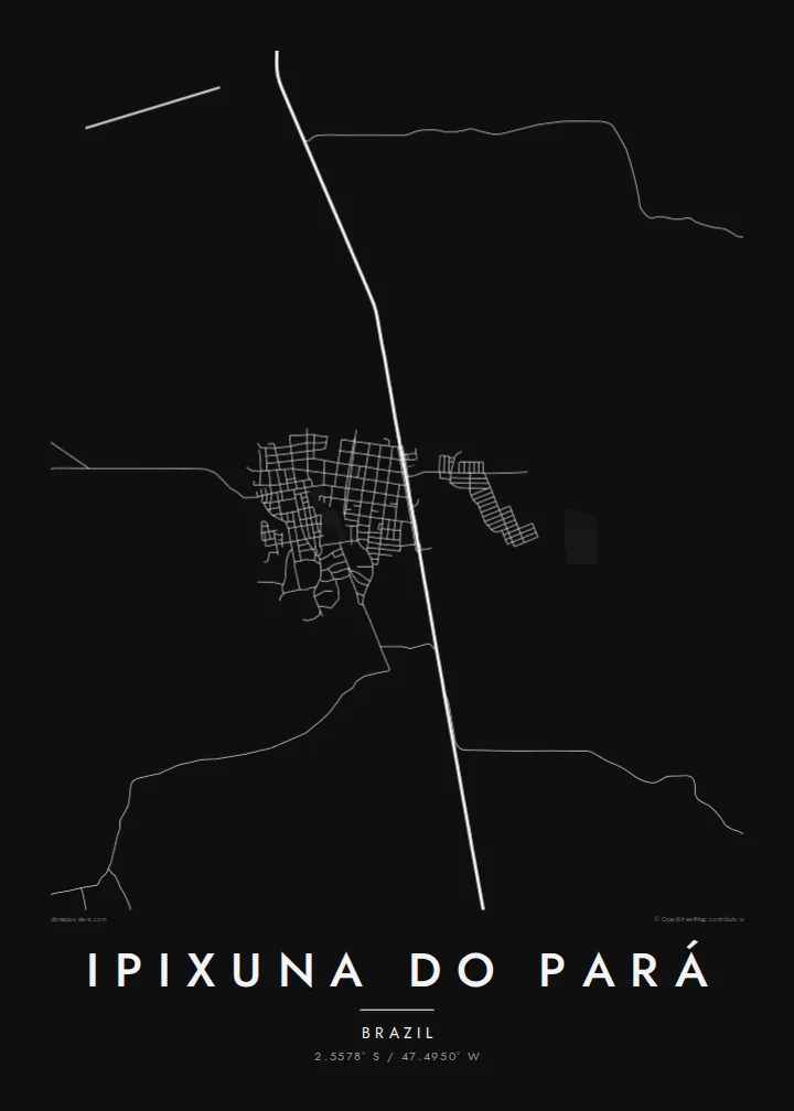
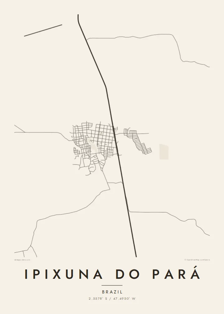

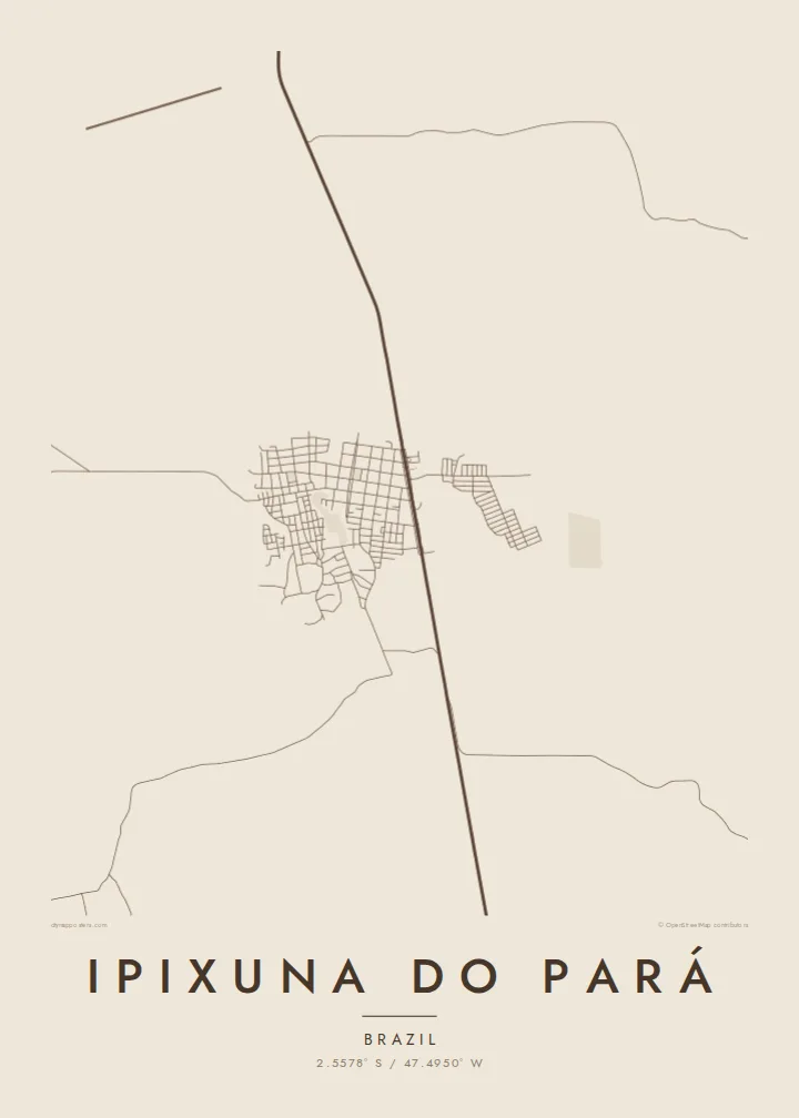
One city, five moods
Tap a style to see it on the wall. Every style costs the same — printed, framed or as HD files.
 Actual pixels · 24 × 36″ print file
Print-sharp
This is a 100% crop of the real print file. Every poster — printed, framed or downloaded — is rendered on our servers at 300 DPI, up to 7,200 × 10,800 pixels, so even the smallest lanes stay crisp on a 24 × 36″ print.
On the wall


The map
Ipixuna do Pará lies in north-eastern Pará, south of Belém, in a large municipality where the Amazon forest meets farming frontier. From above, the town is a relatively small grid of streets beside the BR-010, the Belém–Brasília highway. Beyond it, the landscape opens into a patchwork of pasture, cleared land, remaining forest and winding river channels.
Like many towns along the Belém–Brasília corridor, Ipixuna do Pará grew with the road. Its economy has depended on logging, cattle raising and farming. The municipality covers a wide area, so most of its population and most of its land lie outside the town itself. Scattered roads and settlements reach into the surrounding countryside.
An Ipixuna do Pará map poster reflects this frontier geography. It shows the straight highway, the regular grid of the town, and side roads branching off into the countryside. Rivers meander through the remaining forest. It is a simple, honest composition, well suited to families with roots here or anyone who knows the long road between Belém and the south.
The Belém–Brasília highway passes the town and is its main link to the rest of Brazil. It forms the strongest, straightest line on the map.
The urban area is a compact grid of streets beside the highway. It shows a planned layout typical of towns founded along Amazon frontier roads.
Winding waterways and remaining forest fill much of the municipality. They contrast with the straight lines of the roads and cleared land.
Make it yours
Add a date, a name or a line of your own, switch style, size or orientation.
The free preview is low-resolution with a watermark. Prints and HD files are rendered at 300 DPI, up to 7,200 × 10,800 px, without a watermark.
Why Ipixuna do Pará
For families who built their lives in Ipixuna do Pará, the grid beside the highway is home. For others it is a stop on a long journey through the Amazon. Either way, a map keeps that place in view.
Add a title, a subtitle in Portuguese and a coordinates line. Choose from Classic black & white, Noir, Paper, Blueprint or Sand. Buy the HD files for $9, with no watermark, or order a matte print with an optional wooden frame.
Order the Ipixuna do Pará poster| Print size | Resolution | Files |
|---|---|---|
| 30 × 40 cm11.8 × 15.7″ | 3,543 × 4,724 px | PNG · PDF |
| 29.7 × 42 cm (A3)11.7 × 16.5″ | 3,508 × 4,961 px | PNG · PDF |
| 42 × 59.4 cm (A2)16.5 × 23.4″ | 4,961 × 7,016 px | PNG · PDF |
| 45.7 × 61 cm18 × 24″ | 5,400 × 7,200 px | PNG · PDF |
| 50 × 70 cm19.7 × 27.6″ | 5,906 × 8,268 px | PNG · PDF |
| 61 × 91.4 cm24 × 36″ | 7,200 × 10,800 px | PNG · PDF |
For comparison, the free preview is 900 px wide, watermarked and meant for screens. The HD files have up to 8× the resolution in each direction and print cleanly at full poster size.
Pick a style at the top of the page, then choose Printed Poster — a size and, if you like, a frame — or Digital HD Files. Checkout takes one step, and your order page updates as soon as the payment goes through.
It is printed on premium 200 gsm matte paper in one of six sizes, from 30 × 40 cm to 24 × 36″. Printed posters start at $39, shipping included.
Yes. Choose a solid wood frame in black, white, natural oak or dark wood. It comes with shatterproof glazing and is ready to hang. Framed posters start at $99, shipping included.
Shipping is free to 60+ countries. Each poster is printed by the nearest of our print partners in 30+ countries and usually arrives in 3–7 business days. You can follow the status and tracking under My Orders. A few countries take 2–5 weeks, and where we don't ship yet, the site tells you before you pay.
Send us a photo within 14 days of delivery and we will reprint it for free or refund you.
Yes. In the editor on this page, change the title, the subtitle and the coordinates line to anything you like, and pick a style and size. Printed, framed and digital orders all use exactly your design.
For $9 you get 300 DPI PNG and print-ready PDF files in all six sizes, without a watermark, to print anywhere. Not sure yet? Download a free watermarked preview first.
Nearby
