Mount Iriga
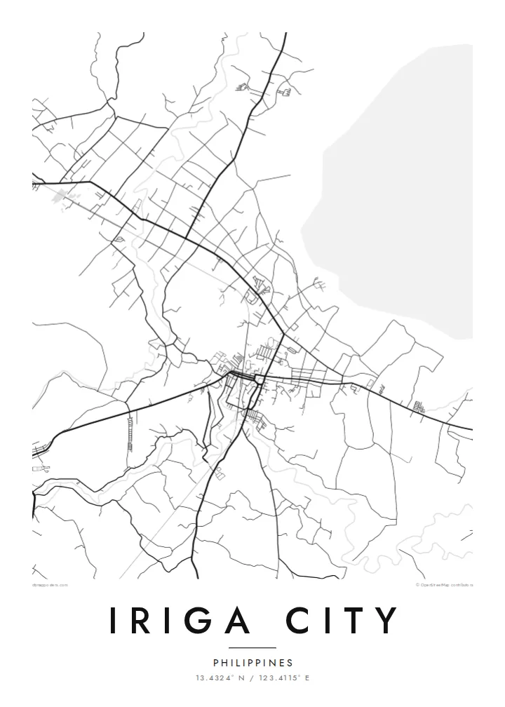
The volcano rises east of the city. Its wide lower slopes and ridges fill a large part of the map and give the flat urban area a strong natural counterweight.
Minimalist map poster · Philippines
13.4324° N / 123.4115° E
A Bicol city on the plain below Mount Iriga, with a compact centre, rice fields and roads leading toward the volcano's slopes.
One city, five moods
Tap a style to see it on the wall. Every style costs the same — printed, framed or as HD files.
 Actual pixels · 24 × 36″ print file
Print-sharp
This is a 100% crop of the real print file. Every poster — printed, framed or downloaded — is rendered on our servers at 300 DPI, up to 7,200 × 10,800 pixels, so even the smallest lanes stay crisp on a 24 × 36″ print.
On the wall


The map
Iriga City lies in the Rinconada area of Camarines Sur, on a fertile plain overlooked by Mount Iriga, also called Mount Asog. From above, the city appears as a dense centre of short blocks around the church and market. Main roads branch out from it through a patchwork of rice fields and villages. The mountain rises to the east, and its broad lower slopes fill much of any wider view.
Mount Iriga is a volcano with a large scar on its flank, left by a collapse long ago. On the far side of the mountain lies Lake Buhi, known for the sinarapan, one of the smallest fish in the world to be caught commercially. The mountain gives the city's landscape a clear, fixed point, and residents and visitors alike use it to find their bearings.
Iriga is also a regional crossroads, linked by road and rail to other Bicol cities such as Naga and Legazpi. An Iriga City map poster brings together the dense urban core, the surrounding farmland and the rising ground of the mountain. Together they show clearly why this corner of Bicol looks the way it does.
The volcano rises east of the city. Its wide lower slopes and ridges fill a large part of the map and give the flat urban area a strong natural counterweight.
A dense grid of short blocks around the church, plaza and market forms the heart of the city. It is the busiest and most detailed part of the poster.
Around the centre, main roads cut across a patchwork of farmland and small settlements. This gives the outer parts of the map a looser, rural rhythm.
Make it yours
Add a date, a name or a line of your own, switch style, size or orientation.
The free preview is low-resolution with a watermark. Prints and HD files are rendered at 300 DPI, up to 7,200 × 10,800 px, without a watermark.
Why Iriga City
Many people from Iriga now live far away, in Manila or overseas, and a map of the hometown keeps those streets close. It also makes a thoughtful gift for parents or relatives who still live under the mountain.
Add a title, subtitle and coordinates line with a family name or an important date, then choose Classic black & white, Noir, Paper, Blueprint or Sand. The digital HD files come in six print sizes, ready to print locally.
Order the Iriga City poster| Print size | Resolution | Files |
|---|---|---|
| 30 × 40 cm11.8 × 15.7″ | 3,543 × 4,724 px | PNG · PDF |
| 29.7 × 42 cm (A3)11.7 × 16.5″ | 3,508 × 4,961 px | PNG · PDF |
| 42 × 59.4 cm (A2)16.5 × 23.4″ | 4,961 × 7,016 px | PNG · PDF |
| 45.7 × 61 cm18 × 24″ | 5,400 × 7,200 px | PNG · PDF |
| 50 × 70 cm19.7 × 27.6″ | 5,906 × 8,268 px | PNG · PDF |
| 61 × 91.4 cm24 × 36″ | 7,200 × 10,800 px | PNG · PDF |
For comparison, the free preview is 900 px wide, watermarked and meant for screens. The HD files have up to 8× the resolution in each direction and print cleanly at full poster size.
Pick a style at the top of the page, then choose Printed Poster — a size and, if you like, a frame — or Digital HD Files. Checkout takes one step, and your order page updates as soon as the payment goes through.
It is printed on premium 200 gsm matte paper in one of six sizes, from 30 × 40 cm to 24 × 36″. Printed posters start at $39, shipping included.
Yes. Choose a solid wood frame in black, white, natural oak or dark wood. It comes with shatterproof glazing and is ready to hang. Framed posters start at $99, shipping included.
Shipping is free to 60+ countries. Each poster is printed by the nearest of our print partners in 30+ countries and usually arrives in 3–7 business days. You can follow the status and tracking under My Orders. A few countries take 2–5 weeks, and where we don't ship yet, the site tells you before you pay.
Send us a photo within 14 days of delivery and we will reprint it for free or refund you.
Yes. In the editor on this page, change the title, the subtitle and the coordinates line to anything you like, and pick a style and size. Printed, framed and digital orders all use exactly your design.
For $9 you get 300 DPI PNG and print-ready PDF files in all six sizes, without a watermark, to print anywhere. Not sure yet? Download a free watermarked preview first.
Nearby
