Naqsh-e Jahan Square
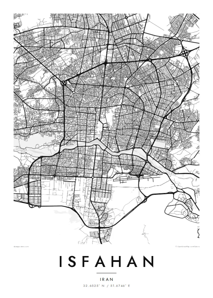
One of the largest city squares in the world forms a clean, elongated rectangle in the centre, the bazaar spreading north from its end in a dense web of covered lanes.
Minimalist map poster · Iran
32.6525° N / 51.6746° E
A Safavid garden city along the Zayanderud, with a vast rectangular square and historic bridges spanning the riverbed.
One city, five moods
Tap a style to see it on the wall. Every style costs the same — printed, framed or as HD files.
 Actual pixels · 24 × 36″ print file
Print-sharp
This is a 100% crop of the real print file. Every poster — printed, framed or downloaded — is rendered on our servers at 300 DPI, up to 7,200 × 10,800 pixels, so even the smallest lanes stay crisp on a 24 × 36″ print.
On the wall


The map
Isfahan lies on the central Iranian plateau beside the Zayanderud, the river that made an oasis possible in this dry region. At the end of the sixteenth century Shah Abbas I made it the Safavid capital and reshaped it with grand public spaces, gardens and avenues, many of which still structure the city's centre and remain easy to pick out on a map.
The most striking shape is Naqsh-e Jahan Square, a long rectangle framed by arcades, with the Shah Mosque, the Sheikh Lotfollah Mosque, the Ali Qapu palace and the entrance to the Grand Bazaar on its four sides. Nearby, the Chaharbagh avenue runs south in a straight line toward the river, once lined with gardens and pavilions. The square is a UNESCO World Heritage Site.
The Zayanderud is crossed by a series of historic bridges, including Si-o-se-pol with its thirty-three arches and the Khaju Bridge, both built for lingering as much as for crossing. In recent years the river has often run dry. An Isfahan map poster brings the square, the avenue and the bridges together, the Safavid plan still visible within the modern city.
One of the largest city squares in the world forms a clean, elongated rectangle in the centre, the bazaar spreading north from its end in a dense web of covered lanes.
This straight Safavid boulevard runs from the old city toward the river, a long axis that organises the surrounding blocks and leads directly to Si-o-se-pol.
Several historic bridges cross the river in quick succession, their short spans stitching together the northern city and the southern districts, including the Armenian quarter of New Julfa.
Make it yours
Add a date, a name or a line of your own, switch style, size or orientation.
The free preview is low-resolution with a watermark. Prints and HD files are rendered at 300 DPI, up to 7,200 × 10,800 px, without a watermark.
Why Isfahan
Isfahan has been called half the world, a phrase that captures its place in Persian culture and in the memories of those who know it. A map of its square and bridges keeps that city present at home, whether you live there or far away.
Write the title in the form that means most to you, add a date or a short phrase in the subtitle and adjust the coordinates line. Choose Classic black & white, Noir, Paper, Blueprint or Sand; Sand echoes the colour of the old brickwork.
Order the Isfahan poster| Print size | Resolution | Files |
|---|---|---|
| 30 × 40 cm11.8 × 15.7″ | 3,543 × 4,724 px | PNG · PDF |
| 29.7 × 42 cm (A3)11.7 × 16.5″ | 3,508 × 4,961 px | PNG · PDF |
| 42 × 59.4 cm (A2)16.5 × 23.4″ | 4,961 × 7,016 px | PNG · PDF |
| 45.7 × 61 cm18 × 24″ | 5,400 × 7,200 px | PNG · PDF |
| 50 × 70 cm19.7 × 27.6″ | 5,906 × 8,268 px | PNG · PDF |
| 61 × 91.4 cm24 × 36″ | 7,200 × 10,800 px | PNG · PDF |
For comparison, the free preview is 900 px wide, watermarked and meant for screens. The HD files have up to 8× the resolution in each direction and print cleanly at full poster size.
Pick a style at the top of the page, then choose Printed Poster — a size and, if you like, a frame — or Digital HD Files. Checkout takes one step, and your order page updates as soon as the payment goes through.
It is printed on premium 200 gsm matte paper in one of six sizes, from 30 × 40 cm to 24 × 36″. Printed posters start at $39, shipping included.
Yes. Choose a solid wood frame in black, white, natural oak or dark wood. It comes with shatterproof glazing and is ready to hang. Framed posters start at $99, shipping included.
Shipping is free to 60+ countries. Each poster is printed by the nearest of our print partners in 30+ countries and usually arrives in 3–7 business days. You can follow the status and tracking under My Orders. A few countries take 2–5 weeks, and where we don't ship yet, the site tells you before you pay.
Send us a photo within 14 days of delivery and we will reprint it for free or refund you.
Yes. In the editor on this page, change the title, the subtitle and the coordinates line to anything you like, and pick a style and size. Printed, framed and digital orders all use exactly your design.
For $9 you get 300 DPI PNG and print-ready PDF files in all six sizes, without a watermark, to print anywhere. Not sure yet? Download a free watermarked preview first.
Nearby
