Regent's Canal tunnel
The canal disappears into a tunnel under Islington and comes out to the east near City Road Basin. On the map it shows up as a broken blue line.
Minimalist map poster · United Kingdom
51.5362° N / 0.1030° W
Georgian squares, the Regent's Canal and Upper Street's long spine, tightly packed into north London between the City and Highbury

One city, five moods
Tap a style to see it on the wall. Every style costs the same — printed, framed or as HD files.
 Actual pixels · 24 × 36″ print file
Print-sharp
This is a 100% crop of the real print file. Every poster — printed, framed or downloaded — is rendered on our servers at 300 DPI, up to 7,200 × 10,800 pixels, so even the smallest lanes stay crisp on a 24 × 36″ print.
On the wall

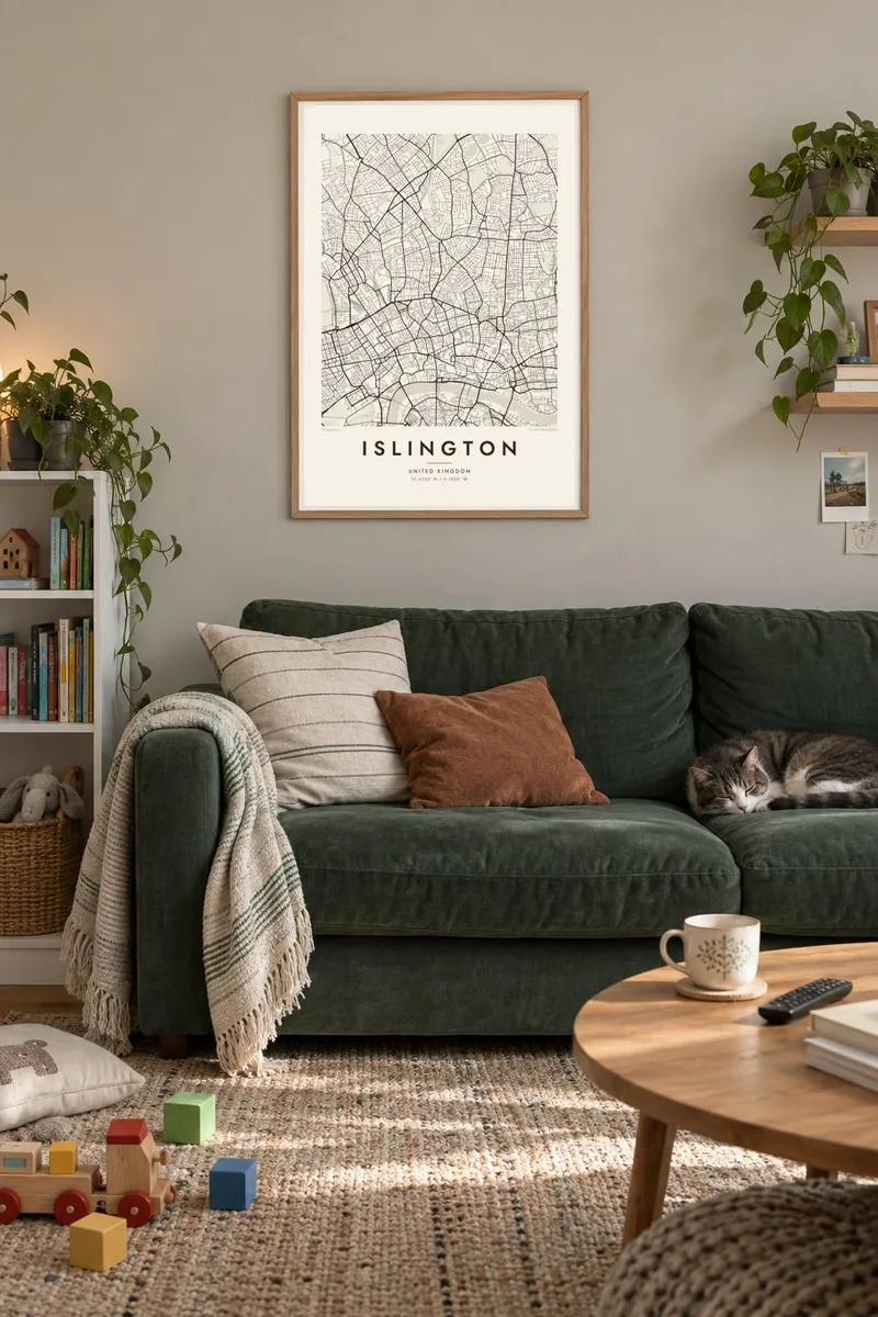

The map
Islington runs north from the edge of the City of London towards Highbury and Archway. It is one of the densest boroughs in the country, and the map shows it. Terraced streets fill almost every gap. Upper Street and Essex Road split north from the Angel junction, forming two main spines that the rest of the neighbourhood hangs off.
The Georgian and early Victorian building boom left behind a series of formal garden squares. In Barnsbury, Canonbury and around Highbury, these appear on an Islington map poster as small, crisp rectangles and ovals set into the terraces. Highbury Fields offers the largest stretch of open grass, a triangle of green at the north end of the high street.
Water crosses the borough in two ways. The Regent's Canal passes underneath through the Islington Tunnel and comes out near City Road Basin. The New River, a seventeenth-century channel built to bring drinking water to London, survives as a thin walkway. Further north, the Emirates Stadium, home to Arsenal, adds a large oval to the tightly packed streets.
The canal disappears into a tunnel under Islington and comes out to the east near City Road Basin. On the map it shows up as a broken blue line.
Georgian and Victorian squares in Barnsbury, Canonbury and elsewhere form neat geometric greens surrounded by terraced houses on every side.
Arsenal's home ground is a large oval near Holloway. It is the biggest single shape in an otherwise dense grain of small streets.
Make it yours
Add a date, a name or a line of your own, switch style, size or orientation.
The free preview is low-resolution with a watermark. Prints and HD files are rendered at 300 DPI, up to 7,200 × 10,800 px, without a watermark.
Why Islington
Islington is often the place people remember from their first London flat, a long tenancy or the walk to a match. A map of those streets carries that memory, whether it hangs in the next flat or somewhere far from London.
Add your own title, perhaps a street name, a subtitle and a coordinates line. Choose Classic black & white, Noir, Paper, Blueprint or Sand. Get HD files for $9 in six sizes including A3 and A2, or order a printed poster with an optional frame.
Order the Islington poster| Print size | Resolution | Files |
|---|---|---|
| 30 × 40 cm11.8 × 15.7″ | 3,543 × 4,724 px | PNG · PDF |
| 29.7 × 42 cm (A3)11.7 × 16.5″ | 3,508 × 4,961 px | PNG · PDF |
| 42 × 59.4 cm (A2)16.5 × 23.4″ | 4,961 × 7,016 px | PNG · PDF |
| 45.7 × 61 cm18 × 24″ | 5,400 × 7,200 px | PNG · PDF |
| 50 × 70 cm19.7 × 27.6″ | 5,906 × 8,268 px | PNG · PDF |
| 61 × 91.4 cm24 × 36″ | 7,200 × 10,800 px | PNG · PDF |
For comparison, the free preview is 900 px wide, watermarked and meant for screens. The HD files have up to 8× the resolution in each direction and print cleanly at full poster size.
Pick a style at the top of the page, then choose Printed Poster — a size and, if you like, a frame — or Digital HD Files. Checkout takes one step, and your order page updates as soon as the payment goes through.
It is printed on premium 200 gsm matte paper in one of six sizes, from 30 × 40 cm to 24 × 36″. Printed posters start at $39, shipping included.
Yes. Choose a solid wood frame in black, white, natural oak or dark wood. It comes with shatterproof glazing and is ready to hang. Framed posters start at $99, shipping included.
Shipping is free to 60+ countries. Each poster is printed by the nearest of our print partners in 30+ countries and usually arrives in 3–7 business days. You can follow the status and tracking under My Orders. A few countries take 2–5 weeks, and where we don't ship yet, the site tells you before you pay.
Send us a photo within 14 days of delivery and we will reprint it for free or refund you.
Yes. In the editor on this page, change the title, the subtitle and the coordinates line to anything you like, and pick a style and size. Printed, framed and digital orders all use exactly your design.
For $9 you get 300 DPI PNG and print-ready PDF files in all six sizes, without a watermark, to print anywhere. Not sure yet? Download a free watermarked preview first.
Nearby
