Walled city grid
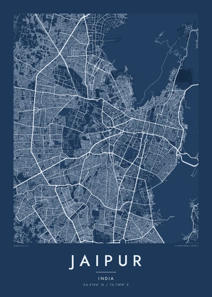
Straight, wide streets cross the old town at right angles and divide it into large blocks. It is one of the clearest planned patterns of any historic city.
Minimalist map poster · India
An eighteenth-century grid city, walled and pink, set against the Aravalli ridges with forts along the skyline.
26.9196° N / 75.7878° E



One city, five moods
Tap a style to see it on the wall. Every style is included in the same $9 price.
 Actual pixels · 24 × 36″ HD file
Print-sharp
This is a crop of the real HD file at 100%. The paid download is rendered on our servers at 300 DPI, up to 7,200 × 10,800 pixels, so even the smallest lanes stay crisp on a 24 × 36″ print.
The map
Jaipur was founded in 1727 by Maharaja Sawai Jai Singh II and built to a deliberate plan, one of the earliest of its kind in India. From above, the walled city is unmistakable. Wide, straight bazaar streets divide the old town into large rectangular blocks, an order rarely found in historic Indian cities, and the walled city is now a UNESCO World Heritage Site.
Its buildings are painted the terracotta pink that gives Jaipur its nickname, the Pink City. The City Palace occupies the centre. Beside it stands the Jantar Mantar, an eighteenth-century astronomical observatory and another UNESCO site, and the honeycombed facade of the Hawa Mahal faces onto one of the main streets.
To the north, the Aravalli hills close in. Nahargarh Fort runs along the ridge above the walled city, the Jal Mahal stands in Man Sagar Lake, and the road continues toward Amer Fort. A Jaipur map poster sets the grid of the old town against these hills, with the modern city spreading south and west.
Straight, wide streets cross the old town at right angles and divide it into large blocks. It is one of the clearest planned patterns of any historic city.
At the heart of the grid, the palace, its courtyards and the neighbouring Jantar Mantar form a large, distinct precinct that anchors the centre of the map.
Hills and forts rise along the north of the city, with Nahargarh on the ridge and Man Sagar Lake below. They form a natural frame for the regular streets.
Make it yours
Add a date, a name or a line of your own, switch style, size or orientation.
Free preview is low-resolution with a watermark. The HD version is 7,200 × 10,800 px, 300 DPI, no watermark.
Why Jaipur
Jaipur is hung by people who love its design as much as its history: architects, travellers and families with roots in Rajasthan. The grid of the walled city looks remarkably modern on a wall, almost like a planning drawing.
Personalise the title and subtitle, perhaps with a wedding date or a family name, and edit the coordinates. Sand and Paper suit the Pink City, while Noir, Blueprint and Classic black & white give crisper contrast. Printed posters ship from partners in 30+ countries.
Get the Jaipur poster — $9| Print size | Resolution | Files |
|---|---|---|
| 30 × 40 cm | 3,543 × 4,724 px | PNG · PDF |
| 50 × 70 cm | 5,906 × 8,268 px | PNG · PDF |
| A3 · 29.7 × 42 cm | 3,508 × 4,961 px | PNG · PDF |
| A2 · 42 × 59.4 cm | 4,961 × 7,016 px | PNG · PDF |
| 18 × 24" | 5,400 × 7,200 px | PNG · PDF |
| 24 × 36" | 7,200 × 10,800 px | PNG · PDF |
For comparison, the free preview is 900 px wide, watermarked and meant for screens. The HD files have up to 8× the resolution in each direction and print cleanly at full poster size.
Yes. Drag and zoom the map in the editor — centre it on your neighbourhood, the old town or the whole metro area. The text updates independently.
The HD purchase includes 30×40 cm, 50×70 cm, A3, A2, 18×24″ and 24×36″, each as a 300 DPI PNG and a print-ready PDF.
You can download a free 900 px preview with a watermark. The paid HD files have no watermark and are sharp enough for large prints.
Send the PDF to any local print shop or online printing service and ask for the matching paper size. Matte paper and a thin black or oak frame suit this style best.
Nearby
