Bhairab River
The river runs past the town centre in a gentle bend. It is the main natural line on an otherwise flat map.
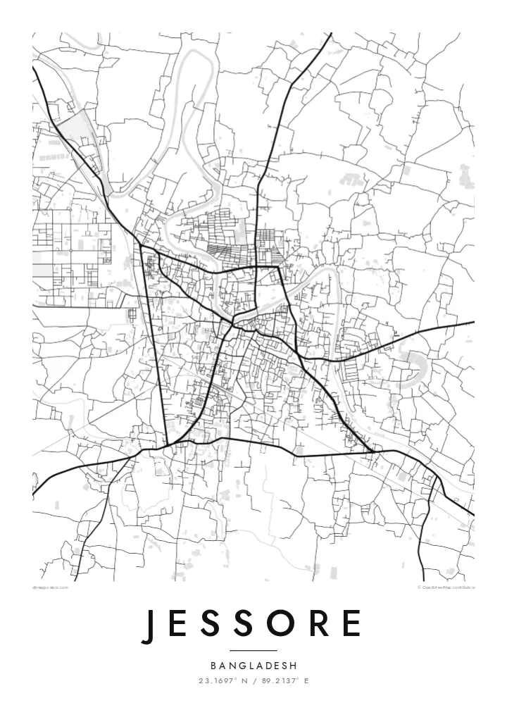
Minimalist map poster · Bangladesh
A compact town on the Bhairab River in southwest Bangladesh, crossed by roads leading west to the Indian border.
23.1697° N / 89.2137° E


One city, five moods
Tap a style to see it on the wall. Every style is included in the same $9 price.
 Actual pixels · 24 × 36″ HD file
Print-sharp
This is a crop of the real HD file at 100%. The paid download is rendered on our servers at 300 DPI, up to 7,200 × 10,800 pixels, so even the smallest lanes stay crisp on a 24 × 36″ print.
The map
Jessore, officially spelled Jashore, lies on the Bhairab River in the Khulna Division of southwestern Bangladesh. The land here is flat, low and crossed by old waterways. On a map, the town centre is a dense cluster of streets near the river. Main roads leave from it towards Khulna, Dhaka and the western border.
The town has long been a trading centre. It sits on the main land route between Bangladesh and Kolkata, which crosses at nearby Benapole. The surrounding district is known for the date palm molasses made in winter. Jessore also has an airport and a large cantonment, both of which appear as distinctive open areas on the map.
A Jessore map poster shows a town that has grown along its roads. It is dense at the centre and spreads outward in long lines. The Bhairab adds a quiet curve, while the cantonment and airport create large, regular spaces at the edges. In black and white, the town appears as a knot of streets surrounded by flat, open land.
The river runs past the town centre in a gentle bend. It is the main natural line on an otherwise flat map.
The highway west towards the border crossing is one of the town's main axes. It follows the long trade route to Kolkata.
The airport and cantonment appear as large, regular spaces set against the finer grain of the older streets.
Make it yours
Add a date, a name or a line of your own, switch style, size or orientation.
Free preview is low-resolution with a watermark. The HD version is 7,200 × 10,800 px, 300 DPI, no watermark.
Why Jessore
For people from Jessore now living elsewhere, or anyone with ties to southwest Bengal, the map of the town is a way to keep it close. The poster shows its streets clearly at every size.
You can edit the title, subtitle and coordinates line, and choose from five styles: Classic black & white, Noir, Paper, Blueprint and Sand. HD files for six print sizes are $9. Printed posters on matte paper ship from partners in over 30 countries.
Get the Jessore poster — $9| Print size | Resolution | Files |
|---|---|---|
| 30 × 40 cm | 3,543 × 4,724 px | PNG · PDF |
| 50 × 70 cm | 5,906 × 8,268 px | PNG · PDF |
| A3 · 29.7 × 42 cm | 3,508 × 4,961 px | PNG · PDF |
| A2 · 42 × 59.4 cm | 4,961 × 7,016 px | PNG · PDF |
| 18 × 24" | 5,400 × 7,200 px | PNG · PDF |
| 24 × 36" | 7,200 × 10,800 px | PNG · PDF |
For comparison, the free preview is 900 px wide, watermarked and meant for screens. The HD files have up to 8× the resolution in each direction and print cleanly at full poster size.
Yes. Drag and zoom the map in the editor — centre it on your neighbourhood, the old town or the whole metro area. The text updates independently.
The HD purchase includes 30×40 cm, 50×70 cm, A3, A2, 18×24″ and 24×36″, each as a 300 DPI PNG and a print-ready PDF.
You can download a free 900 px preview with a watermark. The paid HD files have no watermark and are sharp enough for large prints.
Send the PDF to any local print shop or online printing service and ask for the matching paper size. Matte paper and a thin black or oak frame suit this style best.
Nearby
