The through road
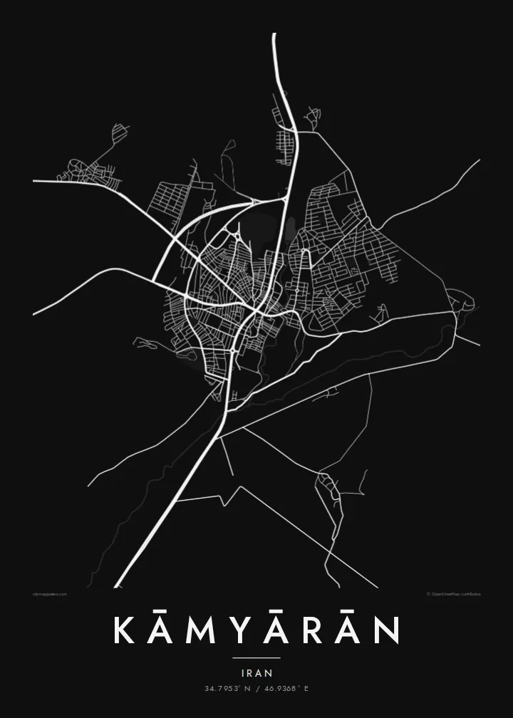
The route linking Sanandaj and Kermanshah runs through the town and acts as its backbone, with most streets leading off it at short intervals.
Minimalist map poster · Iran
A Kurdish valley town in the Zagros, its streets strung along the road between Sanandaj and Kermanshah
34.7953° N / 46.9368° E



One city, five moods
Tap a style to see it on the wall. Every style is included in the same $9 price.
 Actual pixels · 24 × 36″ HD file
Print-sharp
This is a crop of the real HD file at 100%. The paid download is rendered on our servers at 300 DPI, up to 7,200 × 10,800 pixels, so even the smallest lanes stay crisp on a 24 × 36″ print.
The map
Kāmyārān sits in a valley in the Zagros Mountains, in the south of Iran's Kurdistan Province. On a map the town looks long rather than round. Its main streets follow the valley floor, and the built-up area stops where the slopes begin to rise. Around the edges, field boundaries and mountain contours take over from houses.
The town lies on the main road between Sanandaj, the provincial capital to the north, and Kermanshah to the south. That route shapes the whole map. It gives the centre a clear spine, with side streets branching off toward the higher ground on either side. The result is a spare, readable plan, and the setting in the landscape is plain to see.
Kāmyārān is a Kurdish town and the administrative centre of the county of the same name, serving the villages across the surrounding uplands. A Kāmyārān map poster keeps the essentials: the valley, the road running through it, and a town fitted neatly between the mountains. For many people, that is simply what home looks like.
The route linking Sanandaj and Kermanshah runs through the town and acts as its backbone, with most streets leading off it at short intervals.
The built-up area follows the floor of a Zagros valley, so the town has a long shape defined by the slopes on either side.
Where the streets end, the map opens into farmland and hill country, which gives the print wide margins of quiet space around a compact core.
Make it yours
Add a date, a name or a line of your own, switch style, size or orientation.
Free preview is low-resolution with a watermark. The HD version is 7,200 × 10,800 px, 300 DPI, no watermark.
Why Kāmyārān
This is a map for people from Kāmyārān, and for families who left the Kurdish highlands but still carry the town with them. Its simple, valley-bound shape makes a calm print that is easy to live with.
Add a family name, a year or a line in your own language to the title and subtitle, and keep or edit the coordinates. The five styles, Classic black & white, Noir, Paper, Blueprint and Sand, let the same valley feel stark, warm or technical.
Get the Kāmyārān poster — $9| Print size | Resolution | Files |
|---|---|---|
| 30 × 40 cm | 3,543 × 4,724 px | PNG · PDF |
| 50 × 70 cm | 5,906 × 8,268 px | PNG · PDF |
| A3 · 29.7 × 42 cm | 3,508 × 4,961 px | PNG · PDF |
| A2 · 42 × 59.4 cm | 4,961 × 7,016 px | PNG · PDF |
| 18 × 24" | 5,400 × 7,200 px | PNG · PDF |
| 24 × 36" | 7,200 × 10,800 px | PNG · PDF |
For comparison, the free preview is 900 px wide, watermarked and meant for screens. The HD files have up to 8× the resolution in each direction and print cleanly at full poster size.
Yes. Drag and zoom the map in the editor — centre it on your neighbourhood, the old town or the whole metro area. The text updates independently.
The HD purchase includes 30×40 cm, 50×70 cm, A3, A2, 18×24″ and 24×36″, each as a 300 DPI PNG and a print-ready PDF.
You can download a free 900 px preview with a watermark. The paid HD files have no watermark and are sharp enough for large prints.
Send the PDF to any local print shop or online printing service and ask for the matching paper size. Matte paper and a thin black or oak frame suit this style best.
Nearby
