The walled city
The historic core is a dense tangle of lanes and courtyards bounded by the course of the old city walls, a pattern that stands out sharply against the rest of the map.
Minimalist map poster · Nigeria
12.0001° N / 8.5167° E
An ancient walled city on the northern Nigerian plain, its old quarter of tight lanes ringed by the course of earthen walls.

One city, five moods
Tap a style to see it on the wall. Every style costs the same — printed, framed or as HD files.
 Actual pixels · 24 × 36″ print file
Print-sharp
This is a 100% crop of the real print file. Every poster — printed, framed or downloaded — is rendered on our servers at 300 DPI, up to 7,200 × 10,800 pixels, so even the smallest lanes stay crisp on a 24 × 36″ print.
On the wall
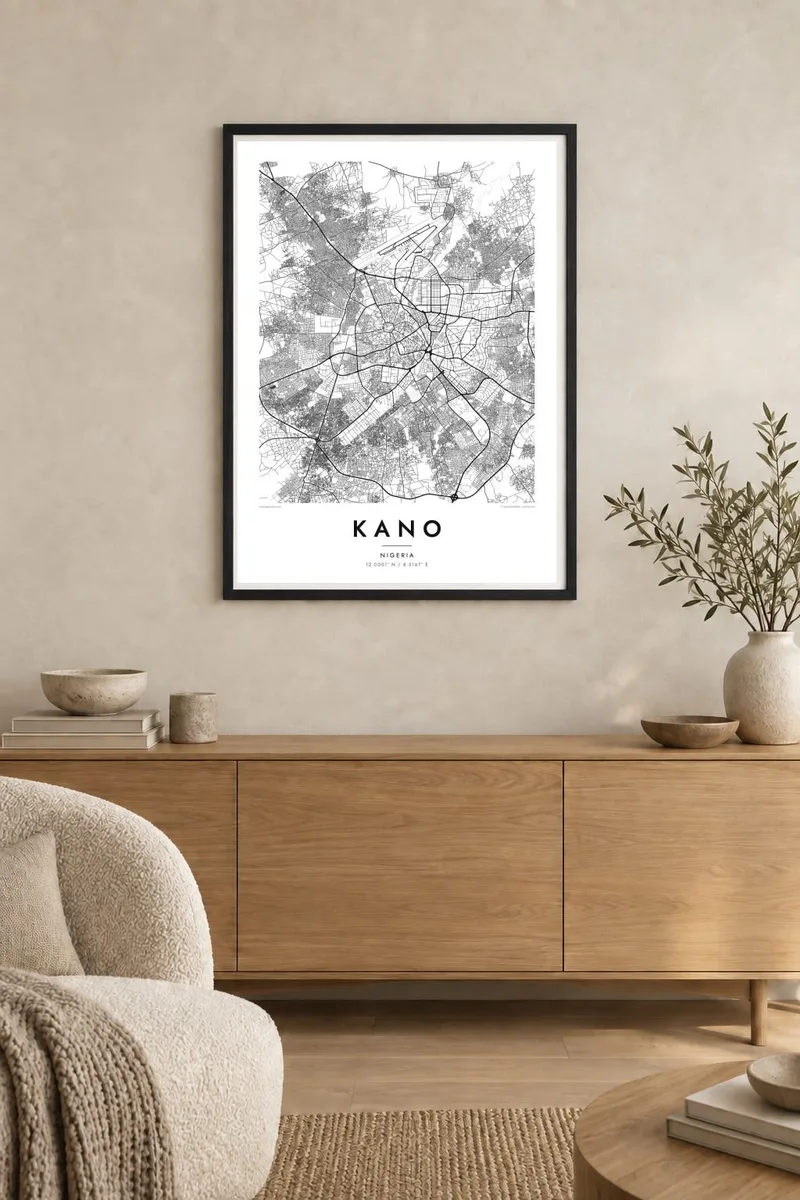


The map
Kano sits on the open, level plain of northern Nigeria, and its map is shaped by a very old centre. The historic walled city forms a dense, irregular mass of narrow lanes and compounds, quite unlike the broader, more regular districts that grew around it during the twentieth century. Main roads radiate outward from the former gates toward the surrounding towns.
Inside the old city, two small hills, Dala and Goron Dutse, rise above the rooftops, and Dala is traditionally linked to the city's origins. The Emir's palace occupies a large walled compound near the centre, and the Kurmi Market has traded for centuries. Outside the walls, planned areas such as Nassarawa and Sabon Gari show more ordered street patterns.
For centuries Kano was a major terminus of trans-Saharan trade, and the Kofar Mata dye pits are still in use. A Kano map poster shows that layering clearly: an intricate core, the line of the old walls, and the newer city spreading out across the plain in every direction.
The historic core is a dense tangle of lanes and courtyards bounded by the course of the old city walls, a pattern that stands out sharply against the rest of the map.
One of two hills inside the old walls, Dala is closely tied to Kano's founding stories and gives the otherwise flat centre a rare point of elevation.
Major roads leave the centre toward Zaria, Katsina and Maiduguri, drawing long straight spokes across the plain from the compact old city outward.
Make it yours
Add a date, a name or a line of your own, switch style, size or orientation.
The free preview is low-resolution with a watermark. Prints and HD files are rendered at 300 DPI, up to 7,200 × 10,800 px, without a watermark.
Why Kano
Kano is a city with deep roots, and for people from there or with family ties to it, a map of the old city and its surroundings says something about continuity. The contrast between the dense centre and the open districts beyond makes a striking graphic print.
You can personalise the title and subtitle, add a meaningful date or the coordinates of a family home, and choose one of five styles. Sand and Paper suit the warm tones of the savanna, while Noir gives the lanes a sharper contrast.
Order the Kano poster| Print size | Resolution | Files |
|---|---|---|
| 30 × 40 cm11.8 × 15.7″ | 3,543 × 4,724 px | PNG · PDF |
| 29.7 × 42 cm (A3)11.7 × 16.5″ | 3,508 × 4,961 px | PNG · PDF |
| 42 × 59.4 cm (A2)16.5 × 23.4″ | 4,961 × 7,016 px | PNG · PDF |
| 45.7 × 61 cm18 × 24″ | 5,400 × 7,200 px | PNG · PDF |
| 50 × 70 cm19.7 × 27.6″ | 5,906 × 8,268 px | PNG · PDF |
| 61 × 91.4 cm24 × 36″ | 7,200 × 10,800 px | PNG · PDF |
For comparison, the free preview is 900 px wide, watermarked and meant for screens. The HD files have up to 8× the resolution in each direction and print cleanly at full poster size.
Pick a style at the top of the page, then choose Printed Poster — a size and, if you like, a frame — or Digital HD Files. Checkout takes one step, and your order page updates as soon as the payment goes through.
It is printed on premium 200 gsm matte paper in one of six sizes, from 30 × 40 cm to 24 × 36″. Printed posters start at $39, shipping included.
Yes. Choose a solid wood frame in black, white, natural oak or dark wood. It comes with shatterproof glazing and is ready to hang. Framed posters start at $99, shipping included.
Shipping is free to 60+ countries. Each poster is printed by the nearest of our print partners in 30+ countries and usually arrives in 3–7 business days. You can follow the status and tracking under My Orders. A few countries take 2–5 weeks, and where we don't ship yet, the site tells you before you pay.
Send us a photo within 14 days of delivery and we will reprint it for free or refund you.
Yes. In the editor on this page, change the title, the subtitle and the coordinates line to anything you like, and pick a style and size. Printed, framed and digital orders all use exactly your design.
For $9 you get 300 DPI PNG and print-ready PDF files in all six sizes, without a watermark, to print anywhere. Not sure yet? Download a free watermarked preview first.
Nearby
