Linked village districts
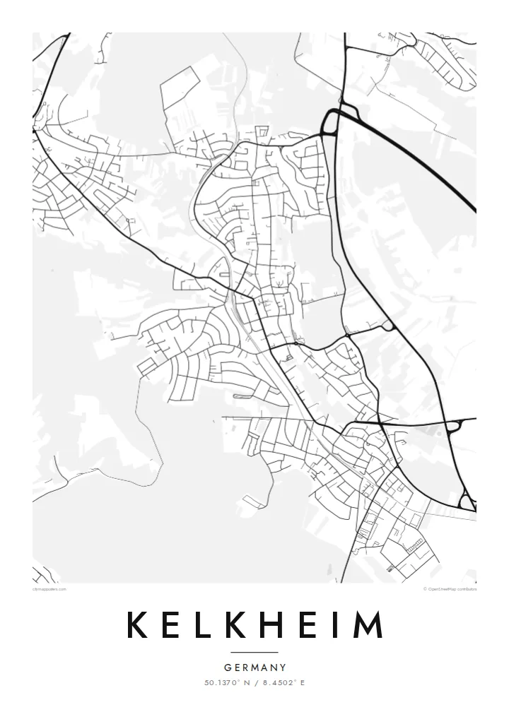
Kelkheim's districts remain distinct clusters of streets, separated by fields and woodland. On the poster they read as a sequence of settlements rather than one continuous town.
Minimalist map poster · Germany
50.1370° N / 8.4502° E
A Taunus foothill town west of Frankfurt, formed from several villages across wooded slopes and small stream valleys
One city, five moods
Tap a style to see it on the wall. Every style costs the same — printed, framed or as HD files.
 Actual pixels · 24 × 36″ print file
Print-sharp
This is a 100% crop of the real print file. Every poster — printed, framed or downloaded — is rendered on our servers at 300 DPI, up to 7,200 × 10,800 pixels, so even the smallest lanes stay crisp on a 24 × 36″ print.
On the wall


The map
Kelkheim lies in the Main-Taunus district of Hesse, where the Rhine-Main plain begins to rise into the wooded Taunus hills. The town is made up of several formerly separate villages, including Münster, Hornau, Fischbach, Ruppertshain and Eppenhain. From above, it looks like a chain of settlements: lower districts spread along stream valleys, higher ones sit on ridges among the forest.
Kelkheim is traditionally known as a furniture town. Carpentry workshops shaped its economy for generations, and the association remains part of its identity. A Franciscan monastery stands on a hill above the centre, and the Königstein railway runs through the town toward the Taunus. From the upper districts there are wide views across to Frankfurt's skyline.
A Kelkheim map poster captures that layered structure. The lower districts show denser streets and the rail line, the upper villages appear as smaller clusters surrounded by forest, and winding roads connect them up the slope. The result shows how a group of villages grew into a single town while each kept its own shape.
Kelkheim's districts remain distinct clusters of streets, separated by fields and woodland. On the poster they read as a sequence of settlements rather than one continuous town.
Toward the north and northwest, the streets give way to extensive forest on the hills. This open space frames the upper districts and gives the map a natural boundary.
The regional line to Königstein runs through the lower part of town. Its smooth curve adds a clear linear element that ties the districts together.
Make it yours
Add a date, a name or a line of your own, switch style, size or orientation.
The free preview is low-resolution with a watermark. Prints and HD files are rendered at 300 DPI, up to 7,200 × 10,800 px, without a watermark.
Why Kelkheim
Kelkheim attracts people who want green surroundings close to Frankfurt, and many families have deep roots in its individual districts. A map showing all the villages together makes a personal piece for a hallway or study, or a gift for a new house.
Add the name of your district, a date or a short dedication in the title and subtitle, and set the coordinates line. Paper and Sand give a warm tone, Classic black & white, Noir and Blueprint a sharper one. Files cost $9, and printed posters are available.
Order the Kelkheim poster| Print size | Resolution | Files |
|---|---|---|
| 30 × 40 cm11.8 × 15.7″ | 3,543 × 4,724 px | PNG · PDF |
| 29.7 × 42 cm (A3)11.7 × 16.5″ | 3,508 × 4,961 px | PNG · PDF |
| 42 × 59.4 cm (A2)16.5 × 23.4″ | 4,961 × 7,016 px | PNG · PDF |
| 45.7 × 61 cm18 × 24″ | 5,400 × 7,200 px | PNG · PDF |
| 50 × 70 cm19.7 × 27.6″ | 5,906 × 8,268 px | PNG · PDF |
| 61 × 91.4 cm24 × 36″ | 7,200 × 10,800 px | PNG · PDF |
For comparison, the free preview is 900 px wide, watermarked and meant for screens. The HD files have up to 8× the resolution in each direction and print cleanly at full poster size.
Pick a style at the top of the page, then choose Printed Poster — a size and, if you like, a frame — or Digital HD Files. Checkout takes one step, and your order page updates as soon as the payment goes through.
It is printed on premium 200 gsm matte paper in one of six sizes, from 30 × 40 cm to 24 × 36″. Printed posters start at $39, shipping included.
Yes. Choose a solid wood frame in black, white, natural oak or dark wood. It comes with shatterproof glazing and is ready to hang. Framed posters start at $99, shipping included.
Shipping is free to 60+ countries. Each poster is printed by the nearest of our print partners in 30+ countries and usually arrives in 3–7 business days. You can follow the status and tracking under My Orders. A few countries take 2–5 weeks, and where we don't ship yet, the site tells you before you pay.
Send us a photo within 14 days of delivery and we will reprint it for free or refund you.
Yes. In the editor on this page, change the title, the subtitle and the coordinates line to anything you like, and pick a style and size. Printed, framed and digital orders all use exactly your design.
For $9 you get 300 DPI PNG and print-ready PDF files in all six sizes, without a watermark, to print anywhere. Not sure yet? Download a free watermarked preview first.
Nearby
