Fishbone old town
Inside the walls of Korčula town, narrow lanes run off a single main street at regular angles. On paper the grid looks like a leaf or a fish skeleton, one of the most recognisable small-town plans on the Adriatic.
Minimalist map poster · Croatia
42.9438° N / 16.9149° E
A long, slender island running parallel to the Dalmatian coast, with a walled town on a tiny peninsula at its eastern tip.

One city, five moods
Tap a style to see it on the wall. Every style costs the same — printed, framed or as HD files.
 Actual pixels · 24 × 36″ print file
Print-sharp
This is a 100% crop of the real print file. Every poster — printed, framed or downloaded — is rendered on our servers at 300 DPI, up to 7,200 × 10,800 pixels, so even the smallest lanes stay crisp on a 24 × 36″ print.
On the wall


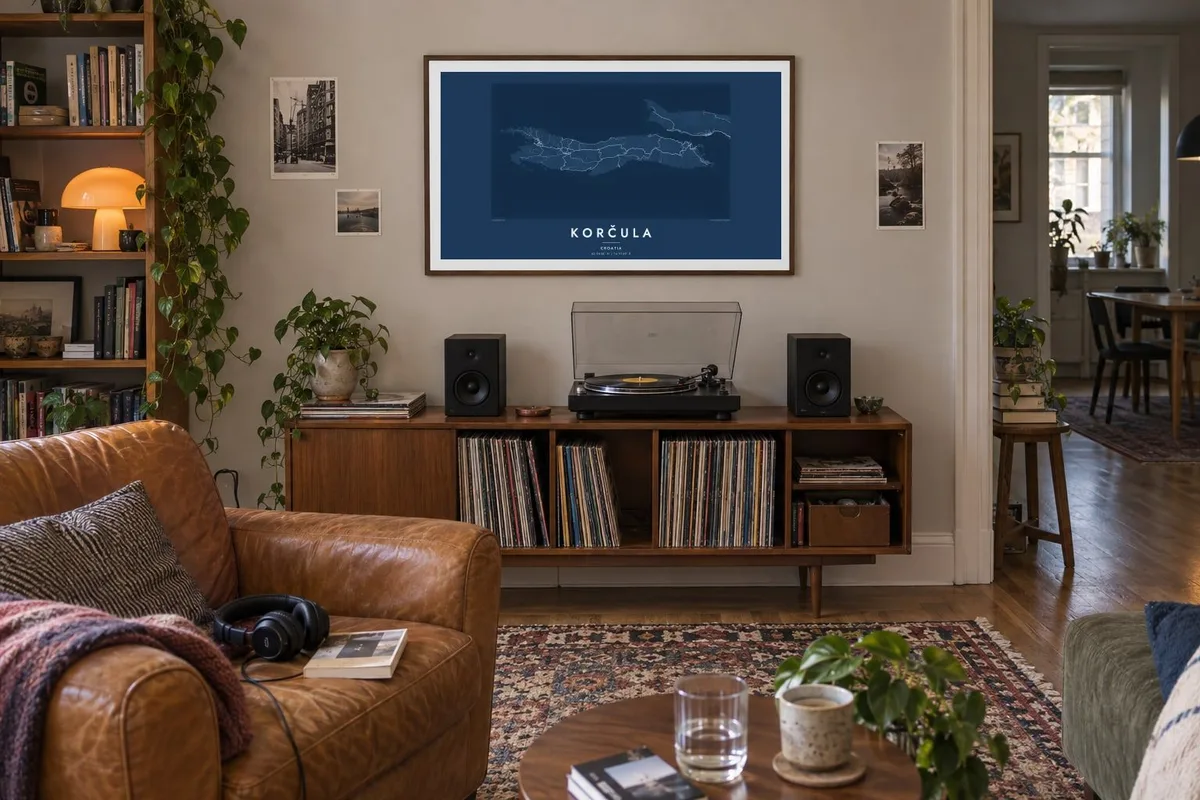
The island
Korčula lies off the southern Dalmatian coast, separated from the Pelješac peninsula by a narrow channel. From above it is long and thin, running roughly east to west, with a rugged shoreline of coves and small inlets. Pine forest, vineyards and olive groves cover most of the island, so roads are few and follow the high ground between scattered villages.
The best-known detail is at the eastern end. Korčula town fills a compact, rounded peninsula enclosed by walls, and its streets branch off a central spine in a pattern often compared to a fish skeleton. The layout is said to let cooling breezes in while blocking colder winds. The town also claims to be the birthplace of Marco Polo, a tradition it still keeps.
A Korčula map poster captures the contrast between the dense old town and the open island beyond it. Heading west, the road runs through inland villages towards Vela Luka, at the head of a deep bay. Lumbarda, near the eastern tip, sits among sandy vineyards, and a scatter of islets offshore adds fine texture to the outline.
Inside the walls of Korčula town, narrow lanes run off a single main street at regular angles. On paper the grid looks like a leaf or a fish skeleton, one of the most recognisable small-town plans on the Adriatic.
At its narrowest, the strait between the island and the Pelješac peninsula is only a short crossing. The two coastlines face each other closely, which gives the eastern part of the poster a strong horizontal frame.
At the western end, a long bay cuts deep into the island, with the town of Vela Luka at its head. Its sheltered shape balances the compact old town at the opposite tip.
Make it yours
Add a date, a name or a line of your own, switch style, size or orientation.
The free preview is low-resolution with a watermark. Prints and HD files are rendered at 300 DPI, up to 7,200 × 10,800 px, without a watermark.
Why Korčula
People choose Korčula for summers spent in its coves, a wedding in the old town, or simply for the pleasure of that fishbone plan. The long, narrow outline sits naturally in a landscape frame above a sofa or desk.
Add your own title, a date or a line of coordinates, and pick one of five styles: Classic black & white, Noir, Paper, Blueprint or Sand. The digital files come in six print sizes for $9, or you can order a printed poster from a print partner near you.
Order the Korčula poster| Print size | Resolution | Files |
|---|---|---|
| 30 × 40 cm11.8 × 15.7″ | 3,543 × 4,724 px | PNG · PDF |
| 29.7 × 42 cm (A3)11.7 × 16.5″ | 3,508 × 4,961 px | PNG · PDF |
| 42 × 59.4 cm (A2)16.5 × 23.4″ | 4,961 × 7,016 px | PNG · PDF |
| 45.7 × 61 cm18 × 24″ | 5,400 × 7,200 px | PNG · PDF |
| 50 × 70 cm19.7 × 27.6″ | 5,906 × 8,268 px | PNG · PDF |
| 61 × 91.4 cm24 × 36″ | 7,200 × 10,800 px | PNG · PDF |
For comparison, the free preview is 900 px wide, watermarked and meant for screens. The HD files have up to 8× the resolution in each direction and print cleanly at full poster size.
Pick a style at the top of the page, then choose Printed Poster — a size and, if you like, a frame — or Digital HD Files. Checkout takes one step, and your order page updates as soon as the payment goes through.
It is printed on premium 200 gsm matte paper in one of six sizes, from 30 × 40 cm to 24 × 36″. Printed posters start at $39, shipping included.
Yes. Choose a solid wood frame in black, white, natural oak or dark wood. It comes with shatterproof glazing and is ready to hang. Framed posters start at $99, shipping included.
Shipping is free to 60+ countries. Each poster is printed by the nearest of our print partners in 30+ countries and usually arrives in 3–7 business days. You can follow the status and tracking under My Orders. A few countries take 2–5 weeks, and where we don't ship yet, the site tells you before you pay.
Send us a photo within 14 days of delivery and we will reprint it for free or refund you.
Yes. In the editor on this page, change the title, the subtitle and the coordinates line to anything you like, and pick a style and size. Printed, framed and digital orders all use exactly your design.
For $9 you get 300 DPI PNG and print-ready PDF files in all six sizes, without a watermark, to print anywhere. Not sure yet? Download a free watermarked preview first.
Nearby
