Every street
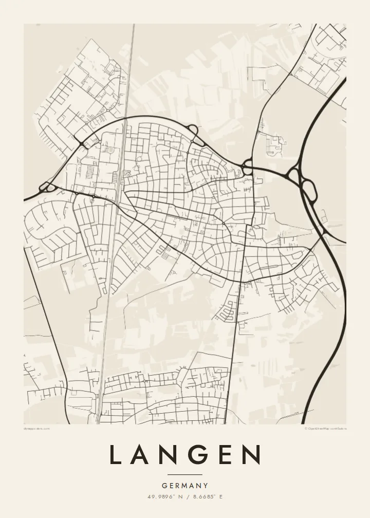
All of Langen's roads are drawn from OpenStreetMap, from the main arteries down to the smallest lanes, with widths that follow the street hierarchy.
Minimalist map poster · Germany
The whole street plan of Langen on a single sheet — minimal, graphic and unmistakably yours.
49.9896° N / 8.6685° E




One city, five moods
Tap a style to see it on the wall. Every style is included in the same $9 price.
 Actual pixels · 24 × 36″ HD file
Print-sharp
This is a crop of the real HD file at 100%. The paid download is rendered on our servers at 300 DPI, up to 7,200 × 10,800 pixels, so even the smallest lanes stay crisp on a 24 × 36″ print.
The map
This Langen map poster turns the city's street grid into pure line art: no labels, no clutter, just the shape of Langen as it looks from above.
Langen (Hesse, Germany) has a population of about 39,000. The map is centred on 49.9896° N, 8.6685° E — you can drag it anywhere.
Road widths follow the street hierarchy, so motorways and avenues read clearly while small streets add texture.
All of Langen's roads are drawn from OpenStreetMap, from the main arteries down to the smallest lanes, with widths that follow the street hierarchy.
Rivers, lakes and coastline are set in soft grey and parks in the palest tone, so the shape of Langen reads at a glance.
The HD files are rendered at 300 DPI — up to 7,200 × 10,800 pixels — so every line stays crisp even at 24 × 36 inches.
Make it yours
Add a date, a name or a line of your own, switch style, size or orientation.
Free preview is low-resolution with a watermark. The HD version is 7,200 × 10,800 px, 300 DPI, no watermark.
Why Langen
Whether you live in Langen, left it, or dream of going, a map of its streets is a quiet daily reminder.
Change the subtitle to a date or a short line, pick portrait or landscape, and it becomes a one-of-a-kind print.
The HD version costs $9 and includes six print sizes as PNG and PDF, ready for any print shop.
Get the Langen poster — $9| Print size | Resolution | Files |
|---|---|---|
| 30 × 40 cm | 3,543 × 4,724 px | PNG · PDF |
| 50 × 70 cm | 5,906 × 8,268 px | PNG · PDF |
| A3 · 29.7 × 42 cm | 3,508 × 4,961 px | PNG · PDF |
| A2 · 42 × 59.4 cm | 4,961 × 7,016 px | PNG · PDF |
| 18 × 24" | 5,400 × 7,200 px | PNG · PDF |
| 24 × 36" | 7,200 × 10,800 px | PNG · PDF |
For comparison, the free preview is 900 px wide, watermarked and meant for screens. The HD files have up to 8× the resolution in each direction and print cleanly at full poster size.
Yes. Drag and zoom the map in the editor — centre it on your neighbourhood, the old town or the whole metro area. The text updates independently.
The HD purchase includes 30×40 cm, 50×70 cm, A3, A2, 18×24″ and 24×36″, each as a 300 DPI PNG and a print-ready PDF.
You can download a free 900 px preview with a watermark. The paid HD files have no watermark and are sharp enough for large prints.
Send the PDF to any local print shop or online printing service and ask for the matching paper size. Matte paper and a thin black or oak frame suit this style best.
Nearby
