Timanfaya lava fields
The volcanic heart of the island is a wide area with very few roads. Its only interruptions are the rounded outlines of cones and a handful of routes through the national park.
Minimalist map poster · Spain
29.0397° N / 13.6507° W
A narrow volcanic island scattered with cones and lava fields, trailing a string of small islets off its northern tip

One city, five moods
Tap a style to see it on the wall. Every style costs the same — printed, framed or as HD files.
 Actual pixels · 24 × 36″ print file
Print-sharp
This is a 100% crop of the real print file. Every poster — printed, framed or downloaded — is rendered on our servers at 300 DPI, up to 7,200 × 10,800 pixels, so even the smallest lanes stay crisp on a 24 × 36″ print.
On the wall
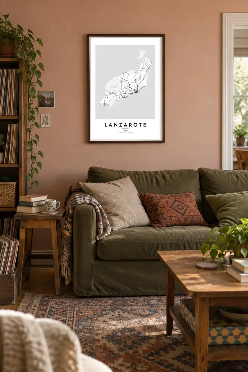


The island
Lanzarote is the easternmost of the Canary Islands, a slim island that runs from southwest to northeast. Its map is shaped far more by volcanoes than by towns. Across the centre and west, the lava fields of Timanfaya show up as broad, open areas with few roads, dotted with the circular cones left by eruptions that began in 1730 and continued for six years.
Most of the streets are along the east and south coasts. Arrecife, the capital, has a compact grid around its harbour and a line of small islets. Resort towns such as Puerto del Carmen and Playa Blanca stretch along the shore as long ribbons of building. Inland, the La Geria wine district appears as a field of small semicircular walls, each one sheltering a single vine planted in volcanic ash.
The artist and architect César Manrique shaped much of the island's modern look. He argued for low, white buildings and for restraint along the coast, and in 1993 Lanzarote became a UNESCO Biosphere Reserve. A Lanzarote map poster shows the result clearly: dark, open volcanic ground, a thin edge of towns and the Chinijo islets strung out to the north.
The volcanic heart of the island is a wide area with very few roads. Its only interruptions are the rounded outlines of cones and a handful of routes through the national park.
Between Timanfaya and the south coast, vines grow in hollows dug into black ash and are protected by low, curved stone walls. The result is a stippled pattern unlike any other farmland.
La Graciosa lies across a narrow channel from the northern cliffs, with its sand tracks and small harbour. Smaller uninhabited islets trail beyond it toward the open Atlantic.
Make it yours
Add a date, a name or a line of your own, switch style, size or orientation.
The free preview is low-resolution with a watermark. Prints and HD files are rendered at 300 DPI, up to 7,200 × 10,800 px, without a watermark.
Why Lanzarote
Many people return to Lanzarote year after year, and its outline is easy to recognise at a glance, with the volcanic core in the middle and the islets to the north. The contrast between empty lava fields and dense coastal towns works especially well in monochrome.
You can change the title to a resort name or the year of your first visit, edit the subtitle and coordinates, and choose from Classic black and white, Noir, Paper, Blueprint and Sand. Printed versions come on matte paper from print partners in more than 30 countries.
Order the Lanzarote poster| Print size | Resolution | Files |
|---|---|---|
| 30 × 40 cm11.8 × 15.7″ | 3,543 × 4,724 px | PNG · PDF |
| 29.7 × 42 cm (A3)11.7 × 16.5″ | 3,508 × 4,961 px | PNG · PDF |
| 42 × 59.4 cm (A2)16.5 × 23.4″ | 4,961 × 7,016 px | PNG · PDF |
| 45.7 × 61 cm18 × 24″ | 5,400 × 7,200 px | PNG · PDF |
| 50 × 70 cm19.7 × 27.6″ | 5,906 × 8,268 px | PNG · PDF |
| 61 × 91.4 cm24 × 36″ | 7,200 × 10,800 px | PNG · PDF |
For comparison, the free preview is 900 px wide, watermarked and meant for screens. The HD files have up to 8× the resolution in each direction and print cleanly at full poster size.
Pick a style at the top of the page, then choose Printed Poster — a size and, if you like, a frame — or Digital HD Files. Checkout takes one step, and your order page updates as soon as the payment goes through.
It is printed on premium 200 gsm matte paper in one of six sizes, from 30 × 40 cm to 24 × 36″. Printed posters start at $39, shipping included.
Yes. Choose a solid wood frame in black, white, natural oak or dark wood. It comes with shatterproof glazing and is ready to hang. Framed posters start at $99, shipping included.
Shipping is free to 60+ countries. Each poster is printed by the nearest of our print partners in 30+ countries and usually arrives in 3–7 business days. You can follow the status and tracking under My Orders. A few countries take 2–5 weeks, and where we don't ship yet, the site tells you before you pay.
Send us a photo within 14 days of delivery and we will reprint it for free or refund you.
Yes. In the editor on this page, change the title, the subtitle and the coordinates line to anything you like, and pick a style and size. Printed, framed and digital orders all use exactly your design.
For $9 you get 300 DPI PNG and print-ready PDF files in all six sizes, without a watermark, to print anywhere. Not sure yet? Download a free watermarked preview first.
Nearby
