North Cape plateau
The island's northern edge ends in a sheer headland. The road that reaches it crosses open, lake-dotted highland and stops abruptly at the cliff.
Minimalist map poster · Norway
71.0589° N / 25.7340° E
A nearly treeless Arctic island of bare plateaus and deep fjords, reaching north to the cliffs of the North Cape.

One city, five moods
Tap a style to see it on the wall. Every style costs the same — printed, framed or as HD files.
 Actual pixels · 24 × 36″ print file
Print-sharp
This is a 100% crop of the real print file. Every poster — printed, framed or downloaded — is rendered on our servers at 300 DPI, up to 7,200 × 10,800 pixels, so even the smallest lanes stay crisp on a 24 × 36″ print.
On the wall
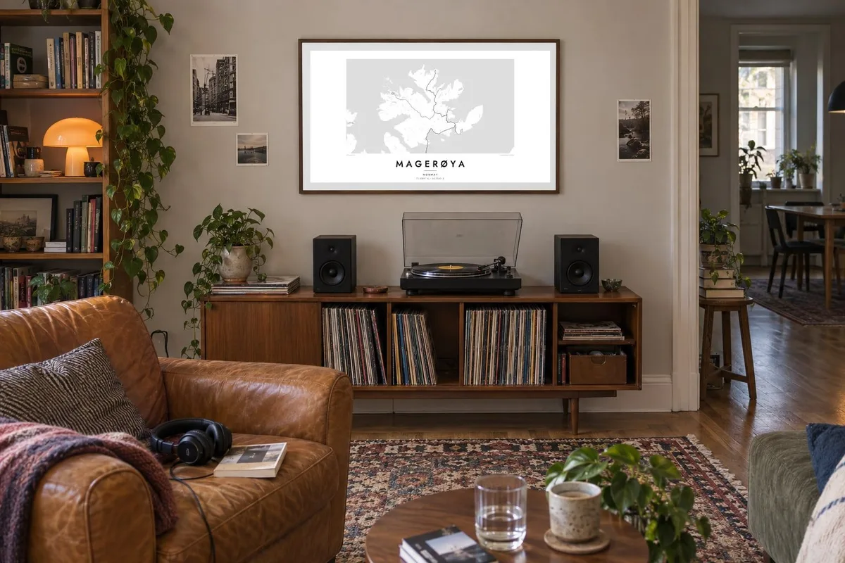


The island
Magerøya lies just off the northern tip of mainland Norway in Finnmark, separated from it by a narrow sound that the North Cape Tunnel crosses beneath the sea. From above it is a rugged, irregular island. Fjords and bays cut into its coast, and its interior is an open plateau of rock, lakes and tundra with almost no trees.
The island is famous for the North Cape, a steep cliff rising about 300 metres from the sea and long promoted as the northernmost point of Europe. A low headland a little to the west, Knivskjellodden, actually reaches slightly further north. In summer the midnight sun stays above the horizon for weeks, and Sámi herders bring reindeer to graze on the plateau.
Honningsvåg, the main town, sits in a sheltered bay on the southeast coast, a compact grid of streets and harbour quays where cruise ships call. From there a single road climbs across the plateau to the cape. A Magerøya map poster shows that journey clearly: the harbour, the long empty road and the cliff at the end of it.
The island's northern edge ends in a sheer headland. The road that reaches it crosses open, lake-dotted highland and stops abruptly at the cliff.
The main town wraps around a deep, protected bay, its streets packed between the water and the surrounding hills. It is by far the densest patch of the map.
Long fjords and bays cut into the island from several sides, giving Magerøya the ragged, lobed outline typical of the Finnmark coast.
Make it yours
Add a date, a name or a line of your own, switch style, size or orientation.
The free preview is low-resolution with a watermark. Prints and HD files are rendered at 300 DPI, up to 7,200 × 10,800 px, without a watermark.
Why Magerøya
For many travellers, Magerøya is the end of a long road north, whether they come by car, motorbike, bicycle or coastal ship. A poster of the island marks that arrival in a way a photograph of the cliff cannot, because it shows the whole route and the empty land around it.
Put the date you reached the cape, or the distance you travelled, in the title and subtitle, and edit the coordinates line to match. Choose one of five styles; Noir suits the polar night. Download the HD files for $9, or have a matte poster printed and shipped from a nearby partner.
Order the Magerøya poster| Print size | Resolution | Files |
|---|---|---|
| 30 × 40 cm11.8 × 15.7″ | 3,543 × 4,724 px | PNG · PDF |
| 29.7 × 42 cm (A3)11.7 × 16.5″ | 3,508 × 4,961 px | PNG · PDF |
| 42 × 59.4 cm (A2)16.5 × 23.4″ | 4,961 × 7,016 px | PNG · PDF |
| 45.7 × 61 cm18 × 24″ | 5,400 × 7,200 px | PNG · PDF |
| 50 × 70 cm19.7 × 27.6″ | 5,906 × 8,268 px | PNG · PDF |
| 61 × 91.4 cm24 × 36″ | 7,200 × 10,800 px | PNG · PDF |
For comparison, the free preview is 900 px wide, watermarked and meant for screens. The HD files have up to 8× the resolution in each direction and print cleanly at full poster size.
Pick a style at the top of the page, then choose Printed Poster — a size and, if you like, a frame — or Digital HD Files. Checkout takes one step, and your order page updates as soon as the payment goes through.
It is printed on premium 200 gsm matte paper in one of six sizes, from 30 × 40 cm to 24 × 36″. Printed posters start at $39, shipping included.
Yes. Choose a solid wood frame in black, white, natural oak or dark wood. It comes with shatterproof glazing and is ready to hang. Framed posters start at $99, shipping included.
Shipping is free to 60+ countries. Each poster is printed by the nearest of our print partners in 30+ countries and usually arrives in 3–7 business days. You can follow the status and tracking under My Orders. A few countries take 2–5 weeks, and where we don't ship yet, the site tells you before you pay.
Send us a photo within 14 days of delivery and we will reprint it for free or refund you.
Yes. In the editor on this page, change the title, the subtitle and the coordinates line to anything you like, and pick a style and size. Printed, framed and digital orders all use exactly your design.
For $9 you get 300 DPI PNG and print-ready PDF files in all six sizes, without a watermark, to print anywhere. Not sure yet? Download a free watermarked preview first.
Nearby
