River channels
Wide, braided rivers cross the plain around Maināguri, their sandy beds and shifting channels creating soft, irregular bands across the flat landscape.
Minimalist map poster · India
26.5626° N / 88.8204° E
A Dooars town on the plains below the Himalaya, surrounded by braided rivers, tea gardens and rice fields.

One city, five moods
Tap a style to see it on the wall. Every style costs the same — printed, framed or as HD files.
 Actual pixels · 24 × 36″ print file
Print-sharp
This is a 100% crop of the real print file. Every poster — printed, framed or downloaded — is rendered on our servers at 300 DPI, up to 7,200 × 10,800 pixels, so even the smallest lanes stay crisp on a 24 × 36″ print.
On the wall


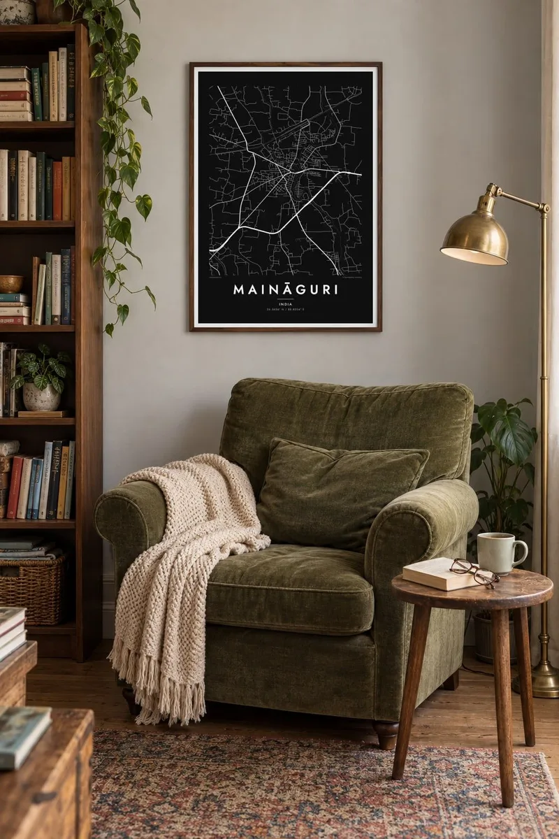
The map
Maināguri lies in the Jalpaiguri district of northern West Bengal, in the Dooars, the broad plain at the foot of the eastern Himalaya. The land is flat and crossed by many rivers flowing south from the mountains, the Teesta among them to the west. On a map the town appears as a compact cluster of streets on the plain, with the railway and roads running out towards Jalpaiguri and the tea country.
The surroundings are green and finely patterned: tea estates with their regular rows, paddy fields divided into small plots, and braided riverbeds that shift with each monsoon. Close to the town stands the Jalpesh temple, an old Shiva shrine that draws large gatherings of pilgrims, especially during the fair held around Shivaratri.
A Maināguri map poster brings together the regular lines of the town, the looser shapes of the rivers and the geometry of fields and plantations. It is a detailed, finely grained map, and a way for families from the Dooars to keep a hometown visible wherever they now live.
Wide, braided rivers cross the plain around Maināguri, their sandy beds and shifting channels creating soft, irregular bands across the flat landscape.
The Jalpesh Shiva temple stands a short distance from the town, a long-established pilgrimage site whose grounds and access roads form a distinct point on the map.
Tea gardens and rice fields surround the settlement, their plot boundaries and planting rows giving the edges of the map a subtle, orderly texture.
Make it yours
Add a date, a name or a line of your own, switch style, size or orientation.
The free preview is low-resolution with a watermark. Prints and HD files are rendered at 300 DPI, up to 7,200 × 10,800 px, without a watermark.
Why Maināguri
People from Maināguri often carry memories of monsoon rivers, tea garden roads and temple fairs. A print of the town gives those memories a clear, calm shape, well suited to a home far from the Dooars.
Add a title, a subtitle and the coordinates line in wording that means something to you, then pick Classic black & white, Noir, Paper, Blueprint or Sand. Files cover 30×40 cm, 50×70 cm, A3, A2, 18×24″ and 24×36″.
Order the Maināguri poster| Print size | Resolution | Files |
|---|---|---|
| 30 × 40 cm11.8 × 15.7″ | 3,543 × 4,724 px | PNG · PDF |
| 29.7 × 42 cm (A3)11.7 × 16.5″ | 3,508 × 4,961 px | PNG · PDF |
| 42 × 59.4 cm (A2)16.5 × 23.4″ | 4,961 × 7,016 px | PNG · PDF |
| 45.7 × 61 cm18 × 24″ | 5,400 × 7,200 px | PNG · PDF |
| 50 × 70 cm19.7 × 27.6″ | 5,906 × 8,268 px | PNG · PDF |
| 61 × 91.4 cm24 × 36″ | 7,200 × 10,800 px | PNG · PDF |
For comparison, the free preview is 900 px wide, watermarked and meant for screens. The HD files have up to 8× the resolution in each direction and print cleanly at full poster size.
Pick a style at the top of the page, then choose Printed Poster — a size and, if you like, a frame — or Digital HD Files. Checkout takes one step, and your order page updates as soon as the payment goes through.
It is printed on premium 200 gsm matte paper in one of six sizes, from 30 × 40 cm to 24 × 36″. Printed posters start at $39, shipping included.
Yes. Choose a solid wood frame in black, white, natural oak or dark wood. It comes with shatterproof glazing and is ready to hang. Framed posters start at $99, shipping included.
Shipping is free to 60+ countries. Each poster is printed by the nearest of our print partners in 30+ countries and usually arrives in 3–7 business days. You can follow the status and tracking under My Orders. A few countries take 2–5 weeks, and where we don't ship yet, the site tells you before you pay.
Send us a photo within 14 days of delivery and we will reprint it for free or refund you.
Yes. In the editor on this page, change the title, the subtitle and the coordinates line to anything you like, and pick a style and size. Printed, framed and digital orders all use exactly your design.
For $9 you get 300 DPI PNG and print-ready PDF files in all six sizes, without a watermark, to print anywhere. Not sure yet? Download a free watermarked preview first.
Nearby
