East coast centre
Lakatoro and Norsup, on the east coast, form the island's main hub. Their streets and roads are the densest part of the map, set against the surrounding forest.
Minimalist map poster · Vanuatu
16.2342° S / 167.4944° E
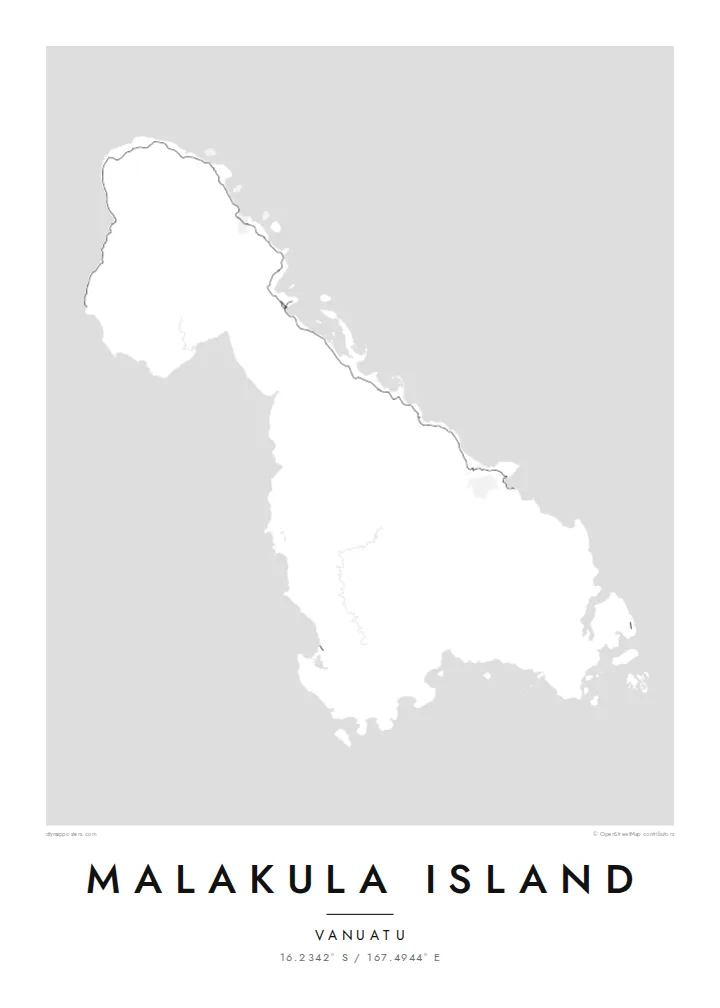
Vanuatu's second-largest island, an irregular landmass of forested hills with small island groups scattered off its coasts.
One city, five moods
Tap a style to see it on the wall. Every style costs the same — printed, framed or as HD files.
 Actual pixels · 24 × 36″ print file
Print-sharp
This is a 100% crop of the real print file. Every poster — printed, framed or downloaded — is rendered on our servers at 300 DPI, up to 7,200 × 10,800 pixels, so even the smallest lanes stay crisp on a 24 × 36″ print.
On the wall


The island
Malakula, also spelled Malekula, is the second-largest island in Vanuatu, in the South Pacific. Its outline is irregular, with a broad main body, a coastline cut by bays and headlands, and small islands and island groups scattered close offshore. The Maskelyne Islands lie off the southeastern tip. The interior is hilly and forested, and it is crossed by only a few roads.
The island is known for its remarkable cultural and linguistic diversity. A large number of distinct languages are spoken on Malakula, a notable concentration even by the standards of Vanuatu. It is also associated with the Big Nambas and Small Nambas, well-known cultural groups. The provincial centre, Lakatoro, and the nearby airstrip at Norsup lie on the east coast.
A Malakula Island map poster balances coastline and open ground. A road runs along parts of the coast, linking villages, and the east coast holds the densest clusters. The rest of the interior remains largely empty, where the forested hills rise. Offshore, the small islands add a lively scatter of shapes around the main body of the island.
Lakatoro and Norsup, on the east coast, form the island's main hub. Their streets and roads are the densest part of the map, set against the surrounding forest.
Small islands, including the Maskelyne group near the southeastern tip, lie close to Malakula's coast. They add a scatter of small shapes around the main outline.
The hilly interior has very few roads. On the map it leaves a broad open area inside the coastline, underlining how much of the island is rugged and wild.
Make it yours
Add a date, a name or a line of your own, switch style, size or orientation.
The free preview is low-resolution with a watermark. Prints and HD files are rendered at 300 DPI, up to 7,200 × 10,800 px, without a watermark.
Why Malakula Island
Malakula means a great deal to its many communities and to those who have lived, taught or travelled there. Its irregular outline and scattered offshore islands make a distinctive print, well suited to someone whose connection to Vanuatu runs deep.
Add your own title and subtitle, such as a village or a year, and edit the coordinates line. Pick from Classic black & white, Noir, Paper, Blueprint and Sand. Get the $9 HD files in six print sizes, or order a printed poster shipped from partners in more than 30 countries.
Order the Malakula Island poster| Print size | Resolution | Files |
|---|---|---|
| 30 × 40 cm11.8 × 15.7″ | 3,543 × 4,724 px | PNG · PDF |
| 29.7 × 42 cm (A3)11.7 × 16.5″ | 3,508 × 4,961 px | PNG · PDF |
| 42 × 59.4 cm (A2)16.5 × 23.4″ | 4,961 × 7,016 px | PNG · PDF |
| 45.7 × 61 cm18 × 24″ | 5,400 × 7,200 px | PNG · PDF |
| 50 × 70 cm19.7 × 27.6″ | 5,906 × 8,268 px | PNG · PDF |
| 61 × 91.4 cm24 × 36″ | 7,200 × 10,800 px | PNG · PDF |
For comparison, the free preview is 900 px wide, watermarked and meant for screens. The HD files have up to 8× the resolution in each direction and print cleanly at full poster size.
Pick a style at the top of the page, then choose Printed Poster — a size and, if you like, a frame — or Digital HD Files. Checkout takes one step, and your order page updates as soon as the payment goes through.
It is printed on premium 200 gsm matte paper in one of six sizes, from 30 × 40 cm to 24 × 36″. Printed posters start at $39, shipping included.
Yes. Choose a solid wood frame in black, white, natural oak or dark wood. It comes with shatterproof glazing and is ready to hang. Framed posters start at $99, shipping included.
Shipping is free to 60+ countries. Each poster is printed by the nearest of our print partners in 30+ countries and usually arrives in 3–7 business days. You can follow the status and tracking under My Orders. A few countries take 2–5 weeks, and where we don't ship yet, the site tells you before you pay.
Send us a photo within 14 days of delivery and we will reprint it for free or refund you.
Yes. In the editor on this page, change the title, the subtitle and the coordinates line to anything you like, and pick a style and size. Printed, framed and digital orders all use exactly your design.
For $9 you get 300 DPI PNG and print-ready PDF files in all six sizes, without a watermark, to print anywhere. Not sure yet? Download a free watermarked preview first.
Nearby
