The upper Lualaba
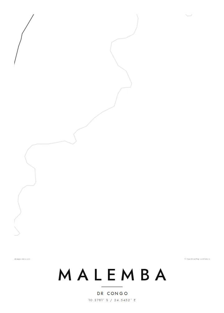
The river that later becomes the Congo passes the town as a broad, shifting line. It is the widest and most defining shape on the map and anchors the whole composition.
Minimalist map poster · DR Congo
10.3781° S / 24.5452° E
A river town drawn along the upper Lualaba, where channels, marsh and scattered lanes meet the open savanna.
One city, five moods
Tap a style to see it on the wall. Every style costs the same — printed, framed or as HD files.
 Actual pixels · 24 × 36″ print file
Print-sharp
This is a 100% crop of the real print file. Every poster — printed, framed or downloaded — is rendered on our servers at 300 DPI, up to 7,200 × 10,800 pixels, so even the smallest lanes stay crisp on a 24 × 36″ print.
On the wall


The map
Malemba sits on the upper Lualaba, the long headstream of the Congo, in the south-east of the Democratic Republic of the Congo. From above, the river sets the scene. It is a wide ribbon edged by wetland, and the town's lanes run back from its bank toward drier ground. Few maps of central Africa show this much water and this little pavement in the same frame.
The surrounding country is low and flat. It belongs to a basin of lakes, swamps and seasonal floodplains, and protected land lies not far away. On a map this becomes a soft pattern of braided channels and pale open ground. The built area is a compact cluster of tracks and plots rather than a dense grid, so the river remains the strongest line on the sheet.
A Malemba map poster suits anyone who knows the place through the river: the landings, the water level after the rains, the distances measured in hours by boat rather than kilometres by road. Reduced to black lines on white, the town is modest and the water is generous. That balance is honest about how Malemba sits in its landscape.
The river that later becomes the Congo passes the town as a broad, shifting line. It is the widest and most defining shape on the map and anchors the whole composition.
Marsh and floodplain press close to the settlement. On the poster they read as fine, irregular edges where the land and the water never quite agree on a boundary.
Instead of a formal grid, the town is a loose web of tracks and lanes. The open spaces between them keep the design light and airy.
Make it yours
Add a date, a name or a line of your own, switch style, size or orientation.
The free preview is low-resolution with a watermark. Prints and HD files are rendered at 300 DPI, up to 7,200 × 10,800 px, without a watermark.
Why Malemba
People hang a map of Malemba to keep a river town close after moving away, or to mark years of work in the region. A title such as a family name or the year of a first journey turns the sheet into a record that belongs to one person.
The layout comes in five styles: Classic black & white, Noir, Paper, Blueprint and Sand. Sand and Paper suit the warm tones of savanna country. The title, subtitle and coordinates line can all be edited before you download the HD file or order a print.
Order the Malemba poster| Print size | Resolution | Files |
|---|---|---|
| 30 × 40 cm11.8 × 15.7″ | 3,543 × 4,724 px | PNG · PDF |
| 29.7 × 42 cm (A3)11.7 × 16.5″ | 3,508 × 4,961 px | PNG · PDF |
| 42 × 59.4 cm (A2)16.5 × 23.4″ | 4,961 × 7,016 px | PNG · PDF |
| 45.7 × 61 cm18 × 24″ | 5,400 × 7,200 px | PNG · PDF |
| 50 × 70 cm19.7 × 27.6″ | 5,906 × 8,268 px | PNG · PDF |
| 61 × 91.4 cm24 × 36″ | 7,200 × 10,800 px | PNG · PDF |
For comparison, the free preview is 900 px wide, watermarked and meant for screens. The HD files have up to 8× the resolution in each direction and print cleanly at full poster size.
Pick a style at the top of the page, then choose Printed Poster — a size and, if you like, a frame — or Digital HD Files. Checkout takes one step, and your order page updates as soon as the payment goes through.
It is printed on premium 200 gsm matte paper in one of six sizes, from 30 × 40 cm to 24 × 36″. Printed posters start at $39, shipping included.
Yes. Choose a solid wood frame in black, white, natural oak or dark wood. It comes with shatterproof glazing and is ready to hang. Framed posters start at $99, shipping included.
Shipping is free to 60+ countries. Each poster is printed by the nearest of our print partners in 30+ countries and usually arrives in 3–7 business days. You can follow the status and tracking under My Orders. A few countries take 2–5 weeks, and where we don't ship yet, the site tells you before you pay.
Send us a photo within 14 days of delivery and we will reprint it for free or refund you.
Yes. In the editor on this page, change the title, the subtitle and the coordinates line to anything you like, and pick a style and size. Printed, framed and digital orders all use exactly your design.
For $9 you get 300 DPI PNG and print-ready PDF files in all six sizes, without a watermark, to print anywhere. Not sure yet? Download a free watermarked preview first.
Nearby
