Two rivers
The Yumurí and San Juan rivers flow through the city into the bay. They cut the street grid into three parts and give the map its distinctive divided structure.
Minimalist map poster · Cuba
23.0439° N / 81.5828° W
A bay city split by two rivers into three districts, joined by a series of bridges on the northern Cuban coast.

One city, five moods
Tap a style to see it on the wall. Every style costs the same — printed, framed or as HD files.
 Actual pixels · 24 × 36″ print file
Print-sharp
This is a 100% crop of the real print file. Every poster — printed, framed or downloaded — is rendered on our servers at 300 DPI, up to 7,200 × 10,800 pixels, so even the smallest lanes stay crisp on a 24 × 36″ print.
On the wall


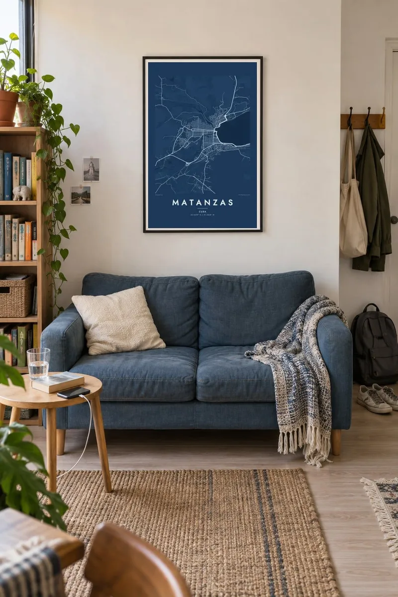
The map
Matanzas sits at the head of a deep bay on Cuba's north coast, about a hundred kilometres east of Havana. Two rivers, the Yumurí and the San Juan, cross the city on their way to the sea and divide it into three historic districts. Bridges therefore appear again and again across the map, which is why Matanzas is often called the city of bridges.
Matanzas was founded in 1693 and grew wealthy in the nineteenth century on sugar shipped through its port. That prosperity paid for theatres, libraries and elegant squares. The Sauto Theatre, opened in 1863, stands near the Plaza de la Vigía, and the city's cultural life earned it the nickname Athens of Cuba. The historic centre follows a regular colonial grid between the two rivers.
Matanzas is also the birthplace of danzón, whose first piece was performed here in 1879. The Yumurí valley opens dramatically just behind the city. A Matanzas map poster shows the grid pressed between the river mouths and the curve of the bay. It also takes in the roads leading east toward Varadero, one of the best-known beach areas in the Caribbean.
The Yumurí and San Juan rivers flow through the city into the bay. They cut the street grid into three parts and give the map its distinctive divided structure.
Many bridges cross the two rivers. On the map they appear as short, repeated links between districts, one of the clearest signatures of the Matanzas street plan.
The wide, deep bay opens out from the city toward the sea. Its smooth shoreline frames the historic centre and the port that once shipped much of the region's sugar.
Make it yours
Add a date, a name or a line of your own, switch style, size or orientation.
The free preview is low-resolution with a watermark. Prints and HD files are rendered at 300 DPI, up to 7,200 × 10,800 px, without a watermark.
Why Matanzas
Matanzas holds a special place in Cuban music, poetry and memory, and for many Cubans abroad it is the home city where family remains. The rivers and bridges give its grid a clear structure, so the map is easy to read and full of personal landmarks for anyone who knows it.
Add your own title, subtitle and coordinates line, perhaps a line of verse, a family name or a date. Choose from Classic black & white, Noir, Paper, Blueprint or Sand. The Paper style gives the colonial grid a soft, archival feel.
Order the Matanzas poster| Print size | Resolution | Files |
|---|---|---|
| 30 × 40 cm11.8 × 15.7″ | 3,543 × 4,724 px | PNG · PDF |
| 29.7 × 42 cm (A3)11.7 × 16.5″ | 3,508 × 4,961 px | PNG · PDF |
| 42 × 59.4 cm (A2)16.5 × 23.4″ | 4,961 × 7,016 px | PNG · PDF |
| 45.7 × 61 cm18 × 24″ | 5,400 × 7,200 px | PNG · PDF |
| 50 × 70 cm19.7 × 27.6″ | 5,906 × 8,268 px | PNG · PDF |
| 61 × 91.4 cm24 × 36″ | 7,200 × 10,800 px | PNG · PDF |
For comparison, the free preview is 900 px wide, watermarked and meant for screens. The HD files have up to 8× the resolution in each direction and print cleanly at full poster size.
Pick a style at the top of the page, then choose Printed Poster — a size and, if you like, a frame — or Digital HD Files. Checkout takes one step, and your order page updates as soon as the payment goes through.
It is printed on premium 200 gsm matte paper in one of six sizes, from 30 × 40 cm to 24 × 36″. Printed posters start at $39, shipping included.
Yes. Choose a solid wood frame in black, white, natural oak or dark wood. It comes with shatterproof glazing and is ready to hang. Framed posters start at $99, shipping included.
Shipping is free to 60+ countries. Each poster is printed by the nearest of our print partners in 30+ countries and usually arrives in 3–7 business days. You can follow the status and tracking under My Orders. A few countries take 2–5 weeks, and where we don't ship yet, the site tells you before you pay.
Send us a photo within 14 days of delivery and we will reprint it for free or refund you.
Yes. In the editor on this page, change the title, the subtitle and the coordinates line to anything you like, and pick a style and size. Printed, framed and digital orders all use exactly your design.
For $9 you get 300 DPI PNG and print-ready PDF files in all six sizes, without a watermark, to print anywhere. Not sure yet? Download a free watermarked preview first.
Nearby
