Karst islet maze
South and east of the main island, countless small limestone islands and channels crowd together. On the poster they form an elaborate, fine-grained pattern at the edge of the land.
Minimalist map poster · Indonesia
1.8671° S / 130.0823° E
A large island in southern Raja Ampat, its southern edge dissolving into a maze of limestone islets and lagoons.

One city, five moods
Tap a style to see it on the wall. Every style costs the same — printed, framed or as HD files.
 Actual pixels · 24 × 36″ print file
Print-sharp
This is a 100% crop of the real print file. Every poster — printed, framed or downloaded — is rendered on our servers at 300 DPI, up to 7,200 × 10,800 pixels, so even the smallest lanes stay crisp on a 24 × 36″ print.
On the wall

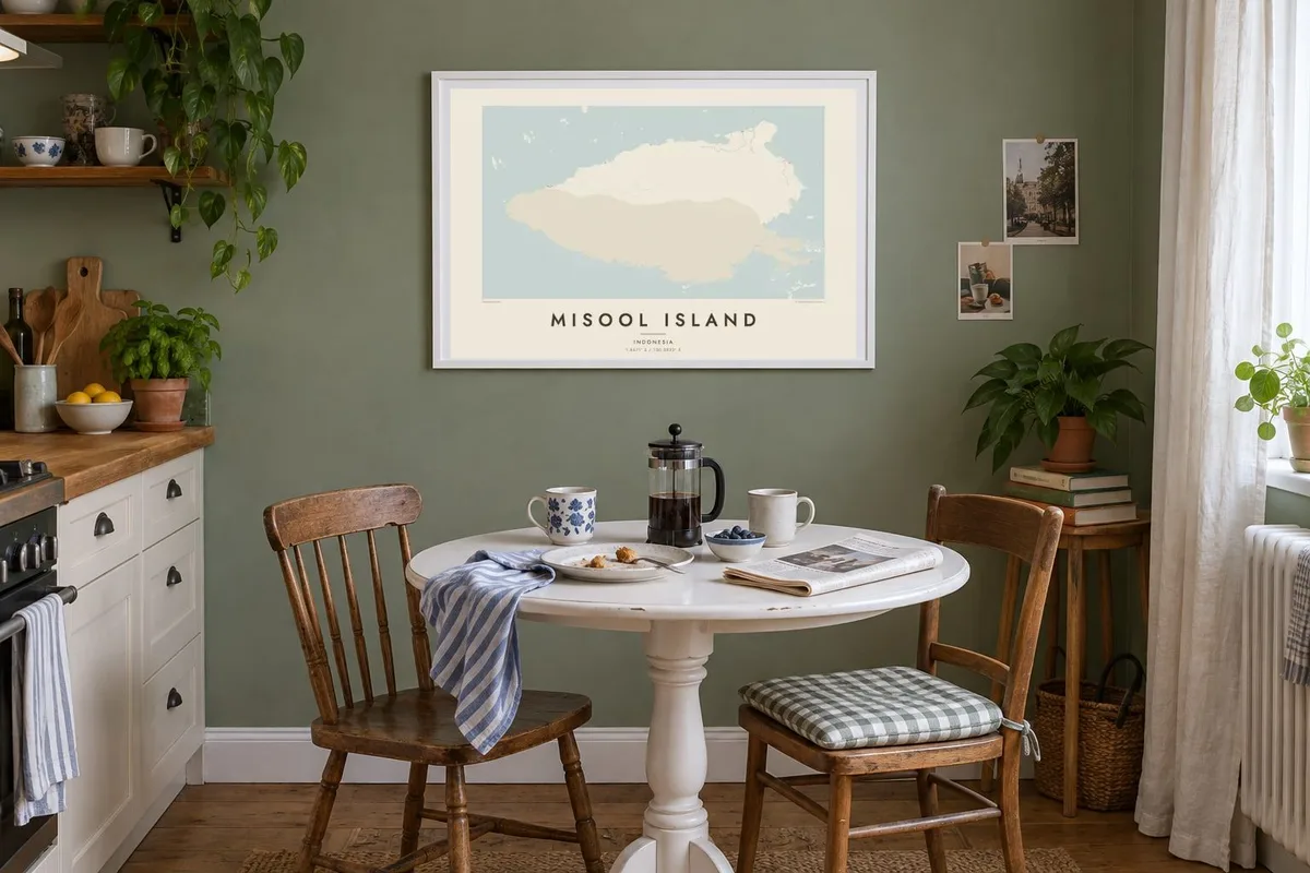

The island
Misool is the southernmost of the four main islands of Raja Ampat, off the western tip of New Guinea. Its northern half is broad and relatively solid, but toward the south and east the coastline breaks apart into a great number of limestone islets, channels and enclosed lagoons that make it one of the most intricate shapes in the region.
Those karst islands rise steeply from the water, many of them undercut at the waterline and covered in forest. Some of the cliffs hold ancient rock paintings. Villages are small and scattered along the coast, and boats, not roads, are the main way of getting around.
The waters around Misool are protected as part of the Raja Ampat marine conservation network and known for exceptional reef diversity. A Misool Island map poster makes that fragmented southern coast its main subject, a dense field of shapes that looks almost like lace against the sea.
South and east of the main island, countless small limestone islands and channels crowd together. On the poster they form an elaborate, fine-grained pattern at the edge of the land.
Some of the karst clusters wrap around sheltered inner lagoons, visible on the map as pockets of water almost cut off from the open sea.
The sea around Misool belongs to Raja Ampat's protected marine areas. On the map it is simply water, but it frames a reef system that divers cross the world to see.
Make it yours
Add a date, a name or a line of your own, switch style, size or orientation.
The free preview is low-resolution with a watermark. Prints and HD files are rendered at 300 DPI, up to 7,200 × 10,800 px, without a watermark.
Why Misool Island
Misool is a destination for divers and for anyone who has travelled through Raja Ampat by boat. The map keeps the memory of those channels and islets, and its detail rewards a closer look every time you pass it.
The title, subtitle and coordinates line are yours to personalise, for example with the dates of a liveaboard trip. Choose Classic black & white, Noir, Paper, Blueprint or Sand. Noir makes the islets stand out especially well.
Order the Misool Island poster| Print size | Resolution | Files |
|---|---|---|
| 30 × 40 cm11.8 × 15.7″ | 3,543 × 4,724 px | PNG · PDF |
| 29.7 × 42 cm (A3)11.7 × 16.5″ | 3,508 × 4,961 px | PNG · PDF |
| 42 × 59.4 cm (A2)16.5 × 23.4″ | 4,961 × 7,016 px | PNG · PDF |
| 45.7 × 61 cm18 × 24″ | 5,400 × 7,200 px | PNG · PDF |
| 50 × 70 cm19.7 × 27.6″ | 5,906 × 8,268 px | PNG · PDF |
| 61 × 91.4 cm24 × 36″ | 7,200 × 10,800 px | PNG · PDF |
For comparison, the free preview is 900 px wide, watermarked and meant for screens. The HD files have up to 8× the resolution in each direction and print cleanly at full poster size.
Pick a style at the top of the page, then choose Printed Poster — a size and, if you like, a frame — or Digital HD Files. Checkout takes one step, and your order page updates as soon as the payment goes through.
It is printed on premium 200 gsm matte paper in one of six sizes, from 30 × 40 cm to 24 × 36″. Printed posters start at $39, shipping included.
Yes. Choose a solid wood frame in black, white, natural oak or dark wood. It comes with shatterproof glazing and is ready to hang. Framed posters start at $99, shipping included.
Shipping is free to 60+ countries. Each poster is printed by the nearest of our print partners in 30+ countries and usually arrives in 3–7 business days. You can follow the status and tracking under My Orders. A few countries take 2–5 weeks, and where we don't ship yet, the site tells you before you pay.
Send us a photo within 14 days of delivery and we will reprint it for free or refund you.
Yes. In the editor on this page, change the title, the subtitle and the coordinates line to anything you like, and pick a style and size. Printed, framed and digital orders all use exactly your design.
For $9 you get 300 DPI PNG and print-ready PDF files in all six sizes, without a watermark, to print anywhere. Not sure yet? Download a free watermarked preview first.
Nearby
