Plateau setting
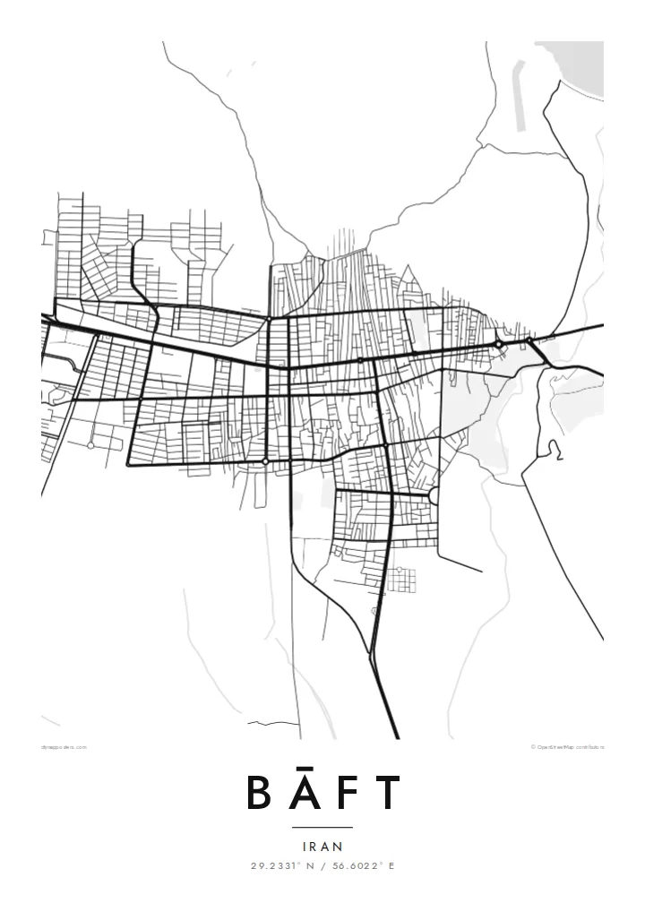
The town occupies a comparatively level basin between higher ground, so the built-up area appears as a compact patch surrounded by empty, rising terrain.
Poster minimalist tal-mappa · l-Iran
29.2331° N / 56.6022° E
A high mountain town in southern Kerman, its streets spread across a sloping plain ringed by bare ranges.


Belt waħda, ħames atmosferi
Agħfas fuq stil biex tarah fuq il-ħajt. Kull stil jiswa l-istess — stampat, inkurnat jew bħala fajls HD.
 Pixels reali · fajl tal-istampar 24 × 36″
Preċiż għall-istampar
Dan huwa qtugħ ta' 100% mill-fajl tal-istampar reali. Kull poster — stampat, inkurnat jew iddawnlowdjat — jiġi ġġenerat fuq is-servers tagħna b'300 DPI, sa 7,200 × 10,800 pixel, biex saħansitra l-iżgħar toroq jibqgħu ċari fuq stampa ta' 24 × 36″.
Fuq il-ħajt


Il-mappa
Bāft lies in the mountains of southern Kerman province, high enough that winters are cold despite the desert latitude. From above, the town spreads over a gently sloping plain, its streets forming a loose grid that thins into walled gardens and orchards at the edges. Beyond that, the land rises quickly into bare, folded ranges that frame the settlement on the map.
The surrounding region has long been home to pastoral and tribal communities, and the wider area has a strong tradition of hand-woven rugs. On paper, though, the town is defined by its setting: a pocket of cultivated land and housing held within a wide field of terrain, where every slope and valley leaves its mark on the roads.
A Bāft map poster works best with enough surrounding ground to show that relationship. The main roads leave town in a few clear directions, threading between ridges, and dry watercourses mark the slopes with thin branching lines. The result is spare and quiet, closer to a relief study than a dense city plan, and it holds up well at larger sizes.
The town occupies a comparatively level basin between higher ground, so the built-up area appears as a compact patch surrounded by empty, rising terrain.
Orchards and enclosed plots fringe the residential streets, softening the boundary between town and countryside into a fine texture of small parcels and lanes.
The few roads leading out of Bāft follow valleys and passes, drawing long, curving lines that connect the town to the rest of Kerman province.
Agħmlu tiegħek
Żid data, isem jew sentenza tiegħek, ibdel l-istil, id-daqs jew l-orjentazzjoni.
Il-preview b'xejn hija b'riżoluzzjoni baxxa u bil-watermark. L-istampi u l-fajls HD jiġu ġġenerati b'300 DPI, sa 7,200 × 10,800 px, mingħajr watermark.
Għaliex Bāft
This is a map for someone with roots in Kerman province or memories of travelling through its mountains. It is not a famous skyline but a real place, and its sparse lines make a calm, unusual piece for a study or hallway.
Add a personal title or subtitle, change the coordinates line, and pick one of five styles; Sand and Paper suit the dry landscape particularly well. Download the HD files for $9 or order a matte print from partners in more than 30 countries.
Ordna l-poster Bāft| Daqs tal-istampa | Riżoluzzjoni | Fajls |
|---|---|---|
| 30 × 40 cm (11.8 × 15.7″) | 3,543 × 4,724 px | PNG · PDF |
| 29.7 × 42 cm (A3, 11.7 × 16.5″) | 3,508 × 4,961 px | PNG · PDF |
| 42 × 59.4 cm (A2, 16.5 × 23.4″) | 4,961 × 7,016 px | PNG · PDF |
| 45.7 × 61 cm (18 × 24″) | 5,400 × 7,200 px | PNG · PDF |
| 50 × 70 cm (19.7 × 27.6″) | 5,906 × 8,268 px | PNG · PDF |
| 61 × 91.4 cm (24 × 36″) | 7,200 × 10,800 px | PNG · PDF |
Għal paragun, il-preview b'xejn huwa wiesa' 900 px, għandu watermark u huwa maħsub għall-iskrins. Il-fajls HD għandhom sa 8× ir-riżoluzzjoni f'kull direzzjoni u jiġu stampati b'mod nadif fid-daqs sħiħ tal-poster.
Agħżel stil fin-naħa ta' fuq tal-paġna, imbagħad agħżel Poster Stampat — daqs u, jekk trid, kurniċa — jew Fajls Diġitali HD. Il-ħlas isir f'pass wieħed, u l-paġna tal-ordni tiegħek tiġi aġġornata malli l-ħlas jgħaddi.
Jiġi stampat fuq karta matte premium ta' 200 gsm f'wieħed minn sitt daqsijiet, minn 30 × 40 cm sa 24 × 36″. Il-posters stampati jibdew minn {printFrom}, bil-kunsinna inkluża.
Iva. Agħżel kurniċa tal-injam solidu f'iswed, abjad, ballut naturali jew injam skur. Tiġi bi ħġieġ li ma jinkisirx u lesta biex tittella'. Il-posters inkurnati jibdew minn {framedFrom}, bil-kunsinna inkluża.
Il-kunsinna hija b'xejn madwar id-dinja. Kull poster jiġi stampat mill-eqreb sieħeb tal-istampar tagħna f'aktar minn 30 pajjiż u ġeneralment jasal fi 3–7 ijiem tax-xogħol. Tista' ssegwi l-istatus u t-tracking taħt L-Ordnijiet Tiegħi.
Ibgħatilna ritratt fi żmien 14-il jum mill-kunsinna u aħna nistampawh mill-ġdid b'xejn jew nirrimborżawk.
Iva. Fl-editur ta' din il-paġna, biddel it-titlu, is-sottotitlu u l-linja tal-koordinati għal kwalunkwe ħaġa trid, u agħżel stil u daqs. L-ordnijiet stampati, inkurnati u diġitali kollha jużaw eżattament id-disinn tiegħek.
Għal $9 tikseb fajls PNG b'300 DPI u PDF lesti għall-istampar fis-sitt daqsijiet kollha, mingħajr watermark, biex tistampa kullimkien. Għadek mhux ċert? L-ewwel iddawnlowdja preview b'xejn bil-watermark.
