Northern slopes
Toward the north the grid breaks into winding roads that follow the rising ground, a clear visual shift from the flatter, denser districts in the south.
Poster minimalist tal-mappa · l-Indoneżja
6.9222° S / 107.6069° E
A highland city in a volcanic basin, its streets climbing north toward the slopes of Tangkuban Perahu.


Belt waħda, ħames atmosferi
Agħfas fuq stil biex tarah fuq il-ħajt. Kull stil jiswa l-istess — stampat, inkurnat jew bħala fajls HD.
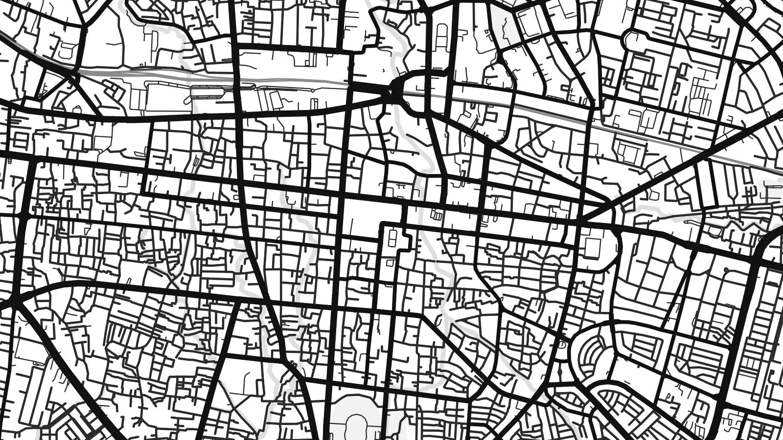 Pixels reali · fajl tal-istampar 24 × 36″
Preċiż għall-istampar
Dan huwa qtugħ ta' 100% mill-fajl tal-istampar reali. Kull poster — stampat, inkurnat jew iddawnlowdjat — jiġi ġġenerat fuq is-servers tagħna b'300 DPI, sa 7,200 × 10,800 pixel, biex saħansitra l-iżgħar toroq jibqgħu ċari fuq stampa ta' 24 × 36″.
Fuq il-ħajt


Il-mappa
Bandung lies in a broad basin in the highlands of West Java, at an elevation of around 700 metres, surrounded by volcanic mountains. On a map the city is densest in the south and centre and gradually climbs toward the north, where the streets become more winding as they follow the slopes rising toward the Tangkuban Perahu volcano.
The Cikapundung River runs north to south through the city, crossing the centre in a narrow, curving valley. The colonial-era core around Jalan Asia Afrika and Jalan Braga has a compact, regular grid, while the northern districts around Dago and the campus of the Institut Teknologi Bandung have a looser, greener layout of hillside roads.
Bandung hosted the Asian–African Conference of 1955 at Gedung Merdeka, an event that brought together leaders from newly independent nations. A Bandung map poster shows the city as it sits in its basin, with the tight grid of the old centre, the river valley and the looser streets reaching up the northern slopes.
Toward the north the grid breaks into winding roads that follow the rising ground, a clear visual shift from the flatter, denser districts in the south.
The river crosses the city from north to south in a narrow green corridor, a thin curved line that divides the centre into east and west.
The old centre around Asia Afrika and Braga streets forms a compact grid, the most regular part of an otherwise organic city plan.
Agħmlu tiegħek
Żid data, isem jew sentenza tiegħek, ibdel l-istil, id-daqs jew l-orjentazzjoni.
Il-preview b'xejn hija b'riżoluzzjoni baxxa u bil-watermark. L-istampi u l-fajls HD jiġu ġġenerati b'300 DPI, sa 7,200 × 10,800 px, mingħajr watermark.
Għaliex Bandung
Bandung has a long association with students, design and creative work, and many people keep a strong tie to the city after their years there. A map of the basin and its northern hills is a good way to hold onto that time.
The poster can be personalised with a title, a subtitle and your own coordinates, naming a campus, a neighbourhood or a year. Choose one of five styles, including the technical Blueprint, and download 300 DPI PNG and PDF files for $9.
Ordna l-poster Bandung| Daqs tal-istampa | Riżoluzzjoni | Fajls |
|---|---|---|
| 30 × 40 cm11.8 × 15.7″ | 3,543 × 4,724 px | PNG · PDF |
| 29.7 × 42 cm (A3)11.7 × 16.5″ | 3,508 × 4,961 px | PNG · PDF |
| 42 × 59.4 cm (A2)16.5 × 23.4″ | 4,961 × 7,016 px | PNG · PDF |
| 45.7 × 61 cm18 × 24″ | 5,400 × 7,200 px | PNG · PDF |
| 50 × 70 cm19.7 × 27.6″ | 5,906 × 8,268 px | PNG · PDF |
| 61 × 91.4 cm24 × 36″ | 7,200 × 10,800 px | PNG · PDF |
Għal paragun, il-preview b'xejn huwa wiesa' 900 px, għandu watermark u huwa maħsub għall-iskrins. Il-fajls HD għandhom sa 8× ir-riżoluzzjoni f'kull direzzjoni u jiġu stampati b'mod nadif fid-daqs sħiħ tal-poster.
Agħżel stil fin-naħa ta' fuq tal-paġna, imbagħad agħżel Poster Stampat — daqs u, jekk trid, kurniċa — jew Fajls Diġitali HD. Il-ħlas isir f'pass wieħed, u l-paġna tal-ordni tiegħek tiġi aġġornata malli l-ħlas jgħaddi.
Jiġi stampat fuq karta matte premium ta' 200 gsm f'wieħed minn sitt daqsijiet, minn 30 × 40 cm sa 24 × 36″. Il-posters stampati jibdew minn $39, bil-kunsinna inkluża.
Iva. Agħżel kurniċa tal-injam solidu f'iswed, abjad, ballut naturali jew injam skur. Tiġi bi ħġieġ li ma jinkisirx u lesta biex tittella'. Il-posters inkurnati jibdew minn $99, bil-kunsinna inkluża.
It-tbaħħir huwa b'xejn lejn 60+ pajjiż. Kull poster jiġi stampat mill-eqreb wieħed mis-sieħba tal-istampar tagħna f'30+ pajjiż u normalment jaslek fi 3–7 ijiem tax-xogħol. Tista' ssegwi l-istatus u t-traċċar taħt L-Ordnijiet Tiegħi. Xi pajjiżi jieħdu 2–5 ġimgħat, u fejn għadna ma nibagħtux, is-sit jgħidlek qabel tħallas.
Ibgħatilna ritratt fi żmien 14-il jum mill-kunsinna u aħna nistampawh mill-ġdid b'xejn jew nirrimborżawk.
Iva. Fl-editur ta' din il-paġna, biddel it-titlu, is-sottotitlu u l-linja tal-koordinati għal kwalunkwe ħaġa trid, u agħżel stil u daqs. L-ordnijiet stampati, inkurnati u diġitali kollha jużaw eżattament id-disinn tiegħek.
Għal $9 tikseb fajls PNG b'300 DPI u PDF lesti għall-istampar fis-sitt daqsijiet kollha, mingħajr watermark, biex tistampa kullimkien. Għadek mhux ċert? L-ewwel iddawnlowdja preview b'xejn bil-watermark.
