Arroyo de las Vacas
The creek curves along the edge of town before reaching the Río de la Plata. It separates the grid from the green land opposite and gives the map its main curve.
Poster minimalist tal-mappa · l-Urugwaj
34.0002° S / 58.2840° W
A riverside grid on the Río de la Plata, split by a creek and joined by an old swing bridge.


Belt waħda, ħames atmosferi
Agħfas fuq stil biex tarah fuq il-ħajt. Kull stil jiswa l-istess — stampat, inkurnat jew bħala fajls HD.
 Pixels reali · fajl tal-istampar 24 × 36″
Preċiż għall-istampar
Dan huwa qtugħ ta' 100% mill-fajl tal-istampar reali. Kull poster — stampat, inkurnat jew iddawnlowdjat — jiġi ġġenerat fuq is-servers tagħna b'300 DPI, sa 7,200 × 10,800 pixel, biex saħansitra l-iżgħar toroq jibqgħu ċari fuq stampa ta' 24 × 36″.
Fuq il-ħajt


Il-mappa
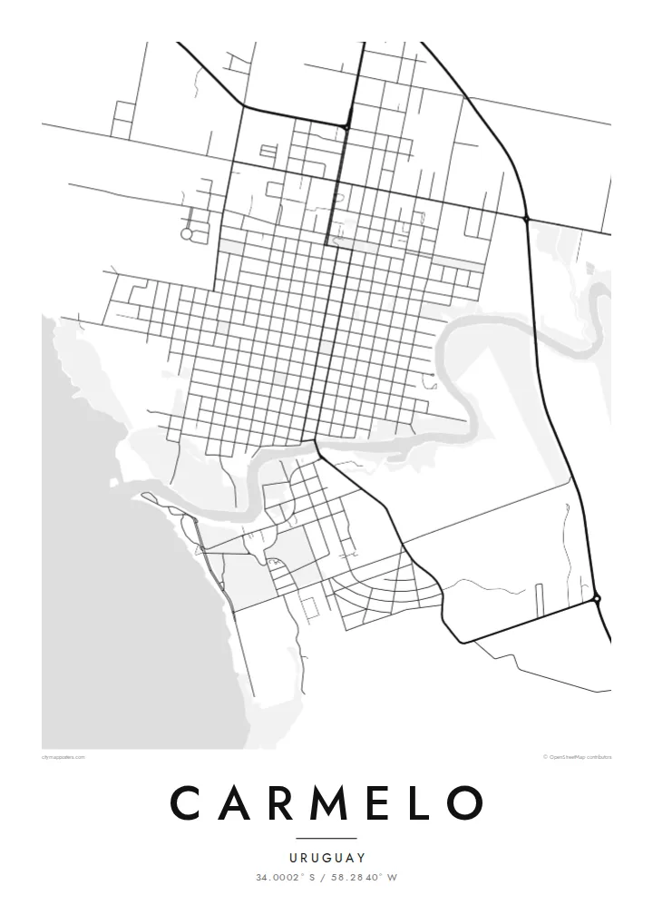
Carmelo sits in the department of Colonia, where the Arroyo de las Vacas meets the wide, brown estuary of the Río de la Plata. The town was founded in 1816 under José Gervasio Artigas. Its plan follows the regular Spanish colonial grid, with square blocks running inland from the waterfront and a central plaza not far from the creek.
The creek is the defining line on the map. It separates the town from the green ground to the south and is crossed by an early twentieth-century swing bridge, the first of its kind in Uruguay and still a local emblem. Boats moor along the arroyo, and launches leave for the Argentine delta across the water.
The Carmelo map poster shows this meeting of grid, creek and estuary with unusual clarity. Streets end cleanly at the shoreline, the arroyo winds out toward the river, and the farmland beyond turns into open space. It is a balanced, legible composition for anyone who knows this quiet corner of western Uruguay.
The creek curves along the edge of town before reaching the Río de la Plata. It separates the grid from the green land opposite and gives the map its main curve.
The historic bridge over the arroyo turns on a pivot to let boats through. It marks the one place where the town's main road crosses the water.
Square blocks laid out in the early nineteenth century run in orderly rows from the plaza toward the river, a pattern that reads crisply in fine black lines.
Agħmlu tiegħek
Żid data, isem jew sentenza tiegħek, ibdel l-istil, id-daqs jew l-orjentazzjoni.
Il-preview b'xejn hija b'riżoluzzjoni baxxa u bil-watermark. L-istampi u l-fajls HD jiġu ġġenerati b'300 DPI, sa 7,200 × 10,800 px, mingħajr watermark.
Għaliex Carmelo
Carmelo draws visitors for its wineries, its calm riverside and the boats to the Paraná delta. For them, and for Uruguayan families with roots here, a map of the town is a simple record of a place that moves more slowly than the capital.
You can edit the title, subtitle and coordinates line, so the poster can carry a name, a wedding date or the year of a trip. Choose Classic black & white, Noir, Paper, Blueprint or Sand. Check the free 900 px preview first, then buy the HD files for $9 or a printed poster.
Ordna l-poster Carmelo| Daqs tal-istampa | Riżoluzzjoni | Fajls |
|---|---|---|
| 30 × 40 cm (11.8 × 15.7″) | 3,543 × 4,724 px | PNG · PDF |
| 29.7 × 42 cm (A3, 11.7 × 16.5″) | 3,508 × 4,961 px | PNG · PDF |
| 42 × 59.4 cm (A2, 16.5 × 23.4″) | 4,961 × 7,016 px | PNG · PDF |
| 45.7 × 61 cm (18 × 24″) | 5,400 × 7,200 px | PNG · PDF |
| 50 × 70 cm (19.7 × 27.6″) | 5,906 × 8,268 px | PNG · PDF |
| 61 × 91.4 cm (24 × 36″) | 7,200 × 10,800 px | PNG · PDF |
Għal paragun, il-preview b'xejn huwa wiesa' 900 px, għandu watermark u huwa maħsub għall-iskrins. Il-fajls HD għandhom sa 8× ir-riżoluzzjoni f'kull direzzjoni u jiġu stampati b'mod nadif fid-daqs sħiħ tal-poster.
Agħżel stil fin-naħa ta' fuq tal-paġna, imbagħad agħżel Poster Stampat — daqs u, jekk trid, kurniċa — jew Fajls Diġitali HD. Il-ħlas isir f'pass wieħed, u l-paġna tal-ordni tiegħek tiġi aġġornata malli l-ħlas jgħaddi.
Jiġi stampat fuq karta matte premium ta' 200 gsm f'wieħed minn sitt daqsijiet, minn 30 × 40 cm sa 24 × 36″. Il-posters stampati jibdew minn {printFrom}, bil-kunsinna inkluża.
Iva. Agħżel kurniċa tal-injam solidu f'iswed, abjad, ballut naturali jew injam skur. Tiġi bi ħġieġ li ma jinkisirx u lesta biex tittella'. Il-posters inkurnati jibdew minn {framedFrom}, bil-kunsinna inkluża.
Il-kunsinna hija b'xejn madwar id-dinja. Kull poster jiġi stampat mill-eqreb sieħeb tal-istampar tagħna f'aktar minn 30 pajjiż u ġeneralment jasal fi 3–7 ijiem tax-xogħol. Tista' ssegwi l-istatus u t-tracking taħt L-Ordnijiet Tiegħi.
Ibgħatilna ritratt fi żmien 14-il jum mill-kunsinna u aħna nistampawh mill-ġdid b'xejn jew nirrimborżawk.
Iva. Fl-editur ta' din il-paġna, biddel it-titlu, is-sottotitlu u l-linja tal-koordinati għal kwalunkwe ħaġa trid, u agħżel stil u daqs. L-ordnijiet stampati, inkurnati u diġitali kollha jużaw eżattament id-disinn tiegħek.
Għal $9 tikseb fajls PNG b'300 DPI u PDF lesti għall-istampar fis-sitt daqsijiet kollha, mingħajr watermark, biex tistampa kullimkien. Għadek mhux ċert? L-ewwel iddawnlowdja preview b'xejn bil-watermark.
