The runway bands
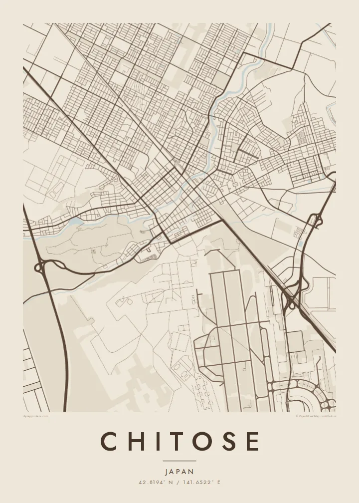
The runways of New Chitose Airport and the adjacent air base run as long, parallel strokes south-east of town. They give the composition a strong linear rhythm that no street pattern could match.
Poster minimalist tal-mappa · il-Ġappun
42.8194° N / 141.6522° E
A grid of streets along the Chitose River, a runway complex to the south, and a caldera lake far to the west


Belt waħda, ħames atmosferi
Agħfas fuq stil biex tarah fuq il-ħajt. Kull stil jiswa l-istess — stampat, inkurnat jew bħala fajls HD.
 Pixels reali · fajl tal-istampar 24 × 36″
Preċiż għall-istampar
Dan huwa qtugħ ta' 100% mill-fajl tal-istampar reali. Kull poster — stampat, inkurnat jew iddawnlowdjat — jiġi ġġenerat fuq is-servers tagħna b'300 DPI, sa 7,200 × 10,800 pixel, biex saħansitra l-iżgħar toroq jibqgħu ċari fuq stampa ta' 24 × 36″.
Fuq il-ħajt


Il-mappa
Chitose sits on the flat, open ground of the Ishikari lowland in western Hokkaido, and from above its streets fall into a regular grid. The Chitose River runs through the town centre as a soft curving line. Wide avenues, rail tracks and long straight roads lead out towards farmland and forest.
The town is known across Japan as the home of New Chitose Airport, the main air gateway to Sapporo and the rest of Hokkaido. On a map the long parallel runways, together with those of the neighbouring air base, form sharp geometric bands. Nothing else in the region has lines this long and straight.
Farther west the municipality reaches Lake Shikotsu, a deep caldera lake ringed by forested volcanic hills. A Chitose map poster can frame the compact urban grid alone, or pull back far enough to show how the town sits between runway, river and a large round body of water.
The runways of New Chitose Airport and the adjacent air base run as long, parallel strokes south-east of town. They give the composition a strong linear rhythm that no street pattern could match.
The river threads through the centre in gentle bends. Against the orthogonal blocks around it, it adds the one flowing line in an otherwise measured, planned-looking street plan.
At the western edge of the municipality lies the broad caldera lake, a near-round expanse of water surrounded by volcanic slopes. It shows up in wider framings as a clean, dark shape.
Agħmlu tiegħek
Żid data, isem jew sentenza tiegħek, ibdel l-istil, id-daqs jew l-orjentazzjoni.
Il-preview b'xejn hija b'riżoluzzjoni baxxa u bil-watermark. L-istampi u l-fajls HD jiġu ġġenerati b'300 DPI, sa 7,200 × 10,800 px, mingħajr watermark.
Għaliex Chitose
For many travellers Chitose is the first and last glimpse of Hokkaido, whether they came for ski trips, summer drives or family visits. A poster of the town keeps hold of that point of arrival, and for people stationed or raised here it is simply home.
You can title the print Chitose, add a flight date or a year in the subtitle, and keep or edit the coordinates line. Blueprint suits the runway geometry. Paper or Sand give the lake and forest a softer, warmer feel.
Ordna l-poster Chitose| Daqs tal-istampa | Riżoluzzjoni | Fajls |
|---|---|---|
| 30 × 40 cm (11.8 × 15.7″) | 3,543 × 4,724 px | PNG · PDF |
| 29.7 × 42 cm (A3, 11.7 × 16.5″) | 3,508 × 4,961 px | PNG · PDF |
| 42 × 59.4 cm (A2, 16.5 × 23.4″) | 4,961 × 7,016 px | PNG · PDF |
| 45.7 × 61 cm (18 × 24″) | 5,400 × 7,200 px | PNG · PDF |
| 50 × 70 cm (19.7 × 27.6″) | 5,906 × 8,268 px | PNG · PDF |
| 61 × 91.4 cm (24 × 36″) | 7,200 × 10,800 px | PNG · PDF |
Għal paragun, il-preview b'xejn huwa wiesa' 900 px, għandu watermark u huwa maħsub għall-iskrins. Il-fajls HD għandhom sa 8× ir-riżoluzzjoni f'kull direzzjoni u jiġu stampati b'mod nadif fid-daqs sħiħ tal-poster.
Agħżel stil fin-naħa ta' fuq tal-paġna, imbagħad agħżel Poster Stampat — daqs u, jekk trid, kurniċa — jew Fajls Diġitali HD. Il-ħlas isir f'pass wieħed, u l-paġna tal-ordni tiegħek tiġi aġġornata malli l-ħlas jgħaddi.
Jiġi stampat fuq karta matte premium ta' 200 gsm f'wieħed minn sitt daqsijiet, minn 30 × 40 cm sa 24 × 36″. Il-posters stampati jibdew minn {printFrom}, bil-kunsinna inkluża.
Iva. Agħżel kurniċa tal-injam solidu f'iswed, abjad, ballut naturali jew injam skur. Tiġi bi ħġieġ li ma jinkisirx u lesta biex tittella'. Il-posters inkurnati jibdew minn {framedFrom}, bil-kunsinna inkluża.
Il-kunsinna hija b'xejn madwar id-dinja. Kull poster jiġi stampat mill-eqreb sieħeb tal-istampar tagħna f'aktar minn 30 pajjiż u ġeneralment jasal fi 3–7 ijiem tax-xogħol. Tista' ssegwi l-istatus u t-tracking taħt L-Ordnijiet Tiegħi.
Ibgħatilna ritratt fi żmien 14-il jum mill-kunsinna u aħna nistampawh mill-ġdid b'xejn jew nirrimborżawk.
Iva. Fl-editur ta' din il-paġna, biddel it-titlu, is-sottotitlu u l-linja tal-koordinati għal kwalunkwe ħaġa trid, u agħżel stil u daqs. L-ordnijiet stampati, inkurnati u diġitali kollha jużaw eżattament id-disinn tiegħek.
Għal $9 tikseb fajls PNG b'300 DPI u PDF lesti għall-istampar fis-sitt daqsijiet kollha, mingħajr watermark, biex tistampa kullimkien. Għadek mhux ċert? L-ewwel iddawnlowdja preview b'xejn bil-watermark.
