Ginza grid
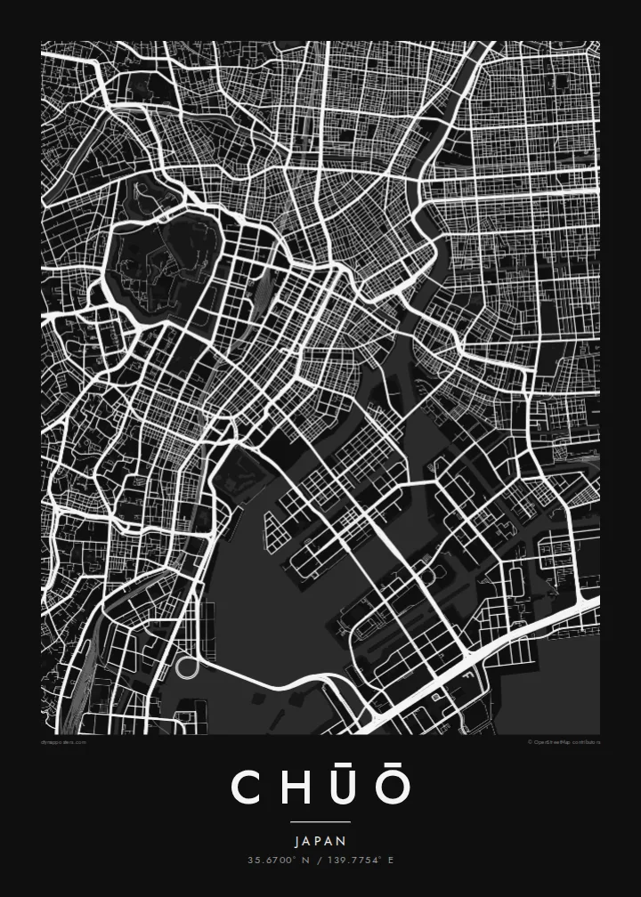
Ginza's regular blocks and main avenues form one of the most orderly street patterns in Tokyo. On the map it sits between former canal routes.
Poster minimalist tal-mappa · il-Ġappun
35.6700° N / 139.7754° E
Tokyo's historic commercial heart between the Imperial moats and the Sumida, extending onto reclaimed islands in the bay



Belt waħda, ħames atmosferi
Agħfas fuq stil biex tarah fuq il-ħajt. Kull stil jiswa l-istess — stampat, inkurnat jew bħala fajls HD.
 Pixels reali · fajl tal-istampar 24 × 36″
Preċiż għall-istampar
Dan huwa qtugħ ta' 100% mill-fajl tal-istampar reali. Kull poster — stampat, inkurnat jew iddawnlowdjat — jiġi ġġenerat fuq is-servers tagħna b'300 DPI, sa 7,200 × 10,800 pixel, biex saħansitra l-iżgħar toroq jibqgħu ċari fuq stampa ta' 24 × 36″.
Fuq il-ħajt


Il-mappa
Chūō is one of Tokyo's central wards, lying between the area around the Imperial Palace and Tokyo Bay. It includes Nihonbashi, the old merchant district, and Ginza, famous for department stores and shopping. In the Edo period, the Nihonbashi bridge was the starting point of the main roads out of the city, and road distances in Japan are still measured from a marker there.
The ward's map is shaped by water. The Sumida River runs along its eastern side, and canals and old moats once surrounded the commercial districts. Some of these are now covered by expressways. To the southeast, the islands of Tsukishima, Kachidoki and Harumi were built on reclaimed land in the bay and are now filled with apartment towers.
A Chūō map poster shows the tight grid of Ginza and Nihonbashi, the wide Sumida, and the geometric outlines of the reclaimed islands. Few parts of Tokyo show so clearly how the city has grown out into the water. It makes a precise and detailed print for anyone who has worked, shopped or lived in the centre of Tokyo.
Ginza's regular blocks and main avenues form one of the most orderly street patterns in Tokyo. On the map it sits between former canal routes.
The old merchant district around the famous bridge, which served as the Edo-period starting point for the main roads leading out of the city.
Tsukishima, Kachidoki and Harumi extend into Tokyo Bay as angular blocks of reclaimed land, connected to the rest of the city by long bridges.
Agħmlu tiegħek
Żid data, isem jew sentenza tiegħek, ibdel l-istil, id-daqs jew l-orjentazzjoni.
Il-preview b'xejn hija b'riżoluzzjoni baxxa u bil-watermark. L-istampi u l-fajls HD jiġu ġġenerati b'300 DPI, sa 7,200 × 10,800 px, mingħajr watermark.
Għaliex Chūō
For many people, Chūō is the part of Tokyo where they worked, stayed or walked on their first visit. The map puts Ginza, Nihonbashi and the Sumida together in one clear view.
You can personalise the title, subtitle and coordinates, for example with an office address or the year of a trip. Choose one of five styles: Classic black & white, Noir, Paper, Blueprint or Sand. Noir suits the dense grid especially well.
Ordna l-poster Chūō| Daqs tal-istampa | Riżoluzzjoni | Fajls |
|---|---|---|
| 30 × 40 cm (11.8 × 15.7″) | 3,543 × 4,724 px | PNG · PDF |
| 29.7 × 42 cm (A3, 11.7 × 16.5″) | 3,508 × 4,961 px | PNG · PDF |
| 42 × 59.4 cm (A2, 16.5 × 23.4″) | 4,961 × 7,016 px | PNG · PDF |
| 45.7 × 61 cm (18 × 24″) | 5,400 × 7,200 px | PNG · PDF |
| 50 × 70 cm (19.7 × 27.6″) | 5,906 × 8,268 px | PNG · PDF |
| 61 × 91.4 cm (24 × 36″) | 7,200 × 10,800 px | PNG · PDF |
Għal paragun, il-preview b'xejn huwa wiesa' 900 px, għandu watermark u huwa maħsub għall-iskrins. Il-fajls HD għandhom sa 8× ir-riżoluzzjoni f'kull direzzjoni u jiġu stampati b'mod nadif fid-daqs sħiħ tal-poster.
Agħżel stil fin-naħa ta' fuq tal-paġna, imbagħad agħżel Poster Stampat — daqs u, jekk trid, kurniċa — jew Fajls Diġitali HD. Il-ħlas isir f'pass wieħed, u l-paġna tal-ordni tiegħek tiġi aġġornata malli l-ħlas jgħaddi.
Jiġi stampat fuq karta matte premium ta' 200 gsm f'wieħed minn sitt daqsijiet, minn 30 × 40 cm sa 24 × 36″. Il-posters stampati jibdew minn {printFrom}, bil-kunsinna inkluża.
Iva. Agħżel kurniċa tal-injam solidu f'iswed, abjad, ballut naturali jew injam skur. Tiġi bi ħġieġ li ma jinkisirx u lesta biex tittella'. Il-posters inkurnati jibdew minn {framedFrom}, bil-kunsinna inkluża.
Il-kunsinna hija b'xejn madwar id-dinja. Kull poster jiġi stampat mill-eqreb sieħeb tal-istampar tagħna f'aktar minn 30 pajjiż u ġeneralment jasal fi 3–7 ijiem tax-xogħol. Tista' ssegwi l-istatus u t-tracking taħt L-Ordnijiet Tiegħi.
Ibgħatilna ritratt fi żmien 14-il jum mill-kunsinna u aħna nistampawh mill-ġdid b'xejn jew nirrimborżawk.
Iva. Fl-editur ta' din il-paġna, biddel it-titlu, is-sottotitlu u l-linja tal-koordinati għal kwalunkwe ħaġa trid, u agħżel stil u daqs. L-ordnijiet stampati, inkurnati u diġitali kollha jużaw eżattament id-disinn tiegħek.
Għal $9 tikseb fajls PNG b'300 DPI u PDF lesti għall-istampar fis-sitt daqsijiet kollha, mingħajr watermark, biex tistampa kullimkien. Għadek mhux ċert? L-ewwel iddawnlowdja preview b'xejn bil-watermark.
