Wizard Island
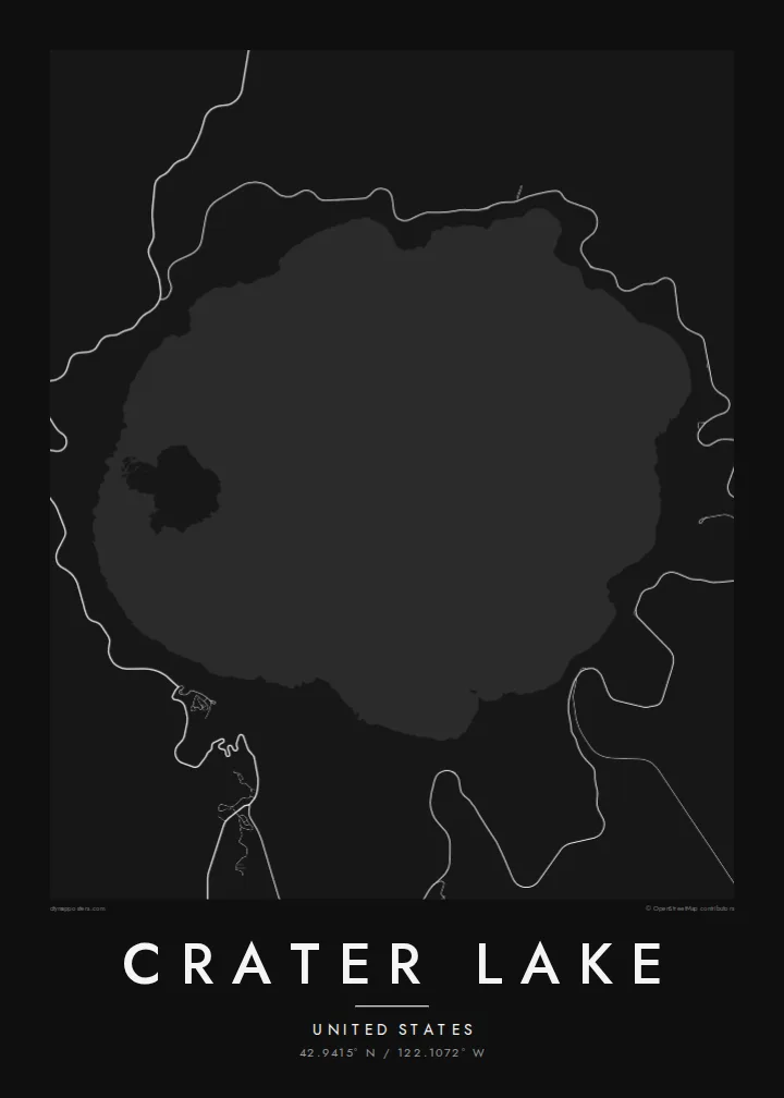
A volcanic cinder cone near the western shore that rises above the water with a small crater at its top, clearly visible as a round mark on the map.
Poster minimalist tal-mappa · l-Istati Uniti
42.9415° N / 122.1072° W
A near-perfect circle of deep water inside a collapsed volcano, with a small cinder cone island near its western rim



Belt waħda, ħames atmosferi
Agħfas fuq stil biex tarah fuq il-ħajt. Kull stil jiswa l-istess — stampat, inkurnat jew bħala fajls HD.
 Pixels reali · fajl tal-istampar 24 × 36″
Preċiż għall-istampar
Dan huwa qtugħ ta' 100% mill-fajl tal-istampar reali. Kull poster — stampat, inkurnat jew iddawnlowdjat — jiġi ġġenerat fuq is-servers tagħna b'300 DPI, sa 7,200 × 10,800 pixel, biex saħansitra l-iżgħar toroq jibqgħu ċari fuq stampa ta' 24 × 36″.
Fuq il-ħajt


Il-mappa
Crater Lake fills the caldera left when Mount Mazama collapsed after a major eruption about 7,700 years ago. From above it is almost circular, enclosed by steep caldera walls, with no rivers flowing in or out. It is fed by rain and snow, which is one reason its water is so clear.
It is the deepest lake in the United States, reaching roughly 590 metres. Near the western shore, Wizard Island rises as a cone with its own small summit crater, and to the southeast the small rock formation called Phantom Ship sits low on the water. Rim Drive traces a loop around the caldera edge.
A Crater Lake map poster is one of the most geometric lake maps you can hang. The round basin, the ring road hugging the rim and the single island produce a composition that feels almost designed. Crater Lake National Park, Oregon's only national park, surrounds it with open forest, so the lines outside the caldera stay sparse.
A volcanic cinder cone near the western shore that rises above the water with a small crater at its top, clearly visible as a round mark on the map.
A scenic road follows the caldera rim around the lake, drawing a loop that frames the water like a border.
With no inflowing or outflowing rivers, the lake is a closed circle, its edge defined entirely by the steep walls of the collapsed volcano.
Agħmlu tiegħek
Żid data, isem jew sentenza tiegħek, ibdel l-istil, id-daqs jew l-orjentazzjoni.
Il-preview b'xejn hija b'riżoluzzjoni baxxa u bil-watermark. L-istampi u l-fajls HD jiġu ġġenerati b'300 DPI, sa 7,200 × 10,800 px, mingħajr watermark.
Għaliex Crater Lake
Crater Lake is a stop on many western road trips and a favourite national park for people who have stood on the rim. The round outline makes a strong, symmetrical poster that suits minimalist interiors.
You can personalise the title, subtitle and coordinates, then choose Classic black & white, Noir, Paper, Blueprint or Sand. The $9 digital pack includes 18×24″ and 24×36″ among six sizes, or order a matte print with an optional wooden frame.
Ordna l-poster Crater Lake| Daqs tal-istampa | Riżoluzzjoni | Fajls |
|---|---|---|
| 30 × 40 cm11.8 × 15.7″ | 3,543 × 4,724 px | PNG · PDF |
| 29.7 × 42 cm (A3)11.7 × 16.5″ | 3,508 × 4,961 px | PNG · PDF |
| 42 × 59.4 cm (A2)16.5 × 23.4″ | 4,961 × 7,016 px | PNG · PDF |
| 45.7 × 61 cm18 × 24″ | 5,400 × 7,200 px | PNG · PDF |
| 50 × 70 cm19.7 × 27.6″ | 5,906 × 8,268 px | PNG · PDF |
| 61 × 91.4 cm24 × 36″ | 7,200 × 10,800 px | PNG · PDF |
Għal paragun, il-preview b'xejn huwa wiesa' 900 px, għandu watermark u huwa maħsub għall-iskrins. Il-fajls HD għandhom sa 8× ir-riżoluzzjoni f'kull direzzjoni u jiġu stampati b'mod nadif fid-daqs sħiħ tal-poster.
Agħżel stil fin-naħa ta' fuq tal-paġna, imbagħad agħżel Poster Stampat — daqs u, jekk trid, kurniċa — jew Fajls Diġitali HD. Il-ħlas isir f'pass wieħed, u l-paġna tal-ordni tiegħek tiġi aġġornata malli l-ħlas jgħaddi.
Jiġi stampat fuq karta matte premium ta' 200 gsm f'wieħed minn sitt daqsijiet, minn 30 × 40 cm sa 24 × 36″. Il-posters stampati jibdew minn $39, bil-kunsinna inkluża.
Iva. Agħżel kurniċa tal-injam solidu f'iswed, abjad, ballut naturali jew injam skur. Tiġi bi ħġieġ li ma jinkisirx u lesta biex tittella'. Il-posters inkurnati jibdew minn $99, bil-kunsinna inkluża.
It-tbaħħir huwa b'xejn lejn 60+ pajjiż. Kull poster jiġi stampat mill-eqreb wieħed mis-sieħba tal-istampar tagħna f'30+ pajjiż u normalment jaslek fi 3–7 ijiem tax-xogħol. Tista' ssegwi l-istatus u t-traċċar taħt L-Ordnijiet Tiegħi. Xi pajjiżi jieħdu 2–5 ġimgħat, u fejn għadna ma nibagħtux, is-sit jgħidlek qabel tħallas.
Ibgħatilna ritratt fi żmien 14-il jum mill-kunsinna u aħna nistampawh mill-ġdid b'xejn jew nirrimborżawk.
Iva. Fl-editur ta' din il-paġna, biddel it-titlu, is-sottotitlu u l-linja tal-koordinati għal kwalunkwe ħaġa trid, u agħżel stil u daqs. L-ordnijiet stampati, inkurnati u diġitali kollha jużaw eżattament id-disinn tiegħek.
Għal $9 tikseb fajls PNG b'300 DPI u PDF lesti għall-istampar fis-sitt daqsijiet kollha, mingħajr watermark, biex tistampa kullimkien. Għadek mhux ċert? L-ewwel iddawnlowdja preview b'xejn bil-watermark.
