Via Emilia axis
The Roman road crosses the city as one long, unbroken line. It links the eastern and western gates and passes straight through the central square, giving the whole plan its main spine.
Poster minimalist tal-mappa · l-Italja
44.2218° N / 12.0414° E
A compact Romagna city laid along the straight Via Emilia, with a dense old core and the Montone river curving past its western edge



Belt waħda, ħames atmosferi
Agħfas fuq stil biex tarah fuq il-ħajt. Kull stil jiswa l-istess — stampat, inkurnat jew bħala fajls HD.
 Pixels reali · fajl tal-istampar 24 × 36″
Preċiż għall-istampar
Dan huwa qtugħ ta' 100% mill-fajl tal-istampar reali. Kull poster — stampat, inkurnat jew iddawnlowdjat — jiġi ġġenerat fuq is-servers tagħna b'300 DPI, sa 7,200 × 10,800 pixel, biex saħansitra l-iżgħar toroq jibqgħu ċari fuq stampa ta' 24 × 36″.
Fuq il-ħajt


Il-mappa
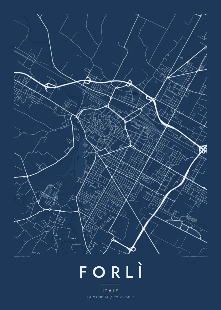
Forlì sits on the flat plain of Romagna, where the Roman Via Emilia runs dead straight from Bologna towards the Adriatic. On a map, that ancient road cuts through the middle of the city. The historic centre gathers around it in a tight knot of lanes, and wider twentieth-century avenues open out towards the railway station.
The heart of the old town is Piazza Aurelio Saffi, a large square with the abbey of San Mercuriale and its tall bell tower on one side. To the south-west stands the Rocca di Ravaldino, the fortress Caterina Sforza held against Cesare Borgia's troops at the end of the fifteenth century. On paper it appears as a solid angular block.
A Forlì map poster shows the contrast between the irregular medieval blocks and the planned axis of Viale della Libertà, lined with rationalist buildings from the 1930s. Farther out, the Montone and Ronco rivers pass on either side of the city and orchards stretch across the plain, so the streets fade gradually into field boundaries.
The Roman road crosses the city as one long, unbroken line. It links the eastern and western gates and passes straight through the central square, giving the whole plan its main spine.
A broad open space in the middle of the dense core. On the map it reads as a clear void among small blocks, with San Mercuriale marking its eastern side.
The Renaissance fortress on the south-western edge of the centre keeps its compact, geometric outline, still set apart from the surrounding streets by open ground.
Agħmlu tiegħek
Żid data, isem jew sentenza tiegħek, ibdel l-istil, id-daqs jew l-orjentazzjoni.
Il-preview b'xejn hija b'riżoluzzjoni baxxa u bil-watermark. L-istampi u l-fajls HD jiġu ġġenerati b'300 DPI, sa 7,200 × 10,800 px, mingħajr watermark.
Għaliex Forlì
Forlì tends to go on the wall of people who studied, married or grew up in Romagna and want a reminder that feels specific without being loud. The straight Roman road and the tight old centre make a composition that still looks balanced from across a room.
You can change the title, subtitle and coordinates line to mark a street, a year or a family name. Choose Classic black & white, Noir, Paper, Blueprint or Sand, depending on whether you want crisp contrast or a warmer, softer finish.
Ordna l-poster Forlì| Daqs tal-istampa | Riżoluzzjoni | Fajls |
|---|---|---|
| 30 × 40 cm (11.8 × 15.7″) | 3,543 × 4,724 px | PNG · PDF |
| 29.7 × 42 cm (A3, 11.7 × 16.5″) | 3,508 × 4,961 px | PNG · PDF |
| 42 × 59.4 cm (A2, 16.5 × 23.4″) | 4,961 × 7,016 px | PNG · PDF |
| 45.7 × 61 cm (18 × 24″) | 5,400 × 7,200 px | PNG · PDF |
| 50 × 70 cm (19.7 × 27.6″) | 5,906 × 8,268 px | PNG · PDF |
| 61 × 91.4 cm (24 × 36″) | 7,200 × 10,800 px | PNG · PDF |
Għal paragun, il-preview b'xejn huwa wiesa' 900 px, għandu watermark u huwa maħsub għall-iskrins. Il-fajls HD għandhom sa 8× ir-riżoluzzjoni f'kull direzzjoni u jiġu stampati b'mod nadif fid-daqs sħiħ tal-poster.
Agħżel stil fin-naħa ta' fuq tal-paġna, imbagħad agħżel Poster Stampat — daqs u, jekk trid, kurniċa — jew Fajls Diġitali HD. Il-ħlas isir f'pass wieħed, u l-paġna tal-ordni tiegħek tiġi aġġornata malli l-ħlas jgħaddi.
Jiġi stampat fuq karta matte premium ta' 200 gsm f'wieħed minn sitt daqsijiet, minn 30 × 40 cm sa 24 × 36″. Il-posters stampati jibdew minn {printFrom}, bil-kunsinna inkluża.
Iva. Agħżel kurniċa tal-injam solidu f'iswed, abjad, ballut naturali jew injam skur. Tiġi bi ħġieġ li ma jinkisirx u lesta biex tittella'. Il-posters inkurnati jibdew minn {framedFrom}, bil-kunsinna inkluża.
Il-kunsinna hija b'xejn madwar id-dinja. Kull poster jiġi stampat mill-eqreb sieħeb tal-istampar tagħna f'aktar minn 30 pajjiż u ġeneralment jasal fi 3–7 ijiem tax-xogħol. Tista' ssegwi l-istatus u t-tracking taħt L-Ordnijiet Tiegħi.
Ibgħatilna ritratt fi żmien 14-il jum mill-kunsinna u aħna nistampawh mill-ġdid b'xejn jew nirrimborżawk.
Iva. Fl-editur ta' din il-paġna, biddel it-titlu, is-sottotitlu u l-linja tal-koordinati għal kwalunkwe ħaġa trid, u agħżel stil u daqs. L-ordnijiet stampati, inkurnati u diġitali kollha jużaw eżattament id-disinn tiegħek.
Għal $9 tikseb fajls PNG b'300 DPI u PDF lesti għall-istampar fis-sitt daqsijiet kollha, mingħajr watermark, biex tistampa kullimkien. Għadek mhux ċert? L-ewwel iddawnlowdja preview b'xejn bil-watermark.
