Rounded outline
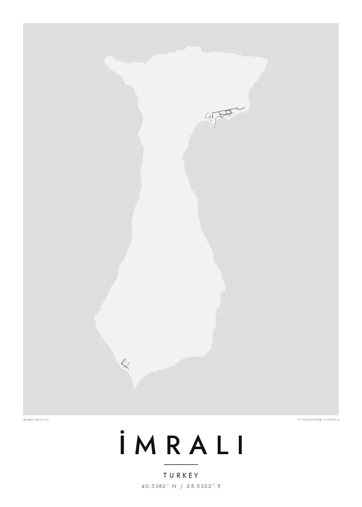
The island's coast is smooth and only lightly indented. The map shows a compact, soft-edged form surrounded by a wide stretch of open water.
Poster minimalist tal-mappa · it-Turkija
40.5382° N / 28.5352° E
A compact, hilly island in the southern Sea of Marmara, with a smooth coastline and few marked features.


Belt waħda, ħames atmosferi
Agħfas fuq stil biex tarah fuq il-ħajt. Kull stil jiswa l-istess — stampat, inkurnat jew bħala fajls HD.
 Pixels reali · fajl tal-istampar 24 × 36″
Preċiż għall-istampar
Dan huwa qtugħ ta' 100% mill-fajl tal-istampar reali. Kull poster — stampat, inkurnat jew iddawnlowdjat — jiġi ġġenerat fuq is-servers tagħna b'300 DPI, sa 7,200 × 10,800 pixel, biex saħansitra l-iżgħar toroq jibqgħu ċari fuq stampa ta' 24 × 36″.
Fuq il-ħajt


Il-mappa
İmralı lies in the southern Sea of Marmara, near the mouth of the Gulf of Gemlik and within sight of the Bursa coastline. On a map it is a small, rounded island with a gently curving outline and a hilly interior. It has almost no marked roads or settlements. Its shape is simple, closer to a pebble than to the jagged islands of the Aegean.
The island has served as a prison since the 1930s, and access has long been limited to the authorities. Since 1999 it has held Abdullah Öcalan, which has made the name widely known in Turkey and abroad. The island therefore stays largely closed to visitors, and maps show few details of its interior.
From the Marmara coast it sits low on the horizon between the mainland and open water. An İmralı map poster treats the island purely as geography: a clean outline in the sea, with the surrounding coast and water giving scale to a place better known by name than by sight.
The island's coast is smooth and only lightly indented. The map shows a compact, soft-edged form surrounded by a wide stretch of open water.
The island lies near the mouth of the Gulf of Gemlik, between the southern coast and the open sea, which frames it clearly on the page.
Access is restricted and there has been little development, so the interior carries few roads or buildings. The hills alone define the map.
Agħmlu tiegħek
Żid data, isem jew sentenza tiegħek, ibdel l-istil, id-daqs jew l-orjentazzjoni.
Il-preview b'xejn hija b'riżoluzzjoni baxxa u bil-watermark. L-istampi u l-fajls HD jiġu ġġenerati b'300 DPI, sa 7,200 × 10,800 px, mingħajr watermark.
Għaliex İmralı
Some people want the island for its place in modern Turkish history, others simply for its shape in the Marmara. Either way the print is restrained and neutral, a piece of geography rather than a statement on the wall.
Change the title and subtitle to suit your purpose, keep the coordinates line, and pick from five styles, such as Classic black & white or Paper. The free watermarked preview lets you check the framing before you choose files or a print.
Ordna l-poster İmralı| Daqs tal-istampa | Riżoluzzjoni | Fajls |
|---|---|---|
| 30 × 40 cm (11.8 × 15.7″) | 3,543 × 4,724 px | PNG · PDF |
| 29.7 × 42 cm (A3, 11.7 × 16.5″) | 3,508 × 4,961 px | PNG · PDF |
| 42 × 59.4 cm (A2, 16.5 × 23.4″) | 4,961 × 7,016 px | PNG · PDF |
| 45.7 × 61 cm (18 × 24″) | 5,400 × 7,200 px | PNG · PDF |
| 50 × 70 cm (19.7 × 27.6″) | 5,906 × 8,268 px | PNG · PDF |
| 61 × 91.4 cm (24 × 36″) | 7,200 × 10,800 px | PNG · PDF |
Għal paragun, il-preview b'xejn huwa wiesa' 900 px, għandu watermark u huwa maħsub għall-iskrins. Il-fajls HD għandhom sa 8× ir-riżoluzzjoni f'kull direzzjoni u jiġu stampati b'mod nadif fid-daqs sħiħ tal-poster.
Agħżel stil fin-naħa ta' fuq tal-paġna, imbagħad agħżel Poster Stampat — daqs u, jekk trid, kurniċa — jew Fajls Diġitali HD. Il-ħlas isir f'pass wieħed, u l-paġna tal-ordni tiegħek tiġi aġġornata malli l-ħlas jgħaddi.
Jiġi stampat fuq karta matte premium ta' 200 gsm f'wieħed minn sitt daqsijiet, minn 30 × 40 cm sa 24 × 36″. Il-posters stampati jibdew minn {printFrom}, bil-kunsinna inkluża.
Iva. Agħżel kurniċa tal-injam solidu f'iswed, abjad, ballut naturali jew injam skur. Tiġi bi ħġieġ li ma jinkisirx u lesta biex tittella'. Il-posters inkurnati jibdew minn {framedFrom}, bil-kunsinna inkluża.
Il-kunsinna hija b'xejn madwar id-dinja. Kull poster jiġi stampat mill-eqreb sieħeb tal-istampar tagħna f'aktar minn 30 pajjiż u ġeneralment jasal fi 3–7 ijiem tax-xogħol. Tista' ssegwi l-istatus u t-tracking taħt L-Ordnijiet Tiegħi.
Ibgħatilna ritratt fi żmien 14-il jum mill-kunsinna u aħna nistampawh mill-ġdid b'xejn jew nirrimborżawk.
Iva. Fl-editur ta' din il-paġna, biddel it-titlu, is-sottotitlu u l-linja tal-koordinati għal kwalunkwe ħaġa trid, u agħżel stil u daqs. L-ordnijiet stampati, inkurnati u diġitali kollha jużaw eżattament id-disinn tiegħek.
Għal $9 tikseb fajls PNG b'300 DPI u PDF lesti għall-istampar fis-sitt daqsijiet kollha, mingħajr watermark, biex tistampa kullimkien. Għadek mhux ċert? L-ewwel iddawnlowdja preview b'xejn bil-watermark.
