Lake Timsah
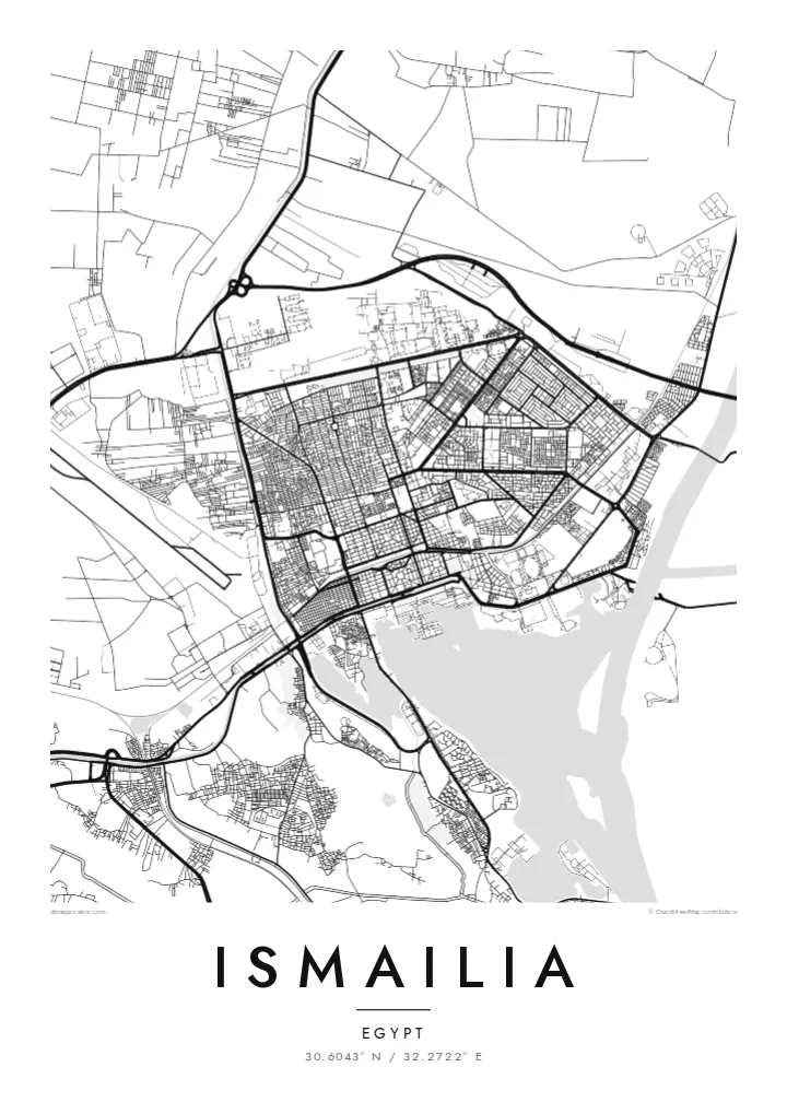
The lake forms a broad open shape at the edge of the city, with the Suez Canal passing through it. Beaches and gardens line the shore facing the water.
Poster minimalist tal-mappa · l-Eġittu
30.6043° N / 32.2722° E
A canal town laid out on the shore of Lake Timsah, halfway along the Suez Canal, with a gridded garden quarter.


Belt waħda, ħames atmosferi
Agħfas fuq stil biex tarah fuq il-ħajt. Kull stil jiswa l-istess — stampat, inkurnat jew bħala fajls HD.
 Pixels reali · fajl tal-istampar 24 × 36″
Preċiż għall-istampar
Dan huwa qtugħ ta' 100% mill-fajl tal-istampar reali. Kull poster — stampat, inkurnat jew iddawnlowdjat — jiġi ġġenerat fuq is-servers tagħna b'300 DPI, sa 7,200 × 10,800 pixel, biex saħansitra l-iżgħar toroq jibqgħu ċari fuq stampa ta' 24 × 36″.
Fuq il-ħajt


Il-mappa
Ismailia was founded in 1863 as a base for the construction of the Suez Canal and named after Khedive Ismail. It stands on the north-western shore of Lake Timsah, roughly midway between Port Said and Suez, and the map is dominated by water: the lake, the straight line of the canal running through it, and the freshwater Ismailia Canal bringing Nile water across the desert.
The original town was planned in a clear grid, with a European quarter of broad streets, villas and gardens that still gives Ismailia a greener, more orderly look than many Egyptian cities. The Suez Canal Authority has its headquarters here, and the waterfront toward the lake is lined with public gardens and small beaches.
Beyond the grid, newer districts spread along the roads to Cairo, Port Said and Suez, and the desert presses close on the edges of the map. An Ismailia map poster brings these layers together: a nineteenth-century planned town, a lake that the canal passes through, and a thin green line of irrigation cutting across the sand.
The lake forms a broad open shape at the edge of the city, with the Suez Canal passing through it. Beaches and gardens line the shore facing the water.
The original planned district has a regular grid of wide streets and villas set among trees, one of the clearest examples of nineteenth-century town planning in Egypt.
A freshwater canal from the Nile reaches the city from the west, a thin line of water and green fields crossing otherwise empty desert on the map.
Agħmlu tiegħek
Żid data, isem jew sentenza tiegħek, ibdel l-istil, id-daqs jew l-orjentazzjoni.
Il-preview b'xejn hija b'riżoluzzjoni baxxa u bil-watermark. L-istampi u l-fajls HD jiġu ġġenerati b'300 DPI, sa 7,200 × 10,800 px, mingħajr watermark.
Għaliex Ismailia
Ismailia is a city many Egyptians associate with calm streets, the lake and the ships passing along the canal. The map works as a keepsake for residents, for people who studied or served there, and for anyone fascinated by the history of the canal.
Personalise the title, subtitle and coordinates line, then choose from five styles: Classic black & white, Noir, Paper, Blueprint or Sand. Blueprint suits the engineering story of the canal particularly well. Printed posters come on matte paper with an optional wooden frame.
Ordna l-poster Ismailia| Daqs tal-istampa | Riżoluzzjoni | Fajls |
|---|---|---|
| 30 × 40 cm11.8 × 15.7″ | 3,543 × 4,724 px | PNG · PDF |
| 29.7 × 42 cm (A3)11.7 × 16.5″ | 3,508 × 4,961 px | PNG · PDF |
| 42 × 59.4 cm (A2)16.5 × 23.4″ | 4,961 × 7,016 px | PNG · PDF |
| 45.7 × 61 cm18 × 24″ | 5,400 × 7,200 px | PNG · PDF |
| 50 × 70 cm19.7 × 27.6″ | 5,906 × 8,268 px | PNG · PDF |
| 61 × 91.4 cm24 × 36″ | 7,200 × 10,800 px | PNG · PDF |
Għal paragun, il-preview b'xejn huwa wiesa' 900 px, għandu watermark u huwa maħsub għall-iskrins. Il-fajls HD għandhom sa 8× ir-riżoluzzjoni f'kull direzzjoni u jiġu stampati b'mod nadif fid-daqs sħiħ tal-poster.
Agħżel stil fin-naħa ta' fuq tal-paġna, imbagħad agħżel Poster Stampat — daqs u, jekk trid, kurniċa — jew Fajls Diġitali HD. Il-ħlas isir f'pass wieħed, u l-paġna tal-ordni tiegħek tiġi aġġornata malli l-ħlas jgħaddi.
Jiġi stampat fuq karta matte premium ta' 200 gsm f'wieħed minn sitt daqsijiet, minn 30 × 40 cm sa 24 × 36″. Il-posters stampati jibdew minn $39, bil-kunsinna inkluża.
Iva. Agħżel kurniċa tal-injam solidu f'iswed, abjad, ballut naturali jew injam skur. Tiġi bi ħġieġ li ma jinkisirx u lesta biex tittella'. Il-posters inkurnati jibdew minn $99, bil-kunsinna inkluża.
It-tbaħħir huwa b'xejn lejn 60+ pajjiż. Kull poster jiġi stampat mill-eqreb wieħed mis-sieħba tal-istampar tagħna f'30+ pajjiż u normalment jaslek fi 3–7 ijiem tax-xogħol. Tista' ssegwi l-istatus u t-traċċar taħt L-Ordnijiet Tiegħi. Xi pajjiżi jieħdu 2–5 ġimgħat, u fejn għadna ma nibagħtux, is-sit jgħidlek qabel tħallas.
Ibgħatilna ritratt fi żmien 14-il jum mill-kunsinna u aħna nistampawh mill-ġdid b'xejn jew nirrimborżawk.
Iva. Fl-editur ta' din il-paġna, biddel it-titlu, is-sottotitlu u l-linja tal-koordinati għal kwalunkwe ħaġa trid, u agħżel stil u daqs. L-ordnijiet stampati, inkurnati u diġitali kollha jużaw eżattament id-disinn tiegħek.
Għal $9 tikseb fajls PNG b'300 DPI u PDF lesti għall-istampar fis-sitt daqsijiet kollha, mingħajr watermark, biex tistampa kullimkien. Għadek mhux ċert? L-ewwel iddawnlowdja preview b'xejn bil-watermark.
