BR-101 corridor
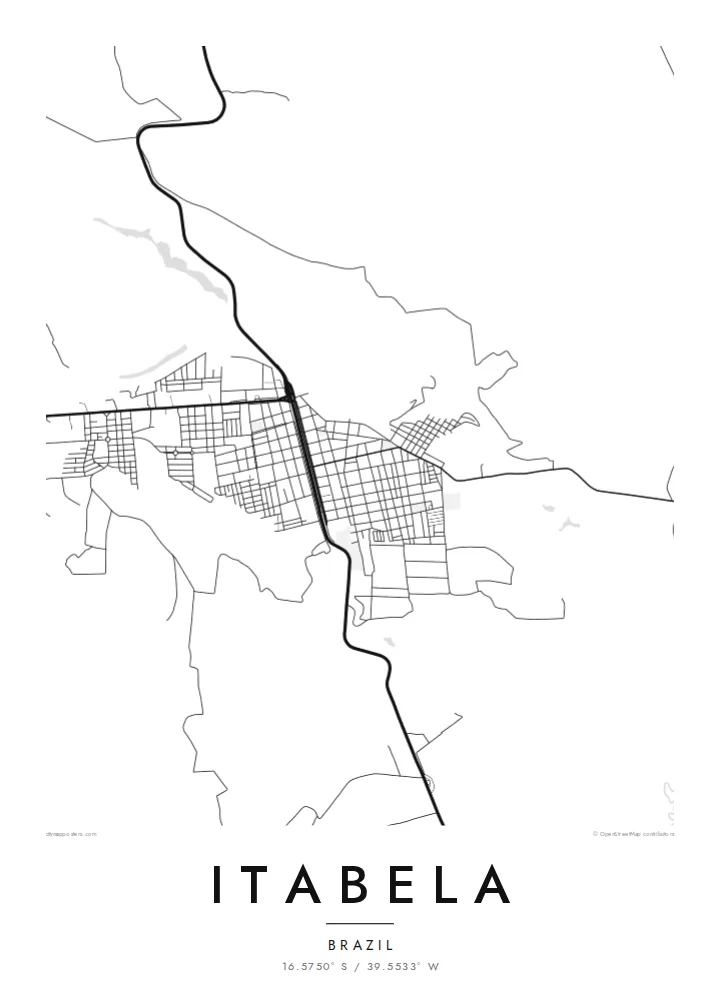
The federal highway runs past the town and forms the main line of the composition. It links Itabela with the other towns of southern Bahia and gives the map its direction.
Poster minimalist tal-mappa · Il-Brażil
16.5750° S / 39.5533° W
A small inland town in southern Bahia, laid along the BR-101 among low hills, pasture and remnants of Atlantic Forest


Belt waħda, ħames atmosferi
Agħfas fuq stil biex tarah fuq il-ħajt. Kull stil jiswa l-istess — stampat, inkurnat jew bħala fajls HD.
 Pixels reali · fajl tal-istampar 24 × 36″
Preċiż għall-istampar
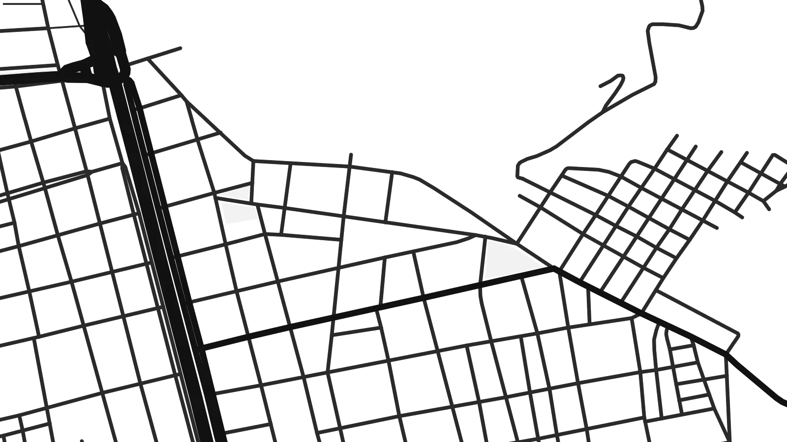
Dan huwa qtugħ ta' 100% mill-fajl tal-istampar reali. Kull poster — stampat, inkurnat jew iddawnlowdjat — jiġi ġġenerat fuq is-servers tagħna b'300 DPI, sa 7,200 × 10,800 pixel, biex saħansitra l-iżgħar toroq jibqgħu ċari fuq stampa ta' 24 × 36″.
Fuq il-ħajt


Il-mappa
Itabela is a municipality in the far south of Bahia, Brazil, inland from the coast around Porto Seguro. The town lies along the BR-101 corridor, the highway that runs parallel to the Atlantic through this part of the country. From above, a compact grid of streets gathers around the road, surrounded by gently rolling land of pasture, plantations and patches of forest.
The region belongs to the hinterland of the Discovery Coast, where Portuguese sailors first sighted Brazil in 1500. Monte Pascoal, the hill they saw from the sea, lies toward the coast to the south. The surrounding land was once covered by Atlantic Forest, and fragments of it remain among the farms.
An Itabela map poster shows a modest town defined by its highway and its rural setting. The BR-101 cuts a strong line across the frame, the streets form a neat cluster beside it, and farm roads and streams spread out into the open land. It is a simple composition that fits the place well.
The federal highway runs past the town and forms the main line of the composition. It links Itabela with the other towns of southern Bahia and gives the map its direction.
The urban area is a small, regular cluster of blocks close to the highway. On the poster it forms the focal point within a much larger rural landscape.
Around the town, farm roads, streams and field boundaries cross low hills. These sparse lines suggest the pastures and forest remnants of the region.
Agħmlu tiegħek
Żid data, isem jew sentenza tiegħek, ibdel l-istil, id-daqs jew l-orjentazzjoni.
Il-preview b'xejn hija b'riżoluzzjoni baxxa u bil-watermark. L-istampi u l-fajls HD jiġu ġġenerati b'300 DPI, sa 7,200 × 10,800 px, mingħajr watermark.
Għaliex Itabela
For families from Itabela and people who know the far south of Bahia, a map of the town is a personal reminder of home. It makes a warm gift for relatives who have moved to Salvador, São Paulo or abroad.
The title, subtitle and coordinates line can be personalised in Portuguese or any other language. Choose Classic black & white, Noir, Paper, Blueprint or Sand. Download HD files for $9, or order a printed poster shipped from a partner in Brazil or elsewhere.
Ordna l-poster Itabela| Daqs tal-istampa | Riżoluzzjoni | Fajls |
|---|---|---|
| 30 × 40 cm (11.8 × 15.7″) | 3,543 × 4,724 px | PNG · PDF |
| 29.7 × 42 cm (A3, 11.7 × 16.5″) | 3,508 × 4,961 px | PNG · PDF |
| 42 × 59.4 cm (A2, 16.5 × 23.4″) | 4,961 × 7,016 px | PNG · PDF |
| 45.7 × 61 cm (18 × 24″) | 5,400 × 7,200 px | PNG · PDF |
| 50 × 70 cm (19.7 × 27.6″) | 5,906 × 8,268 px | PNG · PDF |
| 61 × 91.4 cm (24 × 36″) | 7,200 × 10,800 px | PNG · PDF |
Għal paragun, il-preview b'xejn huwa wiesa' 900 px, għandu watermark u huwa maħsub għall-iskrins. Il-fajls HD għandhom sa 8× ir-riżoluzzjoni f'kull direzzjoni u jiġu stampati b'mod nadif fid-daqs sħiħ tal-poster.
Agħżel stil fin-naħa ta' fuq tal-paġna, imbagħad agħżel Poster Stampat — daqs u, jekk trid, kurniċa — jew Fajls Diġitali HD. Il-ħlas isir f'pass wieħed, u l-paġna tal-ordni tiegħek tiġi aġġornata malli l-ħlas jgħaddi.
Jiġi stampat fuq karta matte premium ta' 200 gsm f'wieħed minn sitt daqsijiet, minn 30 × 40 cm sa 24 × 36″. Il-posters stampati jibdew minn {printFrom}, bil-kunsinna inkluża.
Iva. Agħżel kurniċa tal-injam solidu f'iswed, abjad, ballut naturali jew injam skur. Tiġi bi ħġieġ li ma jinkisirx u lesta biex tittella'. Il-posters inkurnati jibdew minn {framedFrom}, bil-kunsinna inkluża.
Il-kunsinna hija b'xejn madwar id-dinja. Kull poster jiġi stampat mill-eqreb sieħeb tal-istampar tagħna f'aktar minn 30 pajjiż u ġeneralment jasal fi 3–7 ijiem tax-xogħol. Tista' ssegwi l-istatus u t-tracking taħt L-Ordnijiet Tiegħi.
Ibgħatilna ritratt fi żmien 14-il jum mill-kunsinna u aħna nistampawh mill-ġdid b'xejn jew nirrimborżawk.
Iva. Fl-editur ta' din il-paġna, biddel it-titlu, is-sottotitlu u l-linja tal-koordinati għal kwalunkwe ħaġa trid, u agħżel stil u daqs. L-ordnijiet stampati, inkurnati u diġitali kollha jużaw eżattament id-disinn tiegħek.
Għal $9 tikseb fajls PNG b'300 DPI u PDF lesti għall-istampar fis-sitt daqsijiet kollha, mingħajr watermark, biex tistampa kullimkien. Għadek mhux ċert? L-ewwel iddawnlowdja preview b'xejn bil-watermark.
Fil-qrib
