Medan Merdeka
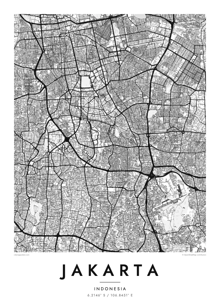
One of the largest city squares in the world, a near-square open field with the National Monument at its centre. On the map it forms a strong, blank anchor in the middle of the city.
Poster minimalist tal-mappa · l-Indoneżja
6.2146° S / 106.8451° E
A flat coastal capital on Java's north shore, crossed by rivers and flood canals, with the old Batavia harbour at its edge.


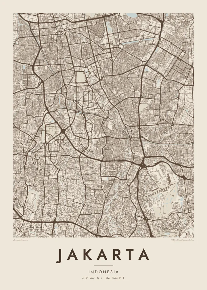
Belt waħda, ħames atmosferi
Agħfas fuq stil biex tarah fuq il-ħajt. Kull stil jiswa l-istess — stampat, inkurnat jew bħala fajls HD.
 Pixels reali · fajl tal-istampar 24 × 36″
Preċiż għall-istampar
Dan huwa qtugħ ta' 100% mill-fajl tal-istampar reali. Kull poster — stampat, inkurnat jew iddawnlowdjat — jiġi ġġenerat fuq is-servers tagħna b'300 DPI, sa 7,200 × 10,800 pixel, biex saħansitra l-iżgħar toroq jibqgħu ċari fuq stampa ta' 24 × 36″.
Fuq il-ħajt


Il-mappa
Jakarta spreads across a low, flat plain on the northern coast of Java, facing Jakarta Bay. Because the land is so level, water shapes much of the map. The Ciliwung and several other rivers flow north through the city to the sea, and two large flood canals, the West and East Banjir Kanal, cut across it to carry water past the centre.
The oldest part of the city is Kota Tua in the north, once the Dutch colonial settlement of Batavia. Its canals and warehouses sit beside Sunda Kelapa, the old harbour where wooden schooners still load cargo. To the south, the planned centre spreads around Medan Merdeka, a vast square with the National Monument at its middle, surrounded by ministries and wide avenues.
Beyond the centre, Jakarta becomes an enormous metropolitan region of toll roads and suburban grids. Parts of the north coast are subsiding, one reason the government decided to develop a new capital, Nusantara, in East Kalimantan. A Jakarta map poster records the city as it is now, from the bay and old port to the long avenues of Thamrin and Sudirman.
One of the largest city squares in the world, a near-square open field with the National Monument at its centre. On the map it forms a strong, blank anchor in the middle of the city.
Two long flood canals that bend around the core, the western one dating from the Dutch period and the eastern completed much later. Their clean curves stand apart from the winding natural rivers.
The old port at the mouth of the Ciliwung, with narrow basins and quays beside Kota Tua. It marks the point where the city began, on the shore of Jakarta Bay.
Agħmlu tiegħek
Żid data, isem jew sentenza tiegħek, ibdel l-istil, id-daqs jew l-orjentazzjoni.
Il-preview b'xejn hija b'riżoluzzjoni baxxa u bil-watermark. L-istampi u l-fajls HD jiġu ġġenerati b'300 DPI, sa 7,200 × 10,800 px, mingħajr watermark.
Għaliex Jakarta
Jakarta is a city many people pass through for work and many more call home, often in one particular kampung or district. A map shows how that corner connects to the bay, the canals and the centre, which is rarely obvious from street level.
Write a title, add a date or subtitle, and adjust the coordinates line, then choose one of five styles. Classic black & white keeps the dense grid legible; Blueprint suits the canals. The $9 download includes a 300 DPI PNG and a print-ready PDF for each size.
Ordna l-poster Jakarta| Daqs tal-istampa | Riżoluzzjoni | Fajls |
|---|---|---|
| 30 × 40 cm (11.8 × 15.7″) | 3,543 × 4,724 px | PNG · PDF |
| 29.7 × 42 cm (A3, 11.7 × 16.5″) | 3,508 × 4,961 px | PNG · PDF |
| 42 × 59.4 cm (A2, 16.5 × 23.4″) | 4,961 × 7,016 px | PNG · PDF |
| 45.7 × 61 cm (18 × 24″) | 5,400 × 7,200 px | PNG · PDF |
| 50 × 70 cm (19.7 × 27.6″) | 5,906 × 8,268 px | PNG · PDF |
| 61 × 91.4 cm (24 × 36″) | 7,200 × 10,800 px | PNG · PDF |
Għal paragun, il-preview b'xejn huwa wiesa' 900 px, għandu watermark u huwa maħsub għall-iskrins. Il-fajls HD għandhom sa 8× ir-riżoluzzjoni f'kull direzzjoni u jiġu stampati b'mod nadif fid-daqs sħiħ tal-poster.
Agħżel stil fin-naħa ta' fuq tal-paġna, imbagħad agħżel Poster Stampat — daqs u, jekk trid, kurniċa — jew Fajls Diġitali HD. Il-ħlas isir f'pass wieħed, u l-paġna tal-ordni tiegħek tiġi aġġornata malli l-ħlas jgħaddi.
Jiġi stampat fuq karta matte premium ta' 200 gsm f'wieħed minn sitt daqsijiet, minn 30 × 40 cm sa 24 × 36″. Il-posters stampati jibdew minn $39, bil-kunsinna inkluża.
Iva. Agħżel kurniċa tal-injam solidu f'iswed, abjad, ballut naturali jew injam skur. Tiġi bi ħġieġ li ma jinkisirx u lesta biex tittella'. Il-posters inkurnati jibdew minn $99, bil-kunsinna inkluża.
L-ispedizzjoni hija b'xejn mad-dinja kollha. Kull poster jiġi stampat mill-eqreb wieħed mis-sieħba tal-istampar tagħna f'aktar minn 30 pajjiż u normalment jaslilek fi 3–7 ijiem tax-xogħol. Tista' tsegwi l-istatus u t-traċċar taħt L-Ordnijiet Tiegħi. Xi pajjiżi jieħdu 2–5 ġimgħat, u fejn għadna ma nispedixxux, is-sit jgħidlek qabel ma tħallas.
Ibgħatilna ritratt fi żmien 14-il jum mill-kunsinna u aħna nistampawh mill-ġdid b'xejn jew nirrimborżawk.
Iva. Fl-editur ta' din il-paġna, biddel it-titlu, is-sottotitlu u l-linja tal-koordinati għal kwalunkwe ħaġa trid, u agħżel stil u daqs. L-ordnijiet stampati, inkurnati u diġitali kollha jużaw eżattament id-disinn tiegħek.
Għal $9 tikseb fajls PNG b'300 DPI u PDF lesti għall-istampar fis-sitt daqsijiet kollha, mingħajr watermark, biex tistampa kullimkien. Għadek mhux ċert? L-ewwel iddawnlowdja preview b'xejn bil-watermark.
