Kemijoki delta
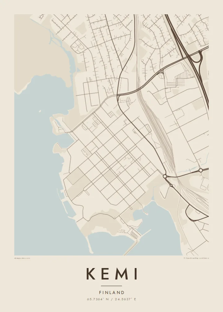
Finland's longest river reaches the sea here, dividing into several channels around islands. These branching arms take up much of the eastern side of the map.
Poster minimalist tal-mappa · il-Finlandja
65.7364° N / 24.5637° E
A Lapland port at the mouth of the Kemijoki, where river channels, islands and harbours meet the frozen Gulf of Bothnia.


Belt waħda, ħames atmosferi
Agħfas fuq stil biex tarah fuq il-ħajt. Kull stil jiswa l-istess — stampat, inkurnat jew bħala fajls HD.
 Pixels reali · fajl tal-istampar 24 × 36″
Preċiż għall-istampar
Dan huwa qtugħ ta' 100% mill-fajl tal-istampar reali. Kull poster — stampat, inkurnat jew iddawnlowdjat — jiġi ġġenerat fuq is-servers tagħna b'300 DPI, sa 7,200 × 10,800 pixel, biex saħansitra l-iżgħar toroq jibqgħu ċari fuq stampa ta' 24 × 36″.
Fuq il-ħajt


Il-mappa
Kemi is on the northern shore of the Gulf of Bothnia, at the mouth of the Kemijoki, the longest river in Finland. The city sits on a peninsula and islands between the river's delta channels and the sea. On a map, water surrounds it: branching river arms to the east, open gulf to the south and west, and deep-water harbours along the shoreline.
The centre has a clear grid of streets near the waterfront, and industrial areas of pulp and paper mills spread out along the shore. In winter the sea freezes, and Kemi has become known for icebreaker cruises on the Sampo and for a snow castle rebuilt each year. South of the centre, the Ajos headland reaches out toward the open water.
A Kemi map poster shows a city defined by river and sea: the delta channels, the harbour piers, the grid of the centre and the islands scattered offshore. In black and white, the shoreline looks almost like an ice chart. It suits northerners and anyone who has visited Lapland in the frozen months and remembers the flat white horizon.
Finland's longest river reaches the sea here, dividing into several channels around islands. These branching arms take up much of the eastern side of the map.
Piers, mills and port basins line the coast. Their straight, engineered edges contrast with the natural curves of the river channels nearby.
A long headland south of the centre stretches into the Gulf of Bothnia, leading the map's composition toward open water and the sea ice.
Agħmlu tiegħek
Żid data, isem jew sentenza tiegħek, ibdel l-istil, id-daqs jew l-orjentazzjoni.
Il-preview b'xejn hija b'riżoluzzjoni baxxa u bil-watermark. L-istampi u l-fajls HD jiġu ġġenerati b'300 DPI, sa 7,200 × 10,800 px, mingħajr watermark.
Għaliex Kemi
Kemi's map is mostly water, and that gives it a rare graphic quality. It suits a Nordic interior and a minimal room, and it makes a quiet memento of a winter journey to Lapland.
You can personalise the title, subtitle and coordinates line, and choose one of five styles. Blueprint suits the harbour and Noir suits the polar night. The free 900 px preview lets you compare them before you buy the $9 HD files.
Ordna l-poster Kemi| Daqs tal-istampa | Riżoluzzjoni | Fajls |
|---|---|---|
| 30 × 40 cm (11.8 × 15.7″) | 3,543 × 4,724 px | PNG · PDF |
| 29.7 × 42 cm (A3, 11.7 × 16.5″) | 3,508 × 4,961 px | PNG · PDF |
| 42 × 59.4 cm (A2, 16.5 × 23.4″) | 4,961 × 7,016 px | PNG · PDF |
| 45.7 × 61 cm (18 × 24″) | 5,400 × 7,200 px | PNG · PDF |
| 50 × 70 cm (19.7 × 27.6″) | 5,906 × 8,268 px | PNG · PDF |
| 61 × 91.4 cm (24 × 36″) | 7,200 × 10,800 px | PNG · PDF |
Għal paragun, il-preview b'xejn huwa wiesa' 900 px, għandu watermark u huwa maħsub għall-iskrins. Il-fajls HD għandhom sa 8× ir-riżoluzzjoni f'kull direzzjoni u jiġu stampati b'mod nadif fid-daqs sħiħ tal-poster.
Agħżel stil fin-naħa ta' fuq tal-paġna, imbagħad agħżel Poster Stampat — daqs u, jekk trid, kurniċa — jew Fajls Diġitali HD. Il-ħlas isir f'pass wieħed, u l-paġna tal-ordni tiegħek tiġi aġġornata malli l-ħlas jgħaddi.
Jiġi stampat fuq karta matte premium ta' 200 gsm f'wieħed minn sitt daqsijiet, minn 30 × 40 cm sa 24 × 36″. Il-posters stampati jibdew minn {printFrom}, bil-kunsinna inkluża.
Iva. Agħżel kurniċa tal-injam solidu f'iswed, abjad, ballut naturali jew injam skur. Tiġi bi ħġieġ li ma jinkisirx u lesta biex tittella'. Il-posters inkurnati jibdew minn {framedFrom}, bil-kunsinna inkluża.
L-ispedizzjoni hija b'xejn mad-dinja kollha. Kull poster jiġi stampat mill-eqreb wieħed mis-sieħba tal-istampar tagħna f'aktar minn 30 pajjiż u normalment jaslilek fi 3–7 ijiem tax-xogħol. Tista' tsegwi l-istatus u t-traċċar taħt L-Ordnijiet Tiegħi. Xi pajjiżi jieħdu 2–5 ġimgħat, u fejn għadna ma nispedixxux, is-sit jgħidlek qabel ma tħallas.
Ibgħatilna ritratt fi żmien 14-il jum mill-kunsinna u aħna nistampawh mill-ġdid b'xejn jew nirrimborżawk.
Iva. Fl-editur ta' din il-paġna, biddel it-titlu, is-sottotitlu u l-linja tal-koordinati għal kwalunkwe ħaġa trid, u agħżel stil u daqs. L-ordnijiet stampati, inkurnati u diġitali kollha jużaw eżattament id-disinn tiegħek.
Għal $9 tikseb fajls PNG b'300 DPI u PDF lesti għall-istampar fis-sitt daqsijiet kollha, mingħajr watermark, biex tistampa kullimkien. Għadek mhux ċert? L-ewwel iddawnlowdja preview b'xejn bil-watermark.
