The Ring
Broad boulevards follow the line of the old city walls in a half-circle from riverbank to riverbank, enclosing the Altstadt and giving the map its signature shape.
Poster minimalist tal-mappa · il-Ġermanja
50.9333° N / 6.9500° E
A half-circle old town pressed against the Rhine, wrapped in concentric boulevards and an outer ring of green.


Belt waħda, ħames atmosferi
Agħfas fuq stil biex tarah fuq il-ħajt. Kull stil jiswa l-istess — stampat, inkurnat jew bħala fajls HD.
 Pixels reali · fajl tal-istampar 24 × 36″
Preċiż għall-istampar
Dan huwa qtugħ ta' 100% mill-fajl tal-istampar reali. Kull poster — stampat, inkurnat jew iddawnlowdjat — jiġi ġġenerat fuq is-servers tagħna b'300 DPI, sa 7,200 × 10,800 pixel, biex saħansitra l-iżgħar toroq jibqgħu ċari fuq stampa ta' 24 × 36″.
Fuq il-ħajt

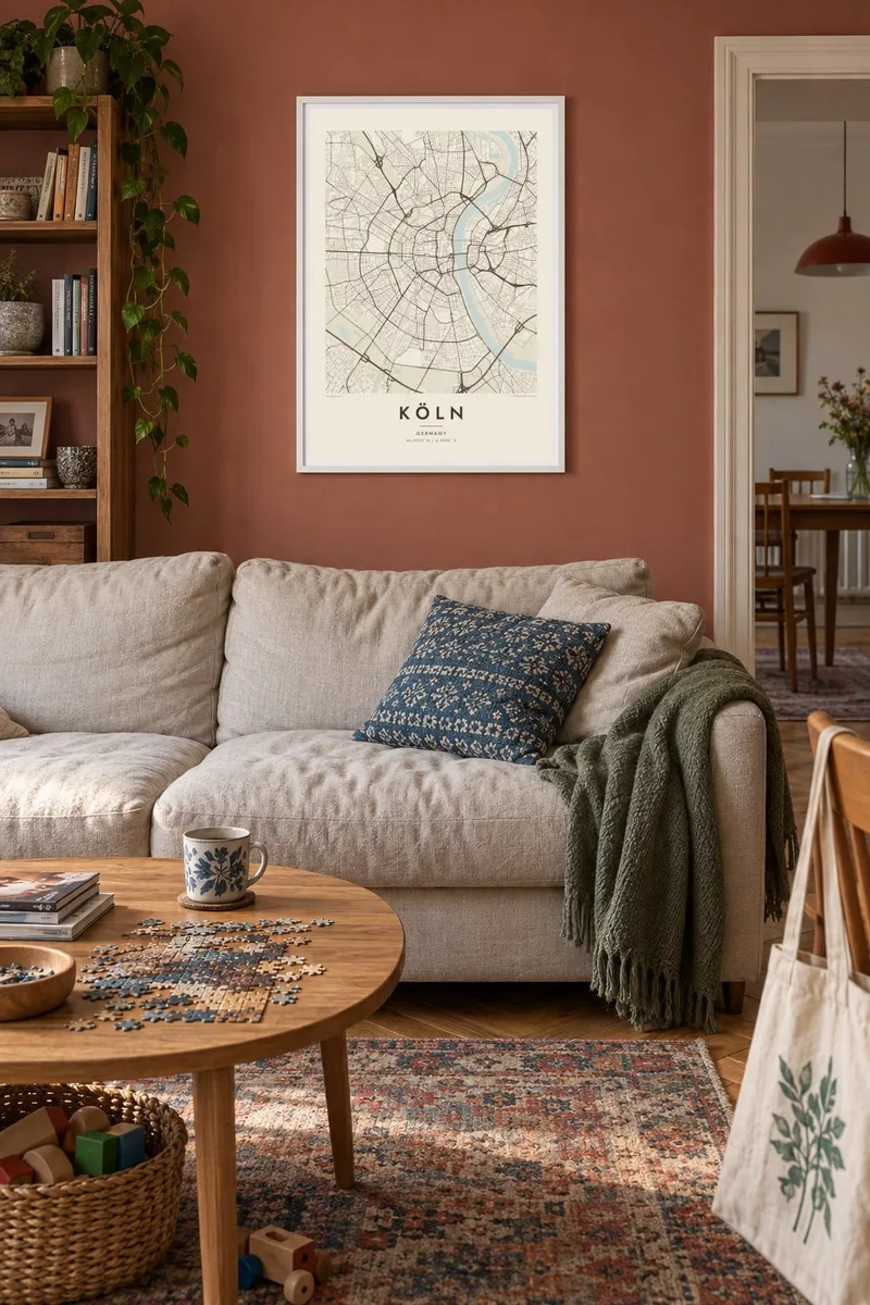
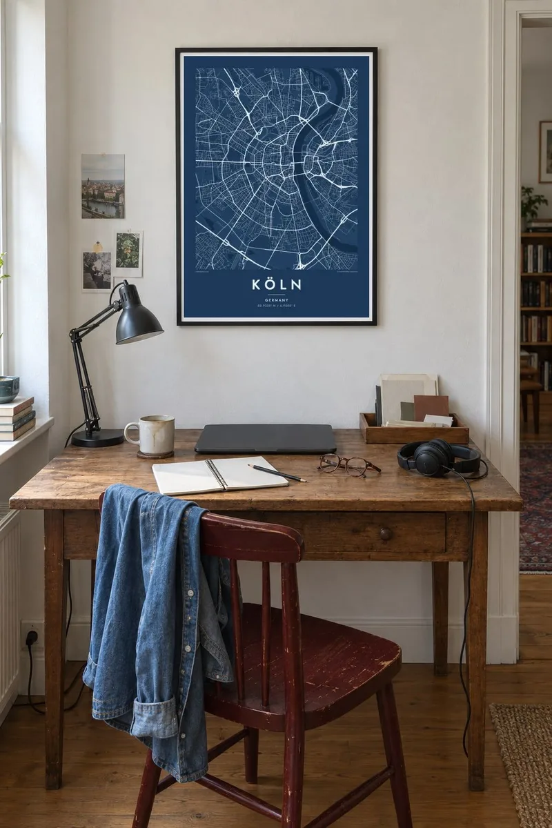
Il-mappa
Köln, or Cologne, spreads along both banks of the Rhine, but its historic core lies entirely on the west side. From above, the old town forms an almost perfect semicircle against the river, a shape inherited from the medieval city walls. When the walls were taken down in the nineteenth century, they were replaced by the Ring, a sequence of broad boulevards that still traces the arc.
Further out, the pattern repeats: another arc of roads and a railway belt, then the Grüngürtel, an inner and an outer green belt of parks and woodland around the city. Across the river, Deutz and the right-bank districts are linked by a series of bridges, among them the Hohenzollern Bridge, a railway bridge known for the thousands of padlocks left on it by couples.
At the centre stands Cologne Cathedral, a UNESCO World Heritage site that was completed only in 1880, more than six centuries after construction began. A Köln map poster shows why the city is so recognisable from above. The river, the arcs and the radial streets form a pattern that stays clear at any print size.
Broad boulevards follow the line of the old city walls in a half-circle from riverbank to riverbank, enclosing the Altstadt and giving the map its signature shape.
A row of bridges crosses the wide river between the old town and Deutz. They cut across the water in firm straight lines, linking the two halves of the city.
Two rings of parks and woodland circle the city further out, forming broad bands of open space that echo the arc of the Ring.
Agħmlu tiegħek
Żid data, isem jew sentenza tiegħek, ibdel l-istil, id-daqs jew l-orjentazzjoni.
Il-preview b'xejn hija b'riżoluzzjoni baxxa u bil-watermark. L-istampi u l-fajls HD jiġu ġġenerati b'300 DPI, sa 7,200 × 10,800 px, mingħajr watermark.
Għaliex Köln
People feel strongly about Köln, whether they were born here, studied at the university or came for carnival and stayed. The half-circle plan is iconic, and the poster reads well from across a room.
Add your own title, either Köln or Cologne, and a subtitle such as a Veedel name or a date. Choose Classic black & white, Noir, Paper, Blueprint or Sand. The digital HD files cost $9, and you can see a free watermarked preview first.
Ordna l-poster Köln| Daqs tal-istampa | Riżoluzzjoni | Fajls |
|---|---|---|
| 30 × 40 cm (11.8 × 15.7″) | 3,543 × 4,724 px | PNG · PDF |
| 29.7 × 42 cm (A3, 11.7 × 16.5″) | 3,508 × 4,961 px | PNG · PDF |
| 42 × 59.4 cm (A2, 16.5 × 23.4″) | 4,961 × 7,016 px | PNG · PDF |
| 45.7 × 61 cm (18 × 24″) | 5,400 × 7,200 px | PNG · PDF |
| 50 × 70 cm (19.7 × 27.6″) | 5,906 × 8,268 px | PNG · PDF |
| 61 × 91.4 cm (24 × 36″) | 7,200 × 10,800 px | PNG · PDF |
Għal paragun, il-preview b'xejn huwa wiesa' 900 px, għandu watermark u huwa maħsub għall-iskrins. Il-fajls HD għandhom sa 8× ir-riżoluzzjoni f'kull direzzjoni u jiġu stampati b'mod nadif fid-daqs sħiħ tal-poster.
Agħżel stil fin-naħa ta' fuq tal-paġna, imbagħad agħżel Poster Stampat — daqs u, jekk trid, kurniċa — jew Fajls Diġitali HD. Il-ħlas isir f'pass wieħed, u l-paġna tal-ordni tiegħek tiġi aġġornata malli l-ħlas jgħaddi.
Jiġi stampat fuq karta matte premium ta' 200 gsm f'wieħed minn sitt daqsijiet, minn 30 × 40 cm sa 24 × 36″. Il-posters stampati jibdew minn {printFrom}, bil-kunsinna inkluża.
Iva. Agħżel kurniċa tal-injam solidu f'iswed, abjad, ballut naturali jew injam skur. Tiġi bi ħġieġ li ma jinkisirx u lesta biex tittella'. Il-posters inkurnati jibdew minn {framedFrom}, bil-kunsinna inkluża.
Il-kunsinna hija b'xejn madwar id-dinja. Kull poster jiġi stampat mill-eqreb sieħeb tal-istampar tagħna f'aktar minn 30 pajjiż u ġeneralment jasal fi 3–7 ijiem tax-xogħol. Tista' ssegwi l-istatus u t-tracking taħt L-Ordnijiet Tiegħi.
Ibgħatilna ritratt fi żmien 14-il jum mill-kunsinna u aħna nistampawh mill-ġdid b'xejn jew nirrimborżawk.
Iva. Fl-editur ta' din il-paġna, biddel it-titlu, is-sottotitlu u l-linja tal-koordinati għal kwalunkwe ħaġa trid, u agħżel stil u daqs. L-ordnijiet stampati, inkurnati u diġitali kollha jużaw eżattament id-disinn tiegħek.
Għal $9 tikseb fajls PNG b'300 DPI u PDF lesti għall-istampar fis-sitt daqsijiet kollha, mingħajr watermark, biex tistampa kullimkien. Għadek mhux ċert? L-ewwel iddawnlowdja preview b'xejn bil-watermark.
