Lakki harbour
A broad, sheltered bay on the west coast with a planned town at its head. Its wider streets and regular blocks stand out against the island's winding lanes.
Poster minimalist tal-mappa · il-Greċja
37.1493° N / 26.8283° E
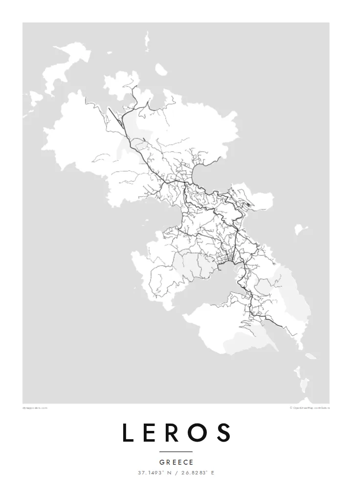
A deeply cut island in the Dodecanese, its coastline pinched by long bays into a chain of narrow waists.


Belt waħda, ħames atmosferi
Agħfas fuq stil biex tarah fuq il-ħajt. Kull stil jiswa l-istess — stampat, inkurnat jew bħala fajls HD.
 Pixels reali · fajl tal-istampar 24 × 36″
Preċiż għall-istampar
Dan huwa qtugħ ta' 100% mill-fajl tal-istampar reali. Kull poster — stampat, inkurnat jew iddawnlowdjat — jiġi ġġenerat fuq is-servers tagħna b'300 DPI, sa 7,200 × 10,800 pixel, biex saħansitra l-iżgħar toroq jibqgħu ċari fuq stampa ta' 24 × 36″.
Fuq il-ħajt


Il-mappa
Leros lies in the Dodecanese between Patmos and Kalymnos, and from above its coastline is what defines it. Several long bays reach deep into the island from both sides. They nearly cut it into separate pieces, leaving narrow necks of land in between. The result is a small island with a surprisingly long shoreline and a map full of curves and inlets.
Lakki, on the west coast, sits on one of the largest natural harbours in the eastern Mediterranean. Its broad streets follow a planned layout quite unlike the other villages. On the east side, Platanos and Agia Marina gather beneath a castle-topped hill, with lanes winding down to the water. A Leros map poster sets these two very different towns side by side.
During the Italian period in the 1930s, Lakki was rebuilt as a planned town in a rationalist style, and its buildings are still an unusual sight in the Aegean. In 1943 the island saw the Battle of Leros, a major clash between German and Allied forces. Wartime relics still survive in the hills and along the shore.
A broad, sheltered bay on the west coast with a planned town at its head. Its wider streets and regular blocks stand out against the island's winding lanes.
Above Platanos, a medieval castle crowns a ridge between two bays. It marks the island's historic centre, where houses cluster tightly on the slopes.
Long, narrow inlets reach into the land from the east and west, giving Leros one of the most intricate outlines in the Dodecanese.
Agħmlu tiegħek
Żid data, isem jew sentenza tiegħek, ibdel l-istil, id-daqs jew l-orjentazzjoni.
Il-preview b'xejn hija b'riżoluzzjoni baxxa u bil-watermark. L-istampi u l-fajls HD jiġu ġġenerati b'300 DPI, sa 7,200 × 10,800 px, mingħajr watermark.
Għaliex Leros
Leros is quiet by Greek island standards, and people who come once often keep coming back. The map suits families with roots here, sailors who anchored in its bays, and anyone interested in its layered twentieth-century history.
You can set your own title, subtitle and coordinates line to mark a home, a boat or a year. Choose one of five styles, from crisp Classic to the warm tones of Sand, and download six print sizes for $9.
Ordna l-poster Leros| Daqs tal-istampa | Riżoluzzjoni | Fajls |
|---|---|---|
| 30 × 40 cm (11.8 × 15.7″) | 3,543 × 4,724 px | PNG · PDF |
| 29.7 × 42 cm (A3, 11.7 × 16.5″) | 3,508 × 4,961 px | PNG · PDF |
| 42 × 59.4 cm (A2, 16.5 × 23.4″) | 4,961 × 7,016 px | PNG · PDF |
| 45.7 × 61 cm (18 × 24″) | 5,400 × 7,200 px | PNG · PDF |
| 50 × 70 cm (19.7 × 27.6″) | 5,906 × 8,268 px | PNG · PDF |
| 61 × 91.4 cm (24 × 36″) | 7,200 × 10,800 px | PNG · PDF |
Għal paragun, il-preview b'xejn huwa wiesa' 900 px, għandu watermark u huwa maħsub għall-iskrins. Il-fajls HD għandhom sa 8× ir-riżoluzzjoni f'kull direzzjoni u jiġu stampati b'mod nadif fid-daqs sħiħ tal-poster.
Agħżel stil fin-naħa ta' fuq tal-paġna, imbagħad agħżel Poster Stampat — daqs u, jekk trid, kurniċa — jew Fajls Diġitali HD. Il-ħlas isir f'pass wieħed, u l-paġna tal-ordni tiegħek tiġi aġġornata malli l-ħlas jgħaddi.
Jiġi stampat fuq karta matte premium ta' 200 gsm f'wieħed minn sitt daqsijiet, minn 30 × 40 cm sa 24 × 36″. Il-posters stampati jibdew minn {printFrom}, bil-kunsinna inkluża.
Iva. Agħżel kurniċa tal-injam solidu f'iswed, abjad, ballut naturali jew injam skur. Tiġi bi ħġieġ li ma jinkisirx u lesta biex tittella'. Il-posters inkurnati jibdew minn {framedFrom}, bil-kunsinna inkluża.
L-ispedizzjoni hija b'xejn mad-dinja kollha. Kull poster jiġi stampat mill-eqreb wieħed mis-sieħba tal-istampar tagħna f'aktar minn 30 pajjiż u normalment jaslilek fi 3–7 ijiem tax-xogħol. Tista' tsegwi l-istatus u t-traċċar taħt L-Ordnijiet Tiegħi. Xi pajjiżi jieħdu 2–5 ġimgħat, u fejn għadna ma nispedixxux, is-sit jgħidlek qabel ma tħallas.
Ibgħatilna ritratt fi żmien 14-il jum mill-kunsinna u aħna nistampawh mill-ġdid b'xejn jew nirrimborżawk.
Iva. Fl-editur ta' din il-paġna, biddel it-titlu, is-sottotitlu u l-linja tal-koordinati għal kwalunkwe ħaġa trid, u agħżel stil u daqs. L-ordnijiet stampati, inkurnati u diġitali kollha jużaw eżattament id-disinn tiegħek.
Għal $9 tikseb fajls PNG b'300 DPI u PDF lesti għall-istampar fis-sitt daqsijiet kollha, mingħajr watermark, biex tistampa kullimkien. Għadek mhux ċert? L-ewwel iddawnlowdja preview b'xejn bil-watermark.
