Lincoln Highway
US 30 crosses the village east to west along the route of the Lincoln Highway, the early twentieth-century road linking New York and San Francisco. On the poster it is one of the longest straight lines.
Poster minimalist tal-mappa · l-Istati Uniti
41.5039° N / 87.7131° W
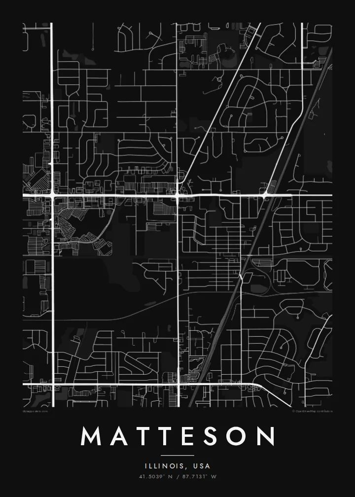
A south-suburban Chicago grid where Interstate 57, the Lincoln Highway and the Metra Electric line cut clean lines across former prairie.



Belt waħda, ħames atmosferi
Agħfas fuq stil biex tarah fuq il-ħajt. Kull stil jiswa l-istess — stampat, inkurnat jew bħala fajls HD.
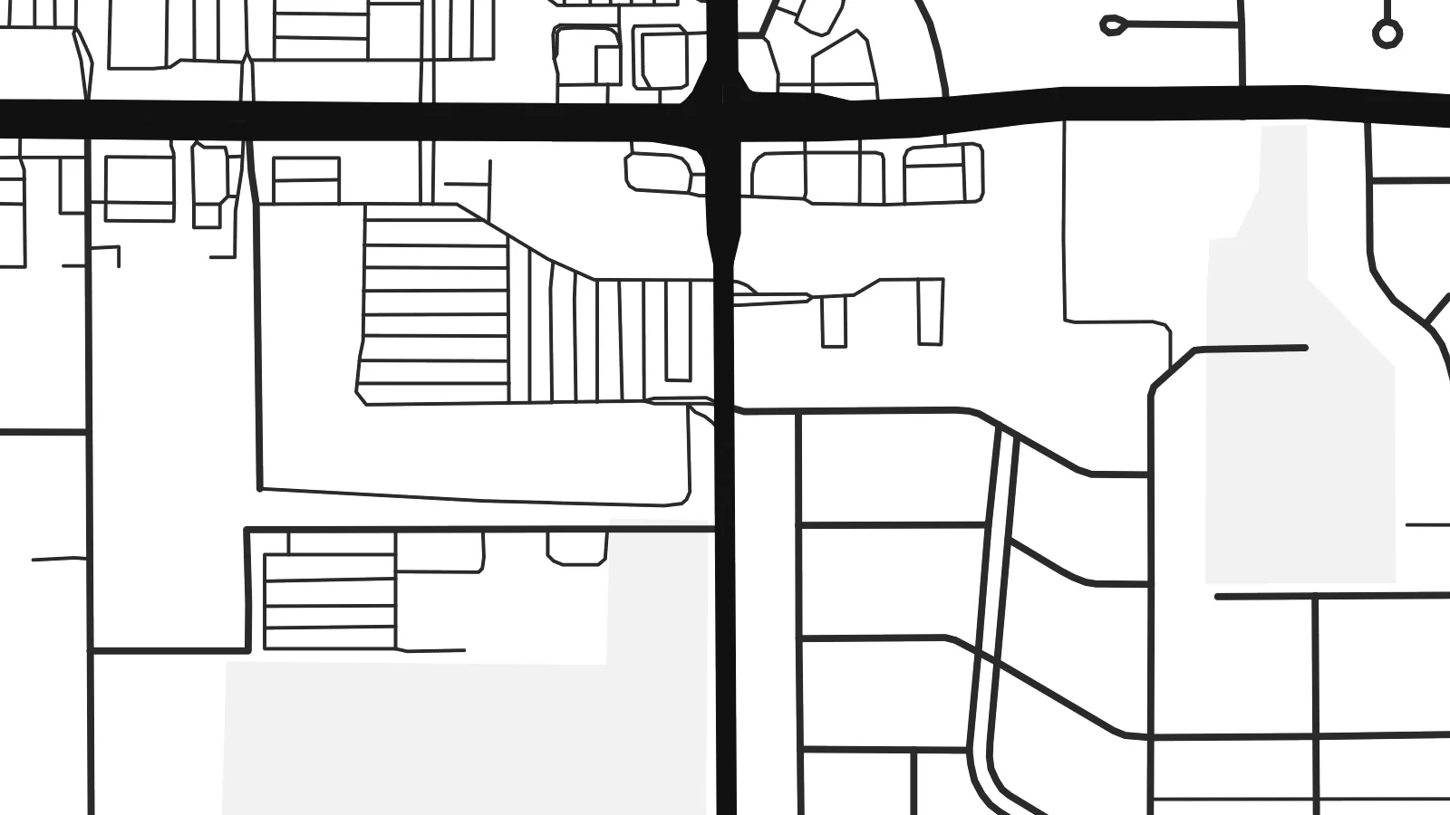 Pixels reali · fajl tal-istampar 24 × 36″
Preċiż għall-istampar
Dan huwa qtugħ ta' 100% mill-fajl tal-istampar reali. Kull poster — stampat, inkurnat jew iddawnlowdjat — jiġi ġġenerat fuq is-servers tagħna b'300 DPI, sa 7,200 × 10,800 pixel, biex saħansitra l-iżgħar toroq jibqgħu ċari fuq stampa ta' 24 × 36″.
Fuq il-ħajt


Il-mappa
Matteson sits on the flat land south of Chicago, where the old prairie was divided into survey-mile squares long before the houses arrived. From above, that pattern is still easy to read. Section-line roads run straight north–south and east–west, and the residential streets inside each square form the loops, cul-de-sacs and short crescents typical of postwar Illinois suburbs.
The village began as a railroad settlement and is named after Joel Matteson, a governor of Illinois in the 1850s. The rail corridor still runs through town and now carries Metra Electric commuter trains toward downtown Chicago. On the map it reads as a long, unbroken line, and most streets meet it at right angles instead of crossing it at random.
Two major roads frame the picture. Interstate 57 runs north–south through the village with its interchange ramps, and US 30, the historic Lincoln Highway, runs east–west along one of the country's earliest coast-to-coast routes. A Matteson map poster shows where a transcontinental road, a commuter railway and quiet residential blocks meet, all in one orderly composition.
US 30 crosses the village east to west along the route of the Lincoln Highway, the early twentieth-century road linking New York and San Francisco. On the poster it is one of the longest straight lines.
The interstate runs north–south through the village. Its interchange ramps are the most curved, sculptural shapes on an otherwise rectilinear map.
Between the section-line roads, subdivisions use curving drives and cul-de-sacs. Each square mile gets its own pattern of rounded lines inside a rigid outer frame.
Agħmlu tiegħek
Żid data, isem jew sentenza tiegħek, ibdel l-istil, id-daqs jew l-orjentazzjoni.
Il-preview b'xejn hija b'riżoluzzjoni baxxa u bil-watermark. L-istampi u l-fajls HD jiġu ġġenerati b'300 DPI, sa 7,200 × 10,800 px, mingħajr watermark.
Għaliex Matteson
For people who grew up in the south suburbs or rode the Metra from here, the map is a quiet record of daily routes: the station, the highway ramps, the street where the family house stood. It suits a hallway, a home office or a first apartment in the city.
You can set your own title, subtitle and coordinates line, for example a family name or a move-in date, and choose Classic black & white, Noir, Paper, Blueprint or Sand. The $9 digital download includes six print sizes as 300 DPI PNG and PDF files. Printed and framed versions ship from partners in 30+ countries.
Ordna l-poster Matteson| Daqs tal-istampa | Riżoluzzjoni | Fajls |
|---|---|---|
| 30 × 40 cm11.8 × 15.7″ | 3,543 × 4,724 px | PNG · PDF |
| 29.7 × 42 cm (A3)11.7 × 16.5″ | 3,508 × 4,961 px | PNG · PDF |
| 42 × 59.4 cm (A2)16.5 × 23.4″ | 4,961 × 7,016 px | PNG · PDF |
| 45.7 × 61 cm18 × 24″ | 5,400 × 7,200 px | PNG · PDF |
| 50 × 70 cm19.7 × 27.6″ | 5,906 × 8,268 px | PNG · PDF |
| 61 × 91.4 cm24 × 36″ | 7,200 × 10,800 px | PNG · PDF |
Għal paragun, il-preview b'xejn huwa wiesa' 900 px, għandu watermark u huwa maħsub għall-iskrins. Il-fajls HD għandhom sa 8× ir-riżoluzzjoni f'kull direzzjoni u jiġu stampati b'mod nadif fid-daqs sħiħ tal-poster.
Agħżel stil fin-naħa ta' fuq tal-paġna, imbagħad agħżel Poster Stampat — daqs u, jekk trid, kurniċa — jew Fajls Diġitali HD. Il-ħlas isir f'pass wieħed, u l-paġna tal-ordni tiegħek tiġi aġġornata malli l-ħlas jgħaddi.
Jiġi stampat fuq karta matte premium ta' 200 gsm f'wieħed minn sitt daqsijiet, minn 30 × 40 cm sa 24 × 36″. Il-posters stampati jibdew minn $39, bil-kunsinna inkluża.
Iva. Agħżel kurniċa tal-injam solidu f'iswed, abjad, ballut naturali jew injam skur. Tiġi bi ħġieġ li ma jinkisirx u lesta biex tittella'. Il-posters inkurnati jibdew minn $99, bil-kunsinna inkluża.
It-tbaħħir huwa b'xejn lejn 60+ pajjiż. Kull poster jiġi stampat mill-eqreb wieħed mis-sieħba tal-istampar tagħna f'30+ pajjiż u normalment jaslek fi 3–7 ijiem tax-xogħol. Tista' ssegwi l-istatus u t-traċċar taħt L-Ordnijiet Tiegħi. Xi pajjiżi jieħdu 2–5 ġimgħat, u fejn għadna ma nibagħtux, is-sit jgħidlek qabel tħallas.
Ibgħatilna ritratt fi żmien 14-il jum mill-kunsinna u aħna nistampawh mill-ġdid b'xejn jew nirrimborżawk.
Iva. Fl-editur ta' din il-paġna, biddel it-titlu, is-sottotitlu u l-linja tal-koordinati għal kwalunkwe ħaġa trid, u agħżel stil u daqs. L-ordnijiet stampati, inkurnati u diġitali kollha jużaw eżattament id-disinn tiegħek.
Għal $9 tikseb fajls PNG b'300 DPI u PDF lesti għall-istampar fis-sitt daqsijiet kollha, mingħajr watermark, biex tistampa kullimkien. Għadek mhux ċert? L-ewwel iddawnlowdja preview b'xejn bil-watermark.
Fil-qrib
