Hoddle Grid
The rectangular city centre bounded by Flinders, Spring, La Trobe and Spencer Streets, with its alternating wide streets and small lanes clearly visible from above.
Poster minimalist tal-mappa · l-Awstralja
37.8140° S / 144.9633° E
A precise rectangular grid on the north bank of the Yarra, opening south to the wide curve of Port Phillip Bay.


Belt waħda, ħames atmosferi
Agħfas fuq stil biex tarah fuq il-ħajt. Kull stil jiswa l-istess — stampat, inkurnat jew bħala fajls HD.
 Pixels reali · fajl tal-istampar 24 × 36″
Preċiż għall-istampar
Dan huwa qtugħ ta' 100% mill-fajl tal-istampar reali. Kull poster — stampat, inkurnat jew iddawnlowdjat — jiġi ġġenerat fuq is-servers tagħna b'300 DPI, sa 7,200 × 10,800 pixel, biex saħansitra l-iżgħar toroq jibqgħu ċari fuq stampa ta' 24 × 36″.
Fuq il-ħajt

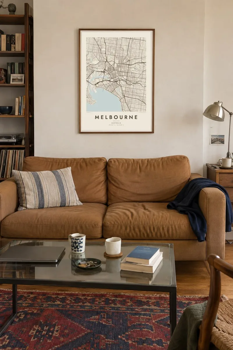

Il-mappa
Melbourne's centre is one of the most orderly on any map. The Hoddle Grid, laid out in 1837, is a rectangle of wide streets crossed by narrower lanes, set at a slight angle along the north bank of the Yarra River. Around it the metropolis stretches for kilometres over mostly flat land, organised by long straight roads and tram lines.
The Yarra winds east to west through the city, past the Royal Botanic Gardens and the sports precinct before reaching Docklands and the port. To the south, Port Phillip Bay forms a vast, almost enclosed body of water, with bayside suburbs such as St Kilda and Brighton following its shore in a long, gentle arc.
Melbourne served as the seat of Australia's federal parliament from 1901 until 1927, when Canberra took over. Its tram network is one of the largest in the world, and the tracks follow many of the main avenues. A Melbourne map poster shows the grid, the river and the bay in one clear and balanced frame.
The rectangular city centre bounded by Flinders, Spring, La Trobe and Spencer Streets, with its alternating wide streets and small lanes clearly visible from above.
A winding river running along the southern edge of the centre, bordered by gardens, parklands and promenades before opening into the port area.
A huge, nearly enclosed bay south of the city, its long shoreline forming the dominant natural shape when the map is drawn at a wider scale.
Agħmlu tiegħek
Żid data, isem jew sentenza tiegħek, ibdel l-istil, id-daqs jew l-orjentazzjoni.
Il-preview b'xejn hija b'riżoluzzjoni baxxa u bil-watermark. L-istampi u l-fajls HD jiġu ġġenerati b'300 DPI, sa 7,200 × 10,800 px, mingħajr watermark.
Għaliex Melbourne
For people who live in Melbourne or have left it, the grid and the bay are unmistakable. The map suits those who love the city's laneways, trams and parks, and it has an architectural calm that fits well in a living room or office.
Change the title, subtitle and coordinates to name a suburb, mark a year or celebrate a move. Choose Classic black & white, Noir, Paper, Blueprint or Sand. Print locally from the $9 HD files or order a framed poster from partners in 30+ countries.
Ordna l-poster Melbourne| Daqs tal-istampa | Riżoluzzjoni | Fajls |
|---|---|---|
| 30 × 40 cm (11.8 × 15.7″) | 3,543 × 4,724 px | PNG · PDF |
| 29.7 × 42 cm (A3, 11.7 × 16.5″) | 3,508 × 4,961 px | PNG · PDF |
| 42 × 59.4 cm (A2, 16.5 × 23.4″) | 4,961 × 7,016 px | PNG · PDF |
| 45.7 × 61 cm (18 × 24″) | 5,400 × 7,200 px | PNG · PDF |
| 50 × 70 cm (19.7 × 27.6″) | 5,906 × 8,268 px | PNG · PDF |
| 61 × 91.4 cm (24 × 36″) | 7,200 × 10,800 px | PNG · PDF |
Għal paragun, il-preview b'xejn huwa wiesa' 900 px, għandu watermark u huwa maħsub għall-iskrins. Il-fajls HD għandhom sa 8× ir-riżoluzzjoni f'kull direzzjoni u jiġu stampati b'mod nadif fid-daqs sħiħ tal-poster.
Agħżel stil fin-naħa ta' fuq tal-paġna, imbagħad agħżel Poster Stampat — daqs u, jekk trid, kurniċa — jew Fajls Diġitali HD. Il-ħlas isir f'pass wieħed, u l-paġna tal-ordni tiegħek tiġi aġġornata malli l-ħlas jgħaddi.
Jiġi stampat fuq karta matte premium ta' 200 gsm f'wieħed minn sitt daqsijiet, minn 30 × 40 cm sa 24 × 36″. Il-posters stampati jibdew minn {printFrom}, bil-kunsinna inkluża.
Iva. Agħżel kurniċa tal-injam solidu f'iswed, abjad, ballut naturali jew injam skur. Tiġi bi ħġieġ li ma jinkisirx u lesta biex tittella'. Il-posters inkurnati jibdew minn {framedFrom}, bil-kunsinna inkluża.
Il-kunsinna hija b'xejn madwar id-dinja. Kull poster jiġi stampat mill-eqreb sieħeb tal-istampar tagħna f'aktar minn 30 pajjiż u ġeneralment jasal fi 3–7 ijiem tax-xogħol. Tista' ssegwi l-istatus u t-tracking taħt L-Ordnijiet Tiegħi.
Ibgħatilna ritratt fi żmien 14-il jum mill-kunsinna u aħna nistampawh mill-ġdid b'xejn jew nirrimborżawk.
Iva. Fl-editur ta' din il-paġna, biddel it-titlu, is-sottotitlu u l-linja tal-koordinati għal kwalunkwe ħaġa trid, u agħżel stil u daqs. L-ordnijiet stampati, inkurnati u diġitali kollha jużaw eżattament id-disinn tiegħek.
Għal $9 tikseb fajls PNG b'300 DPI u PDF lesti għall-istampar fis-sitt daqsijiet kollha, mingħajr watermark, biex tistampa kullimkien. Għadek mhux ċert? L-ewwel iddawnlowdja preview b'xejn bil-watermark.
Fil-qrib
