Old medina
The oldest quarter near the harbour, a dense web of narrow lanes and small courtyards. In a line drawing it becomes the most detailed patch of the entire map.
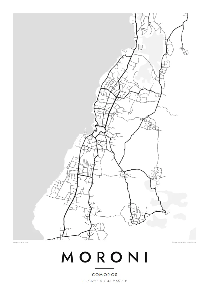
Poster minimalist tal-mappa · Comoros
11.7022° S / 43.2551° E
A small harbour city on a volcanic coast, with narrow old lanes by the sea and roads climbing toward Karthala.


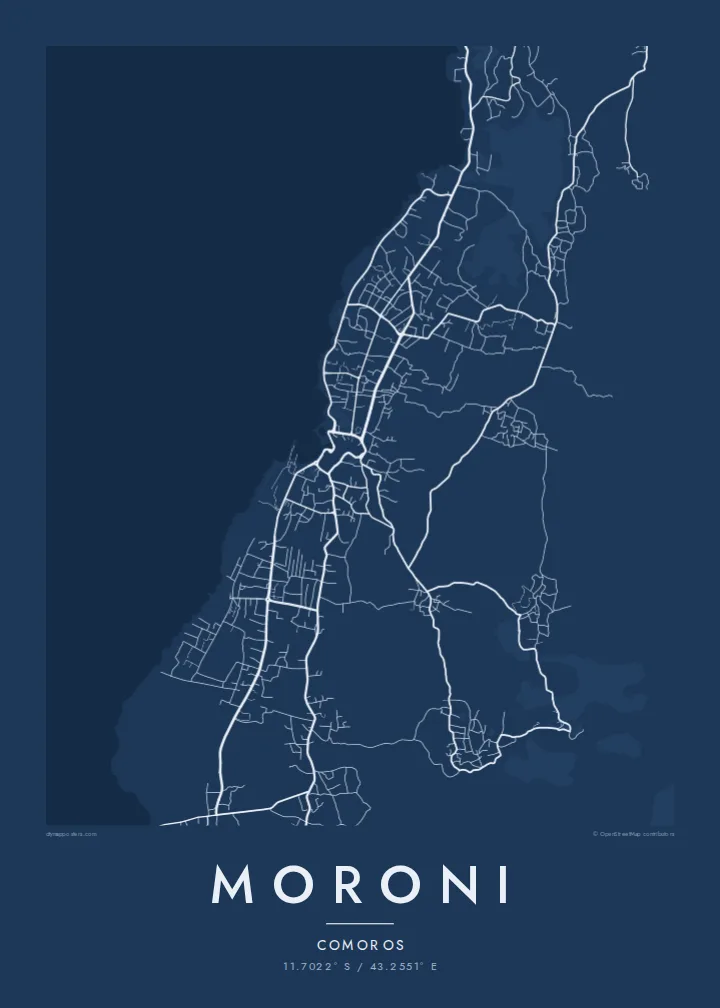

Belt waħda, ħames atmosferi
Agħfas fuq stil biex tarah fuq il-ħajt. Kull stil jiswa l-istess — stampat, inkurnat jew bħala fajls HD.
 Pixels reali · fajl tal-istampar 24 × 36″
Preċiż għall-istampar
Dan huwa qtugħ ta' 100% mill-fajl tal-istampar reali. Kull poster — stampat, inkurnat jew iddawnlowdjat — jiġi ġġenerat fuq is-servers tagħna b'300 DPI, sa 7,200 × 10,800 pixel, biex saħansitra l-iżgħar toroq jibqgħu ċari fuq stampa ta' 24 × 36″.
Fuq il-ħajt


Il-mappa
Moroni sits on the west coast of Grande Comore, the largest island of the Comoros, on a shoreline shaped by old lava flows. Mount Karthala, a large active volcano, rises behind the city to the southeast. From above, the map shows a thin urban band along the coast that gradually widens as roads push inland over rising ground.
The historic centre, or medina, is a maze of narrow lanes close to the water, which gives the old core a very fine-grained texture. It gathers around the small old harbour, where the whitewashed Old Friday Mosque faces the sea. Beyond it, newer districts follow a more open pattern of streets, stretching north and south along the coast and uphill toward the interior.
Moroni is the capital of the Union of the Comoros, and its architecture reflects centuries of Swahili and Arab trade across the western Indian Ocean. A Moroni map poster captures that contrast in scale: a dense, intricate old town beside the harbour and a looser network of roads spreading across the volcanic slopes.
The oldest quarter near the harbour, a dense web of narrow lanes and small courtyards. In a line drawing it becomes the most detailed patch of the entire map.
A small, sheltered harbour at the edge of the old town, overlooked by the Old Friday Mosque. It anchors the city visually along the coastline.
Old volcanic flows have shaped the shore, giving it an irregular, rocky edge rather than a smooth beach curve and adding texture to the poster.
Agħmlu tiegħek
Żid data, isem jew sentenza tiegħek, ibdel l-istil, id-daqs jew l-orjentazzjoni.
Il-preview b'xejn hija b'riżoluzzjoni baxxa u bil-watermark. L-istampi u l-fajls HD jiġu ġġenerati b'300 DPI, sa 7,200 × 10,800 px, mingħajr watermark.
Għaliex Moroni
For Comorians abroad, including the large communities in France, a map of Moroni is a way to keep home close. For travellers, it recalls a quiet capital between the ocean and the volcano, rendered with clarity and restraint.
Personalise the title and subtitle with family names, a village or a date, and adjust the coordinates line. Choose from Classic black & white, Noir, Paper, Blueprint and Sand, then download high-resolution files or order a print.
Ordna l-poster Moroni| Daqs tal-istampa | Riżoluzzjoni | Fajls |
|---|---|---|
| 30 × 40 cm (11.8 × 15.7″) | 3,543 × 4,724 px | PNG · PDF |
| 29.7 × 42 cm (A3, 11.7 × 16.5″) | 3,508 × 4,961 px | PNG · PDF |
| 42 × 59.4 cm (A2, 16.5 × 23.4″) | 4,961 × 7,016 px | PNG · PDF |
| 45.7 × 61 cm (18 × 24″) | 5,400 × 7,200 px | PNG · PDF |
| 50 × 70 cm (19.7 × 27.6″) | 5,906 × 8,268 px | PNG · PDF |
| 61 × 91.4 cm (24 × 36″) | 7,200 × 10,800 px | PNG · PDF |
Għal paragun, il-preview b'xejn huwa wiesa' 900 px, għandu watermark u huwa maħsub għall-iskrins. Il-fajls HD għandhom sa 8× ir-riżoluzzjoni f'kull direzzjoni u jiġu stampati b'mod nadif fid-daqs sħiħ tal-poster.
Agħżel stil fin-naħa ta' fuq tal-paġna, imbagħad agħżel Poster Stampat — daqs u, jekk trid, kurniċa — jew Fajls Diġitali HD. Il-ħlas isir f'pass wieħed, u l-paġna tal-ordni tiegħek tiġi aġġornata malli l-ħlas jgħaddi.
Jiġi stampat fuq karta matte premium ta' 200 gsm f'wieħed minn sitt daqsijiet, minn 30 × 40 cm sa 24 × 36″. Il-posters stampati jibdew minn {printFrom}, bil-kunsinna inkluża.
Iva. Agħżel kurniċa tal-injam solidu f'iswed, abjad, ballut naturali jew injam skur. Tiġi bi ħġieġ li ma jinkisirx u lesta biex tittella'. Il-posters inkurnati jibdew minn {framedFrom}, bil-kunsinna inkluża.
Il-kunsinna hija b'xejn madwar id-dinja. Kull poster jiġi stampat mill-eqreb sieħeb tal-istampar tagħna f'aktar minn 30 pajjiż u ġeneralment jasal fi 3–7 ijiem tax-xogħol. Tista' ssegwi l-istatus u t-tracking taħt L-Ordnijiet Tiegħi.
Ibgħatilna ritratt fi żmien 14-il jum mill-kunsinna u aħna nistampawh mill-ġdid b'xejn jew nirrimborżawk.
Iva. Fl-editur ta' din il-paġna, biddel it-titlu, is-sottotitlu u l-linja tal-koordinati għal kwalunkwe ħaġa trid, u agħżel stil u daqs. L-ordnijiet stampati, inkurnati u diġitali kollha jużaw eżattament id-disinn tiegħek.
Għal $9 tikseb fajls PNG b'300 DPI u PDF lesti għall-istampar fis-sitt daqsijiet kollha, mingħajr watermark, biex tistampa kullimkien. Għadek mhux ċert? L-ewwel iddawnlowdja preview b'xejn bil-watermark.
