The historic hill
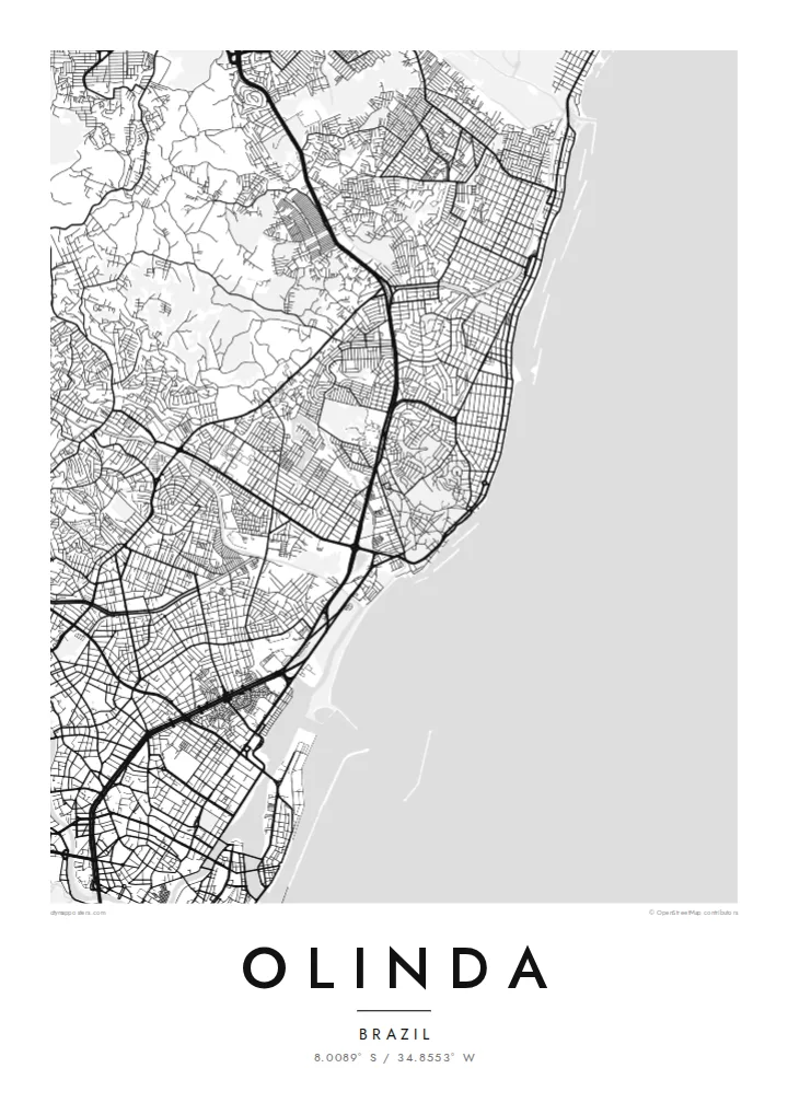
The old town's streets twist over and around the hills, forming an irregular web that stands out clearly against the straighter blocks of the surrounding districts.
Poster minimalist tal-mappa · Il-Brażil
8.0089° S / 34.8553° W
Colonial lanes climbing green hills above the Atlantic, with the larger grid of Recife pressing close to the south.


Belt waħda, ħames atmosferi
Agħfas fuq stil biex tarah fuq il-ħajt. Kull stil jiswa l-istess — stampat, inkurnat jew bħala fajls HD.
 Pixels reali · fajl tal-istampar 24 × 36″
Preċiż għall-istampar
Dan huwa qtugħ ta' 100% mill-fajl tal-istampar reali. Kull poster — stampat, inkurnat jew iddawnlowdjat — jiġi ġġenerat fuq is-servers tagħna b'300 DPI, sa 7,200 × 10,800 pixel, biex saħansitra l-iżgħar toroq jibqgħu ċari fuq stampa ta' 24 × 36″.
Fuq il-ħajt


Il-mappa
Olinda sits on a cluster of hills just north of Recife, and its map is unlike the flat grids of many Brazilian coastal cities. The historic centre is a knot of short, winding streets that bend around the slopes, linking churches and convents set on the high points, while the land drops toward the ocean on the eastern side.
Founded by the Portuguese in the 1530s, the town was one of the earliest colonial centres in Brazil, and its historic core was listed as a UNESCO World Heritage Site in 1982. From the hilltop square of Alto da Sé, the view reaches across tiled rooftops and gardens to the sea and the high-rises of Recife.
An Olinda map poster shows the contrast between that irregular old core and the more regular neighbourhoods that spread north along the coast. Beyond its architecture, the town is famous for its street carnival, when giant puppets are carried through the same steep lanes the map traces in fine black lines.
The old town's streets twist over and around the hills, forming an irregular web that stands out clearly against the straighter blocks of the surrounding districts.
A long coastline runs along the eastern edge, with beaches and seafront roads tracing a gentle line that frames the city from the ocean side.
To the south, Olinda merges into Recife with no visible break, so the map carries the sense of a small historic town attached to a much larger metropolis.
Agħmlu tiegħek
Żid data, isem jew sentenza tiegħek, ibdel l-istil, id-daqs jew l-orjentazzjoni.
Il-preview b'xejn hija b'riżoluzzjoni baxxa u bil-watermark. L-istampi u l-fajls HD jiġu ġġenerati b'300 DPI, sa 7,200 × 10,800 px, mingħajr watermark.
Għaliex Olinda
Olinda is a place people remember through their feet: the climbs, the church steps, the carnival crowds. A map of those lanes makes a fitting keepsake of a trip to Pernambuco, a honeymoon, or a family with roots in the northeast of Brazil.
Add a title, a subtitle such as a carnival year, and a line of coordinates, then pick one of five styles. Paper and Sand suit the colonial mood, while Noir brings out the web of streets. Files come as a 300 DPI PNG and a print-ready PDF.
Ordna l-poster Olinda| Daqs tal-istampa | Riżoluzzjoni | Fajls |
|---|---|---|
| 30 × 40 cm11.8 × 15.7″ | 3,543 × 4,724 px | PNG · PDF |
| 29.7 × 42 cm (A3)11.7 × 16.5″ | 3,508 × 4,961 px | PNG · PDF |
| 42 × 59.4 cm (A2)16.5 × 23.4″ | 4,961 × 7,016 px | PNG · PDF |
| 45.7 × 61 cm18 × 24″ | 5,400 × 7,200 px | PNG · PDF |
| 50 × 70 cm19.7 × 27.6″ | 5,906 × 8,268 px | PNG · PDF |
| 61 × 91.4 cm24 × 36″ | 7,200 × 10,800 px | PNG · PDF |
Għal paragun, il-preview b'xejn huwa wiesa' 900 px, għandu watermark u huwa maħsub għall-iskrins. Il-fajls HD għandhom sa 8× ir-riżoluzzjoni f'kull direzzjoni u jiġu stampati b'mod nadif fid-daqs sħiħ tal-poster.
Agħżel stil fin-naħa ta' fuq tal-paġna, imbagħad agħżel Poster Stampat — daqs u, jekk trid, kurniċa — jew Fajls Diġitali HD. Il-ħlas isir f'pass wieħed, u l-paġna tal-ordni tiegħek tiġi aġġornata malli l-ħlas jgħaddi.
Jiġi stampat fuq karta matte premium ta' 200 gsm f'wieħed minn sitt daqsijiet, minn 30 × 40 cm sa 24 × 36″. Il-posters stampati jibdew minn $39, bil-kunsinna inkluża.
Iva. Agħżel kurniċa tal-injam solidu f'iswed, abjad, ballut naturali jew injam skur. Tiġi bi ħġieġ li ma jinkisirx u lesta biex tittella'. Il-posters inkurnati jibdew minn $99, bil-kunsinna inkluża.
It-tbaħħir huwa b'xejn lejn 60+ pajjiż. Kull poster jiġi stampat mill-eqreb wieħed mis-sieħba tal-istampar tagħna f'30+ pajjiż u normalment jaslek fi 3–7 ijiem tax-xogħol. Tista' ssegwi l-istatus u t-traċċar taħt L-Ordnijiet Tiegħi. Xi pajjiżi jieħdu 2–5 ġimgħat, u fejn għadna ma nibagħtux, is-sit jgħidlek qabel tħallas.
Ibgħatilna ritratt fi żmien 14-il jum mill-kunsinna u aħna nistampawh mill-ġdid b'xejn jew nirrimborżawk.
Iva. Fl-editur ta' din il-paġna, biddel it-titlu, is-sottotitlu u l-linja tal-koordinati għal kwalunkwe ħaġa trid, u agħżel stil u daqs. L-ordnijiet stampati, inkurnati u diġitali kollha jużaw eżattament id-disinn tiegħek.
Għal $9 tikseb fajls PNG b'300 DPI u PDF lesti għall-istampar fis-sitt daqsijiet kollha, mingħajr watermark, biex tistampa kullimkien. Għadek mhux ċert? L-ewwel iddawnlowdja preview b'xejn bil-watermark.
Fil-qrib
