San Juan and San Francisco
The two oldest quarters form a tight knot of narrow, irregular streets. They are clearly distinguishable from the more regular modern districts around them.
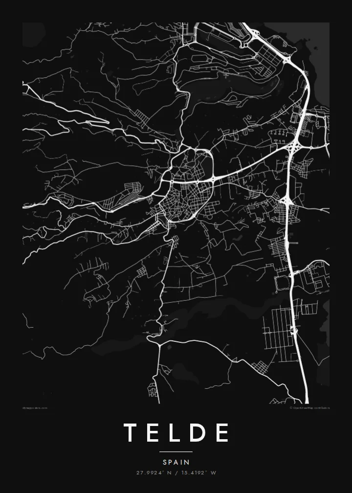
Poster minimalist tal-mappa · Spanja
27.9924° N / 15.4192° W
Gran Canaria's second city, spreading from two historic quarters down a slope of ravines to the eastern coast.



Belt waħda, ħames atmosferi
Agħfas fuq stil biex tarah fuq il-ħajt. Kull stil jiswa l-istess — stampat, inkurnat jew bħala fajls HD.
 Pixels reali · fajl tal-istampar 24 × 36″
Preċiż għall-istampar
Dan huwa qtugħ ta' 100% mill-fajl tal-istampar reali. Kull poster — stampat, inkurnat jew iddawnlowdjat — jiġi ġġenerat fuq is-servers tagħna b'300 DPI, sa 7,200 × 10,800 pixel, biex saħansitra l-iżgħar toroq jibqgħu ċari fuq stampa ta' 24 × 36″.
Fuq il-ħajt


Il-mappa
Telde lies on the eastern side of Gran Canaria, between the island's central highlands and the Atlantic. It is the second-largest municipality on the island. Instead of one compact core it forms a string of districts. They spread across a gently sloping landscape cut by ravines, or barrancos, that run from the hills down to the shore.
Before the Castilian conquest, Telde was one of the island's two indigenous seats of power. Its oldest quarters, San Juan and San Francisco, keep narrow streets and low whitewashed houses, and the Basilica of San Juan Bautista stands at the centre of the former. The coastline includes beaches such as Melenara and La Garita, and Gran Canaria Airport lies just to the south.
A Telde map poster shows a scattered, layered city. There is a historic centre inland, with separate districts spreading across the slope, dry ravines between them, and a rocky coastline along the eastern edge. It is more complex than a typical grid, and that is its appeal.
The two oldest quarters form a tight knot of narrow, irregular streets. They are clearly distinguishable from the more regular modern districts around them.
Dry barrancos run down from the interior to the sea. They leave open corridors that separate the neighbourhoods and give the map strong diagonal lines.
The eastern coast is a series of small bays and headlands. It gives the poster an irregular, detailed edge, with the beach districts clustered along it.
Agħmlu tiegħek
Żid data, isem jew sentenza tiegħek, ibdel l-istil, id-daqs jew l-orjentazzjoni.
Il-preview b'xejn hija b'riżoluzzjoni baxxa u bil-watermark. L-istampi u l-fajls HD jiġu ġġenerati b'300 DPI, sa 7,200 × 10,800 px, mingħajr watermark.
Għaliex Telde
Telde is home for many Canarians and a familiar stop for people who know Gran Canaria beyond the resorts. A print of its districts and ravines is a genuine piece of the island.
Personalise the title, subtitle and coordinates line. The Sand style suits the island's dry landscape, and Noir gives a more modern look. The HD files include six print sizes, and a free watermarked preview is available first.
Ordna l-poster Telde| Daqs tal-istampa | Riżoluzzjoni | Fajls |
|---|---|---|
| 30 × 40 cm (11.8 × 15.7″) | 3,543 × 4,724 px | PNG · PDF |
| 29.7 × 42 cm (A3, 11.7 × 16.5″) | 3,508 × 4,961 px | PNG · PDF |
| 42 × 59.4 cm (A2, 16.5 × 23.4″) | 4,961 × 7,016 px | PNG · PDF |
| 45.7 × 61 cm (18 × 24″) | 5,400 × 7,200 px | PNG · PDF |
| 50 × 70 cm (19.7 × 27.6″) | 5,906 × 8,268 px | PNG · PDF |
| 61 × 91.4 cm (24 × 36″) | 7,200 × 10,800 px | PNG · PDF |
Għal paragun, il-preview b'xejn huwa wiesa' 900 px, għandu watermark u huwa maħsub għall-iskrins. Il-fajls HD għandhom sa 8× ir-riżoluzzjoni f'kull direzzjoni u jiġu stampati b'mod nadif fid-daqs sħiħ tal-poster.
Agħżel stil fin-naħa ta' fuq tal-paġna, imbagħad agħżel Poster Stampat — daqs u, jekk trid, kurniċa — jew Fajls Diġitali HD. Il-ħlas isir f'pass wieħed, u l-paġna tal-ordni tiegħek tiġi aġġornata malli l-ħlas jgħaddi.
Jiġi stampat fuq karta matte premium ta' 200 gsm f'wieħed minn sitt daqsijiet, minn 30 × 40 cm sa 24 × 36″. Il-posters stampati jibdew minn {printFrom}, bil-kunsinna inkluża.
Iva. Agħżel kurniċa tal-injam solidu f'iswed, abjad, ballut naturali jew injam skur. Tiġi bi ħġieġ li ma jinkisirx u lesta biex tittella'. Il-posters inkurnati jibdew minn {framedFrom}, bil-kunsinna inkluża.
Il-kunsinna hija b'xejn madwar id-dinja. Kull poster jiġi stampat mill-eqreb sieħeb tal-istampar tagħna f'aktar minn 30 pajjiż u ġeneralment jasal fi 3–7 ijiem tax-xogħol. Tista' ssegwi l-istatus u t-tracking taħt L-Ordnijiet Tiegħi.
Ibgħatilna ritratt fi żmien 14-il jum mill-kunsinna u aħna nistampawh mill-ġdid b'xejn jew nirrimborżawk.
Iva. Fl-editur ta' din il-paġna, biddel it-titlu, is-sottotitlu u l-linja tal-koordinati għal kwalunkwe ħaġa trid, u agħżel stil u daqs. L-ordnijiet stampati, inkurnati u diġitali kollha jużaw eżattament id-disinn tiegħek.
Għal $9 tikseb fajls PNG b'300 DPI u PDF lesti għall-istampar fis-sitt daqsijiet kollha, mingħajr watermark, biex tistampa kullimkien. Għadek mhux ċert? L-ewwel iddawnlowdja preview b'xejn bil-watermark.
Fil-qrib
