Gore Creek corridor
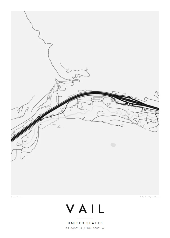
The creek runs the length of town beside Interstate 70, and the two lines together set the east-west grain of the whole map, from the Vail Pass approach down toward West Vail.
Poster minimalist tal-mappa · l-Istati Uniti
39.6438° N / 106.3888° W
A long, narrow town pulled east to west along Gore Creek and the interstate, the ski mountain rising to its south.


Belt waħda, ħames atmosferi
Agħfas fuq stil biex tarah fuq il-ħajt. Kull stil jiswa l-istess — stampat, inkurnat jew bħala fajls HD.
 Pixels reali · fajl tal-istampar 24 × 36″
Preċiż għall-istampar
Dan huwa qtugħ ta' 100% mill-fajl tal-istampar reali. Kull poster — stampat, inkurnat jew iddawnlowdjat — jiġi ġġenerat fuq is-servers tagħna b'300 DPI, sa 7,200 × 10,800 pixel, biex saħansitra l-iżgħar toroq jibqgħu ċari fuq stampa ta' 24 × 36″.
Fuq il-ħajt


Il-mappa
From above, Vail barely has a width. The town follows the floor of the Gore Creek valley for several miles, squeezed between steep slopes, with Interstate 70 running the full length of it. Frontage roads, roundabouts and the thin line of the creek all run in parallel, so the map reads as a set of stretched bands rather than a grid, broken only where the village cores cluster at the base of the lifts.
Vail opened as a ski area in 1962 on what had been grazing land, founded by a group that included Pete Seibert, a veteran of the 10th Mountain Division, which trained at nearby Camp Hale during the Second World War. The pedestrian lanes of Vail Village were laid out with Alpine towns in mind, and they still show up on the map as a knot of short, curving streets among the straight valley lines.
A Vail map poster keeps that contrast legible: the dense little villages of Vail Village and Lionshead, the long parallel ribbons of road and water, and the empty space where the mountain climbs toward the Back Bowls. It is a quiet, graphic picture of a place most people remember in terms of snow and light, redrawn as lines on paper.
The creek runs the length of town beside Interstate 70, and the two lines together set the east-west grain of the whole map, from the Vail Pass approach down toward West Vail.
The original village core is a tight cluster of short, bending pedestrian streets and a covered bridge over Gore Creek, noticeably finer in texture than anything else in the valley.
South of the ridge the mountain opens into wide, treeless bowls. On a street map they appear as open ground, a calm counterweight to the busy valley floor below.
Agħmlu tiegħek
Żid data, isem jew sentenza tiegħek, ibdel l-istil, id-daqs jew l-orjentazzjoni.
Il-preview b'xejn hija b'riżoluzzjoni baxxa u bil-watermark. L-istampi u l-fajls HD jiġu ġġenerati b'300 DPI, sa 7,200 × 10,800 px, mingħajr watermark.
Għaliex Vail
For many people Vail is tied to a specific week: a first trip, an annual family tradition, a season spent working the lifts. A map of the valley brings that back without resorting to a photo, and it sits comfortably in a hallway, a cabin or a city apartment far from the mountains.
You can set your own title and subtitle, adjust the coordinates line to mark a lodge or a year, and choose from five styles: Classic black & white, Noir, Paper, Blueprint or Sand. Download the HD files for $9 or order a matte print, framed in wood if you like.
Ordna l-poster Vail| Daqs tal-istampa | Riżoluzzjoni | Fajls |
|---|---|---|
| 30 × 40 cm (11.8 × 15.7″) | 3,543 × 4,724 px | PNG · PDF |
| 29.7 × 42 cm (A3, 11.7 × 16.5″) | 3,508 × 4,961 px | PNG · PDF |
| 42 × 59.4 cm (A2, 16.5 × 23.4″) | 4,961 × 7,016 px | PNG · PDF |
| 45.7 × 61 cm (18 × 24″) | 5,400 × 7,200 px | PNG · PDF |
| 50 × 70 cm (19.7 × 27.6″) | 5,906 × 8,268 px | PNG · PDF |
| 61 × 91.4 cm (24 × 36″) | 7,200 × 10,800 px | PNG · PDF |
Għal paragun, il-preview b'xejn huwa wiesa' 900 px, għandu watermark u huwa maħsub għall-iskrins. Il-fajls HD għandhom sa 8× ir-riżoluzzjoni f'kull direzzjoni u jiġu stampati b'mod nadif fid-daqs sħiħ tal-poster.
Agħżel stil fin-naħa ta' fuq tal-paġna, imbagħad agħżel Poster Stampat — daqs u, jekk trid, kurniċa — jew Fajls Diġitali HD. Il-ħlas isir f'pass wieħed, u l-paġna tal-ordni tiegħek tiġi aġġornata malli l-ħlas jgħaddi.
Jiġi stampat fuq karta matte premium ta' 200 gsm f'wieħed minn sitt daqsijiet, minn 30 × 40 cm sa 24 × 36″. Il-posters stampati jibdew minn {printFrom}, bil-kunsinna inkluża.
Iva. Agħżel kurniċa tal-injam solidu f'iswed, abjad, ballut naturali jew injam skur. Tiġi bi ħġieġ li ma jinkisirx u lesta biex tittella'. Il-posters inkurnati jibdew minn {framedFrom}, bil-kunsinna inkluża.
Il-kunsinna hija b'xejn madwar id-dinja. Kull poster jiġi stampat mill-eqreb sieħeb tal-istampar tagħna f'aktar minn 30 pajjiż u ġeneralment jasal fi 3–7 ijiem tax-xogħol. Tista' ssegwi l-istatus u t-tracking taħt L-Ordnijiet Tiegħi.
Ibgħatilna ritratt fi żmien 14-il jum mill-kunsinna u aħna nistampawh mill-ġdid b'xejn jew nirrimborżawk.
Iva. Fl-editur ta' din il-paġna, biddel it-titlu, is-sottotitlu u l-linja tal-koordinati għal kwalunkwe ħaġa trid, u agħżel stil u daqs. L-ordnijiet stampati, inkurnati u diġitali kollha jużaw eżattament id-disinn tiegħek.
Għal $9 tikseb fajls PNG b'300 DPI u PDF lesti għall-istampar fis-sitt daqsijiet kollha, mingħajr watermark, biex tistampa kullimkien. Għadek mhux ċert? L-ewwel iddawnlowdja preview b'xejn bil-watermark.
