Uraniborg site
Near the middle of the island, the site of Tycho Brahe's observatory and its reconstructed garden forms a small, deliberate geometric figure among the surrounding farmland.
Poster minimalist tal-mappa · l-Iżvezja
55.9058° N / 12.6958° E
A small, flat-topped island in the Øresund, ringed by steep banks and crossed by quiet lanes between open fields.




Belt waħda, ħames atmosferi
Agħfas fuq stil biex tarah fuq il-ħajt. Kull stil jiswa l-istess — stampat, inkurnat jew bħala fajls HD.
 Pixels reali · fajl tal-istampar 24 × 36″
Preċiż għall-istampar
Dan huwa qtugħ ta' 100% mill-fajl tal-istampar reali. Kull poster — stampat, inkurnat jew iddawnlowdjat — jiġi ġġenerat fuq is-servers tagħna b'300 DPI, sa 7,200 × 10,800 pixel, biex saħansitra l-iżgħar toroq jibqgħu ċari fuq stampa ta' 24 × 36″.
Fuq il-ħajt


Il-mappa
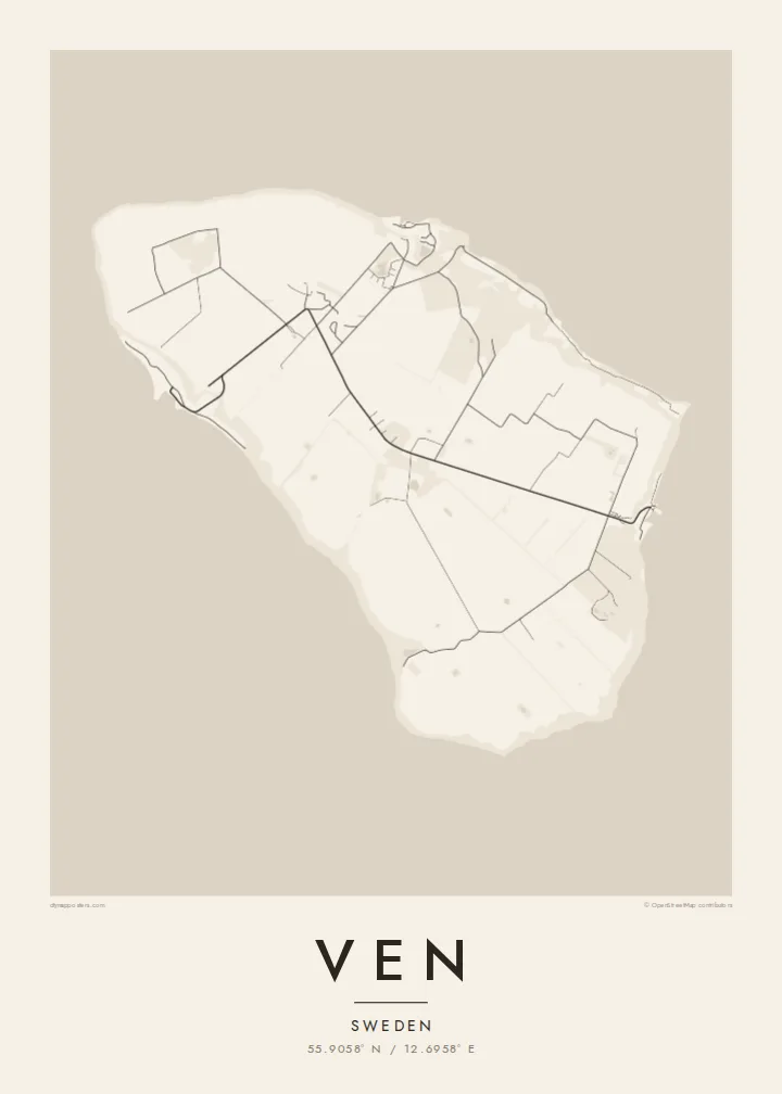
Ven sits in the middle of the Øresund, the strait between Sweden and Denmark, and belongs to Landskrona municipality on the Swedish side. It is a compact oval island, a raised plateau of farmland whose steep slopes and cliffs drop to narrow beaches. From above, the patchwork of fields and the thin lanes crossing them give the interior a gentle, almost ruled texture.
The island is best known for Tycho Brahe, the Danish astronomer who was granted Ven in the 1570s and built two observatories there, Uraniborg and the partly underground Stjerneborg. His precise observations of the stars and planets later helped Johannes Kepler work out the laws of planetary motion. The site is now a museum, and its Renaissance garden has been reconstructed in a clear geometric plan.
The harbours of Bäckviken and Kyrkbacken sit on the east and west coasts respectively, and the lanes between them are mostly travelled by bicycle. A Ven map poster shows the whole island at a glance. A little of the Swedish or Danish shore at the edge hints at how close the island is to both countries, and how separate from them.
Near the middle of the island, the site of Tycho Brahe's observatory and its reconstructed garden forms a small, deliberate geometric figure among the surrounding farmland.
The plateau ends abruptly at steep grassy slopes that drop to the water, so the coastline on the map is a firm, clean edge rather than a ragged one.
The ferry from Landskrona arrives at this small east-coast harbour. From there a short road climbs off the water onto the plateau and fans out into the island's lanes.
Agħmlu tiegħek
Żid data, isem jew sentenza tiegħek, ibdel l-istil, id-daqs jew l-orjentazzjoni.
Il-preview b'xejn hija b'riżoluzzjoni baxxa u bil-watermark. L-istampi u l-fajls HD jiġu ġġenerati b'300 DPI, sa 7,200 × 10,800 px, mingħajr watermark.
Għaliex Ven
Ven suits anyone drawn to the history of astronomy, and the many people who have cycled its lanes on a summer day out from Landskrona or Copenhagen. Its tidy oval shape is easy to recognise and holds a surprising amount of history for so small a place.
Personalise the title, subtitle and coordinates line, perhaps with the date of that ride or a line about Tycho, and choose one of five styles. Noir makes a fitting night sky. The files come as 300 DPI PNG and print-ready PDF in six sizes for $9, or you can order a printed poster, framed if you like.
Ordna l-poster Ven| Daqs tal-istampa | Riżoluzzjoni | Fajls |
|---|---|---|
| 30 × 40 cm (11.8 × 15.7″) | 3,543 × 4,724 px | PNG · PDF |
| 29.7 × 42 cm (A3, 11.7 × 16.5″) | 3,508 × 4,961 px | PNG · PDF |
| 42 × 59.4 cm (A2, 16.5 × 23.4″) | 4,961 × 7,016 px | PNG · PDF |
| 45.7 × 61 cm (18 × 24″) | 5,400 × 7,200 px | PNG · PDF |
| 50 × 70 cm (19.7 × 27.6″) | 5,906 × 8,268 px | PNG · PDF |
| 61 × 91.4 cm (24 × 36″) | 7,200 × 10,800 px | PNG · PDF |
Għal paragun, il-preview b'xejn huwa wiesa' 900 px, għandu watermark u huwa maħsub għall-iskrins. Il-fajls HD għandhom sa 8× ir-riżoluzzjoni f'kull direzzjoni u jiġu stampati b'mod nadif fid-daqs sħiħ tal-poster.
Agħżel stil fin-naħa ta' fuq tal-paġna, imbagħad agħżel Poster Stampat — daqs u, jekk trid, kurniċa — jew Fajls Diġitali HD. Il-ħlas isir f'pass wieħed, u l-paġna tal-ordni tiegħek tiġi aġġornata malli l-ħlas jgħaddi.
Jiġi stampat fuq karta matte premium ta' 200 gsm f'wieħed minn sitt daqsijiet, minn 30 × 40 cm sa 24 × 36″. Il-posters stampati jibdew minn {printFrom}, bil-kunsinna inkluża.
Iva. Agħżel kurniċa tal-injam solidu f'iswed, abjad, ballut naturali jew injam skur. Tiġi bi ħġieġ li ma jinkisirx u lesta biex tittella'. Il-posters inkurnati jibdew minn {framedFrom}, bil-kunsinna inkluża.
L-ispedizzjoni hija b'xejn mad-dinja kollha. Kull poster jiġi stampat mill-eqreb wieħed mis-sieħba tal-istampar tagħna f'aktar minn 30 pajjiż u normalment jaslilek fi 3–7 ijiem tax-xogħol. Tista' tsegwi l-istatus u t-traċċar taħt L-Ordnijiet Tiegħi. Xi pajjiżi jieħdu 2–5 ġimgħat, u fejn għadna ma nispedixxux, is-sit jgħidlek qabel ma tħallas.
Ibgħatilna ritratt fi żmien 14-il jum mill-kunsinna u aħna nistampawh mill-ġdid b'xejn jew nirrimborżawk.
Iva. Fl-editur ta' din il-paġna, biddel it-titlu, is-sottotitlu u l-linja tal-koordinati għal kwalunkwe ħaġa trid, u agħżel stil u daqs. L-ordnijiet stampati, inkurnati u diġitali kollha jużaw eżattament id-disinn tiegħek.
Għal $9 tikseb fajls PNG b'300 DPI u PDF lesti għall-istampar fis-sitt daqsijiet kollha, mingħajr watermark, biex tistampa kullimkien. Għadek mhux ċert? L-ewwel iddawnlowdja preview b'xejn bil-watermark.
