University campuses
The University of Waterloo and Wilfrid Laurier take up large parcels near the centre. On the map they read as open, lightly built areas surrounded by residential streets.
Poster minimalist tal-mappa · il-Kanada
43.4668° N / 80.5164° W
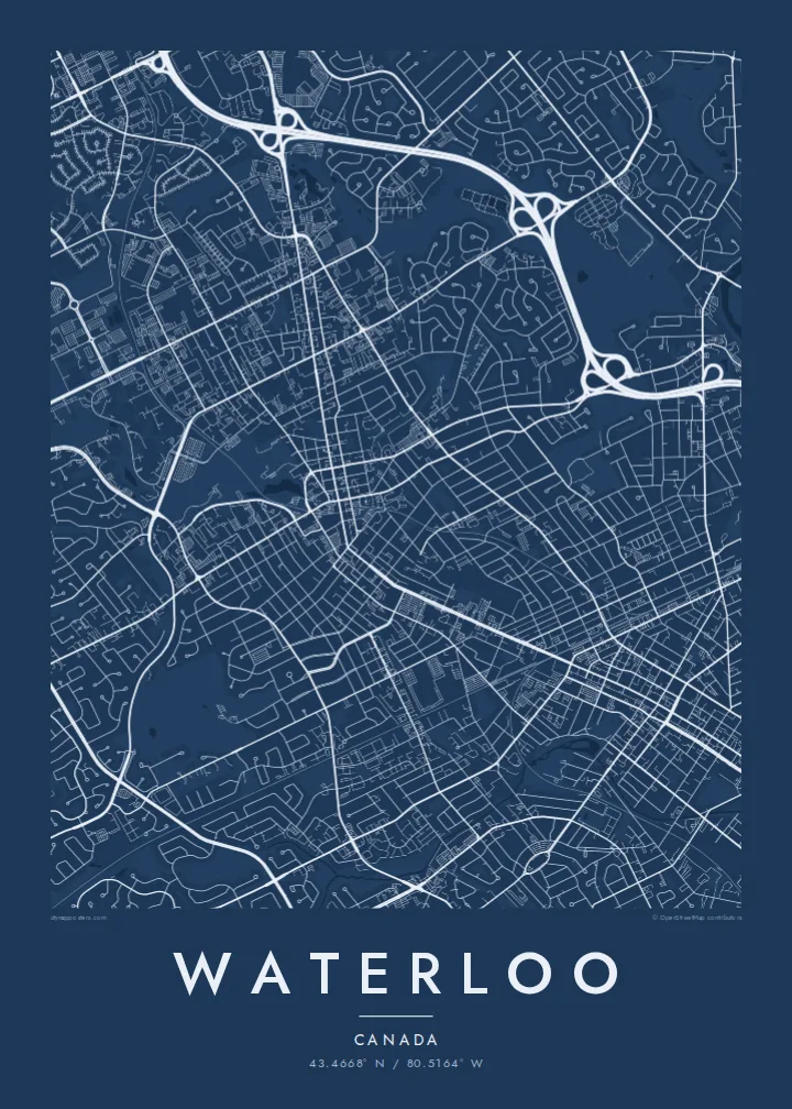
A university city of curving suburban streets and green corridors, with two large campuses at its centre and Kitchener to the south.



Belt waħda, ħames atmosferi
Agħfas fuq stil biex tarah fuq il-ħajt. Kull stil jiswa l-istess — stampat, inkurnat jew bħala fajls HD.
 Pixels reali · fajl tal-istampar 24 × 36″
Preċiż għall-istampar
Dan huwa qtugħ ta' 100% mill-fajl tal-istampar reali. Kull poster — stampat, inkurnat jew iddawnlowdjat — jiġi ġġenerat fuq is-servers tagħna b'300 DPI, sa 7,200 × 10,800 pixel, biex saħansitra l-iżgħar toroq jibqgħu ċari fuq stampa ta' 24 × 36″.
Fuq il-ħajt


Il-mappa
Waterloo runs directly into Kitchener, and on a map the two form one continuous urban area in southwestern Ontario. Waterloo's part is defined by its two universities. The University of Waterloo campus spreads across a wide open parcel north of Uptown, and Wilfrid Laurier sits closer to the centre. Around them, suburban streets curve and loop in the patterns of postwar planning.
Laurel Creek winds through the city from the northwest and feeds Silver Lake in Waterloo Park, which forms a long green band between the campuses and Uptown. The ION light rail line runs north–south through the middle. Waterloo is known for its technology sector, including BlackBerry's origins here, and for research institutions such as the Perimeter Institute for Theoretical Physics.
A Waterloo map poster captures a university town that has grown into a city. In black and white, the campuses and parks appear as large open shapes, Uptown's small grid as a dense knot, and the curving subdivisions as a soft texture reaching out to the farmland on the edges.
The University of Waterloo and Wilfrid Laurier take up large parcels near the centre. On the map they read as open, lightly built areas surrounded by residential streets.
A long stretch of parkland along Laurel Creek and Silver Lake links the campuses to Uptown, a green spine through the middle of the city.
The light rail line runs north–south, connecting Waterloo to Kitchener and marking a straight path through the curving suburban streets.
Agħmlu tiegħek
Żid data, isem jew sentenza tiegħek, ibdel l-istil, id-daqs jew l-orjentazzjoni.
Il-preview b'xejn hija b'riżoluzzjoni baxxa u bil-watermark. L-istampi u l-fajls HD jiġu ġġenerati b'300 DPI, sa 7,200 × 10,800 px, mingħajr watermark.
Għaliex Waterloo
Graduates, researchers and anyone who spent formative years here often feel strongly about Waterloo. A map of the campus and the surrounding streets makes a thoughtful graduation or farewell gift.
Add a class year, a name or a campus as the title and subtitle, keep or adjust the coordinates, and choose one of five styles. Download the HD files for $9 or order a framed or unframed printed poster.
Ordna l-poster Waterloo| Daqs tal-istampa | Riżoluzzjoni | Fajls |
|---|---|---|
| 30 × 40 cm (11.8 × 15.7″) | 3,543 × 4,724 px | PNG · PDF |
| 29.7 × 42 cm (A3, 11.7 × 16.5″) | 3,508 × 4,961 px | PNG · PDF |
| 42 × 59.4 cm (A2, 16.5 × 23.4″) | 4,961 × 7,016 px | PNG · PDF |
| 45.7 × 61 cm (18 × 24″) | 5,400 × 7,200 px | PNG · PDF |
| 50 × 70 cm (19.7 × 27.6″) | 5,906 × 8,268 px | PNG · PDF |
| 61 × 91.4 cm (24 × 36″) | 7,200 × 10,800 px | PNG · PDF |
Għal paragun, il-preview b'xejn huwa wiesa' 900 px, għandu watermark u huwa maħsub għall-iskrins. Il-fajls HD għandhom sa 8× ir-riżoluzzjoni f'kull direzzjoni u jiġu stampati b'mod nadif fid-daqs sħiħ tal-poster.
Agħżel stil fin-naħa ta' fuq tal-paġna, imbagħad agħżel Poster Stampat — daqs u, jekk trid, kurniċa — jew Fajls Diġitali HD. Il-ħlas isir f'pass wieħed, u l-paġna tal-ordni tiegħek tiġi aġġornata malli l-ħlas jgħaddi.
Jiġi stampat fuq karta matte premium ta' 200 gsm f'wieħed minn sitt daqsijiet, minn 30 × 40 cm sa 24 × 36″. Il-posters stampati jibdew minn {printFrom}, bil-kunsinna inkluża.
Iva. Agħżel kurniċa tal-injam solidu f'iswed, abjad, ballut naturali jew injam skur. Tiġi bi ħġieġ li ma jinkisirx u lesta biex tittella'. Il-posters inkurnati jibdew minn {framedFrom}, bil-kunsinna inkluża.
Il-kunsinna hija b'xejn madwar id-dinja. Kull poster jiġi stampat mill-eqreb sieħeb tal-istampar tagħna f'aktar minn 30 pajjiż u ġeneralment jasal fi 3–7 ijiem tax-xogħol. Tista' ssegwi l-istatus u t-tracking taħt L-Ordnijiet Tiegħi.
Ibgħatilna ritratt fi żmien 14-il jum mill-kunsinna u aħna nistampawh mill-ġdid b'xejn jew nirrimborżawk.
Iva. Fl-editur ta' din il-paġna, biddel it-titlu, is-sottotitlu u l-linja tal-koordinati għal kwalunkwe ħaġa trid, u agħżel stil u daqs. L-ordnijiet stampati, inkurnati u diġitali kollha jużaw eżattament id-disinn tiegħek.
Għal $9 tikseb fajls PNG b'300 DPI u PDF lesti għall-istampar fis-sitt daqsijiet kollha, mingħajr watermark, biex tistampa kullimkien. Għadek mhux ċert? L-ewwel iddawnlowdja preview b'xejn bil-watermark.
