Rhône-Rhine Canal
The canal traces a smooth arc just south of the historic centre, running alongside the railway and giving the lower part of the map a clear, sweeping edge.
Minimalist map poster · France
47.7520° N / 7.3287° E
An Alsatian industrial city threaded by canals and rail yards, with a compact old core and rows of workers' housing.

One city, five moods
Tap a style to see it on the wall. Every style costs the same — printed, framed or as HD files.
 Actual pixels · 24 × 36″ print file
Print-sharp
This is a 100% crop of the real print file. Every poster — printed, framed or downloaded — is rendered on our servers at 300 DPI, up to 7,200 × 10,800 pixels, so even the smallest lanes stay crisp on a 24 × 36″ print.
On the wall

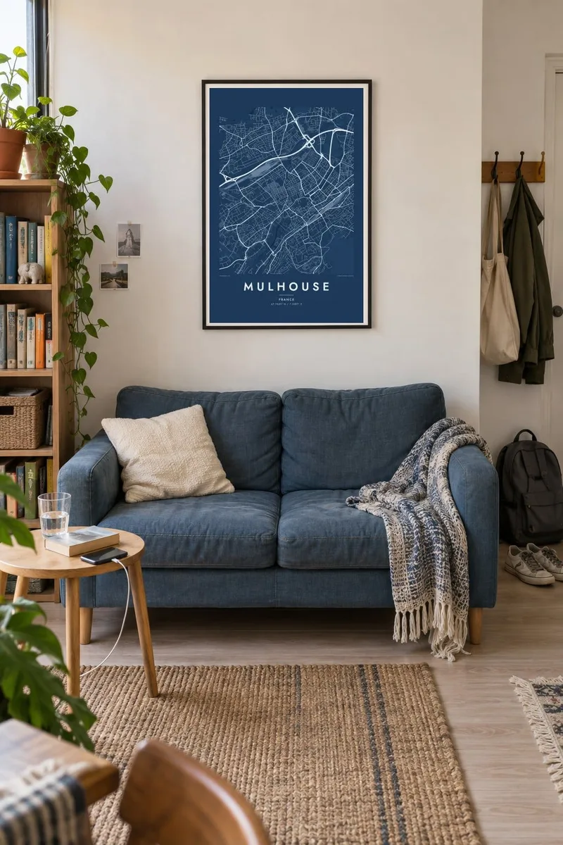

The map
Mulhouse lies in southern Alsace, a short distance from both the Swiss and German borders. On the map the city is threaded with water: the Ill and its branches, and the Rhône-Rhine Canal, which curves south of the centre beside the main railway station. Tracks and industrial sites fill much of the space between, remnants of the textile and engineering works that made the city prosperous.
The historic core is small and dense, gathered around Place de la Réunion and its town hall with painted facades. Mulhouse was a free city allied with the Swiss Confederation until it voted to join France in 1798, and its compact medieval footprint still stands apart from the broader nineteenth-century boulevards and industrial districts that grew up around it.
Beyond the centre lies the Cité ouvrière, one of the earliest planned workers' housing estates in Europe, begun in the 1850s as regular rows of small houses with gardens. A Mulhouse map poster brings these layers out clearly, from the old town to the industrial grid, along with the city's well-known museums of cars and trains on its fringes.
The canal traces a smooth arc just south of the historic centre, running alongside the railway and giving the lower part of the map a clear, sweeping edge.
The old town gathers around this square, with the Protestant Temple Saint-Étienne and the painted town hall. Its narrow streets form the tightest pattern on the sheet.
The nineteenth-century workers' estate is laid out in precise rows of near-identical plots, a patch of order that reads almost like a diagram when printed in black and white.
Make it yours
Add a date, a name or a line of your own, switch style, size or orientation.
The free preview is low-resolution with a watermark. Prints and HD files are rendered at 300 DPI, up to 7,200 × 10,800 px, without a watermark.
Why Mulhouse
Mulhouse suits people who admire industrial heritage, grew up in Alsace, or cross into the city from Basel or Freiburg for work. Its mix of canal curves, rail lines and dense old streets gives a poster that looks technical and intricate at once.
Name it in French or Alsatian, add a subtitle with a date that matters, and edit the coordinates line. Blueprint fits the engineering past, while Classic black and white, Noir, Paper and Sand offer alternatives. Printed posters ship on matte paper, framed or unframed.
Order the Mulhouse poster| Print size | Resolution | Files |
|---|---|---|
| 30 × 40 cm11.8 × 15.7″ | 3,543 × 4,724 px | PNG · PDF |
| 29.7 × 42 cm (A3)11.7 × 16.5″ | 3,508 × 4,961 px | PNG · PDF |
| 42 × 59.4 cm (A2)16.5 × 23.4″ | 4,961 × 7,016 px | PNG · PDF |
| 45.7 × 61 cm18 × 24″ | 5,400 × 7,200 px | PNG · PDF |
| 50 × 70 cm19.7 × 27.6″ | 5,906 × 8,268 px | PNG · PDF |
| 61 × 91.4 cm24 × 36″ | 7,200 × 10,800 px | PNG · PDF |
For comparison, the free preview is 900 px wide, watermarked and meant for screens. The HD files have up to 8× the resolution in each direction and print cleanly at full poster size.
Pick a style at the top of the page, then choose Printed Poster — a size and, if you like, a frame — or Digital HD Files. Checkout takes one step, and your order page updates as soon as the payment goes through.
It is printed on premium 200 gsm matte paper in one of six sizes, from 30 × 40 cm to 24 × 36″. Printed posters start at $39, shipping included.
Yes. Choose a solid wood frame in black, white, natural oak or dark wood. It comes with shatterproof glazing and is ready to hang. Framed posters start at $99, shipping included.
Shipping is free to 60+ countries. Each poster is printed by the nearest of our print partners in 30+ countries and usually arrives in 3–7 business days. You can follow the status and tracking under My Orders. A few countries take 2–5 weeks, and where we don't ship yet, the site tells you before you pay.
Send us a photo within 14 days of delivery and we will reprint it for free or refund you.
Yes. In the editor on this page, change the title, the subtitle and the coordinates line to anything you like, and pick a style and size. Printed, framed and digital orders all use exactly your design.
For $9 you get 300 DPI PNG and print-ready PDF files in all six sizes, without a watermark, to print anywhere. Not sure yet? Download a free watermarked preview first.
Nearby
