Public Square crossroads
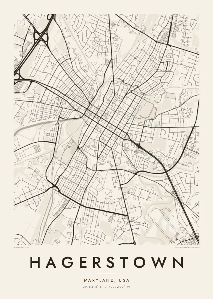
The downtown grid is organised around Public Square, where the city's two main streets meet. It is the historic centre and the point from which the map unfolds.
Minimalist map poster · United States
39.6418° N / 77.7200° W
A historic grid centred on Public Square, where two interstates meet in the Cumberland Valley of western Maryland




One city, five moods
Ekamowa emwit style ouga bwe ouga ekamowa e dedaña ñan bwega. Style otata a kor eangan — eprint, eframe ke HD files.
 Pixel ekwan · 24 × 36″ print file
Print-sharp
Enin 100% crop eo mai print file eo elango. Poster otata — eprint, eframe ke edownload — erender iaan server bwir e 300 DPI, dedaña ñan 7,200 × 10,800 pixels, bwe lane ekekedik ekwan ebwe crisp iaan print 24 × 36″.
Ituro


The map
Hagerstown was founded in the eighteenth century by Jonathan Hager and grew into the county seat of Washington County, Maryland. Its downtown follows a regular grid of streets meeting at Public Square, where the two main streets cross. From that point the grid extends in every direction before loosening into later neighbourhoods and commercial strips.
The city is nicknamed the Hub City because of the railroads that once converged here, and today Interstates 70 and 81 cross just outside town. Nearby lie the Antietam battlefield and the Appalachian Trail, and City Park, with its lake and art museum, forms a green area close to downtown.
A Hagerstown map poster brings out the clarity of the old grid alongside the curving highways and rail lines that made the city a crossroads. The square downtown blocks, the park and the lines of transport give the design balance and a strong sense of history, all in the calm language of black and white.
The downtown grid is organised around Public Square, where the city's two main streets meet. It is the historic centre and the point from which the map unfolds.
Railroad lines sweep through the city, remnants of the network that gave Hagerstown its nickname. They cut across the grid in long curves that add movement to the map.
City Park, with its lake and museum, forms a large open shape close to downtown, softening the grid and giving the composition a place to rest.
Make it yours
Add a date, a name or a line of your own, switch style, size or orientation.
Preview ededa low-resolution im watermark. Print im HD files erender iaan 300 DPI, dedaña ñan 7,200 × 10,800 px, ededa watermark.
Why Hagerstown
A Hagerstown map suits people who grew up in the Cumberland Valley, alumni of local schools, or history lovers drawn to western Maryland. Add a family name, a founding year or a wedding date to the title for a personal touch.
Pick a style from Classic black & white, Noir, Paper, Blueprint and Sand. Printed posters on matte paper, with an optional wooden frame, are shipped from partners in over 30 countries, or you can download HD files for $9.
Oder poster Hagerstown| Print size | Resolution | Files |
|---|---|---|
| 30 × 40 cm11.8 × 15.7″ | 3,543 × 4,724 px | PNG · PDF |
| 29.7 × 42 cm (A3)11.7 × 16.5″ | 3,508 × 4,961 px | PNG · PDF |
| 42 × 59.4 cm (A2)16.5 × 23.4″ | 4,961 × 7,016 px | PNG · PDF |
| 45.7 × 61 cm18 × 24″ | 5,400 × 7,200 px | PNG · PDF |
| 50 × 70 cm19.7 × 27.6″ | 5,906 × 8,268 px | PNG · PDF |
| 61 × 91.4 cm24 × 36″ | 7,200 × 10,800 px | PNG · PDF |
For comparison, the free preview is 900 px wide, watermarked and meant for screens. The HD files have up to 8× the resolution in each direction and print cleanly at full poster size.
Emwit style iaan capña page, im dogen Printed Poster — size eo, im framme ouga tomwin — ke Digital HD Files. Checkout eaer sit step, im order page bwira eupdate iaan payment eo emej.
Eprint iaan matte paper 200 gsm, iaan size eo eo, mai 30 × 40 cm ñan 24 × 36″. Poster eprint eo emeja iaan $39, shipping ededo.
Eko. Emwit frame wood solid iaan black, white, oak natural ke wood dark. Etaña shatterproof glazing im ready ñan hang. Poster eframe emeja iaan $99, shipping ededo.
Shipping ma free ägen 60+ country. Poster ngaga eo e print ägen print partner nearest ibiema 30+ country, ae e tep ägen 3–7 business day. Ngaga kor status ae tracking ibe My Orders. Country ibiema e tep 2–5 week, ae country ngaga ibe shipping e bwaren, website e ibin oen bwa ngaga pay.
Kabun photo bwira iaan 14 aean mai delivery, im bwira ereprint ededo ke erefund.
Eko. Iaan editor page eanin, ouga change title, subtitle, im coordinates line ñan tomwin ouga koda, im emwit style im size. Order eprint, eframe im digital otata ekamowa design ouga tomwin.
Iaan $9 ouga ereub 300 DPI PNG im PDF print-ready iaan size otata eo, ededa watermark, ñan print ekamowa tomwin. Ouga aewedik? Download preview ededa watermarked kabun.
Nearby
