The border river
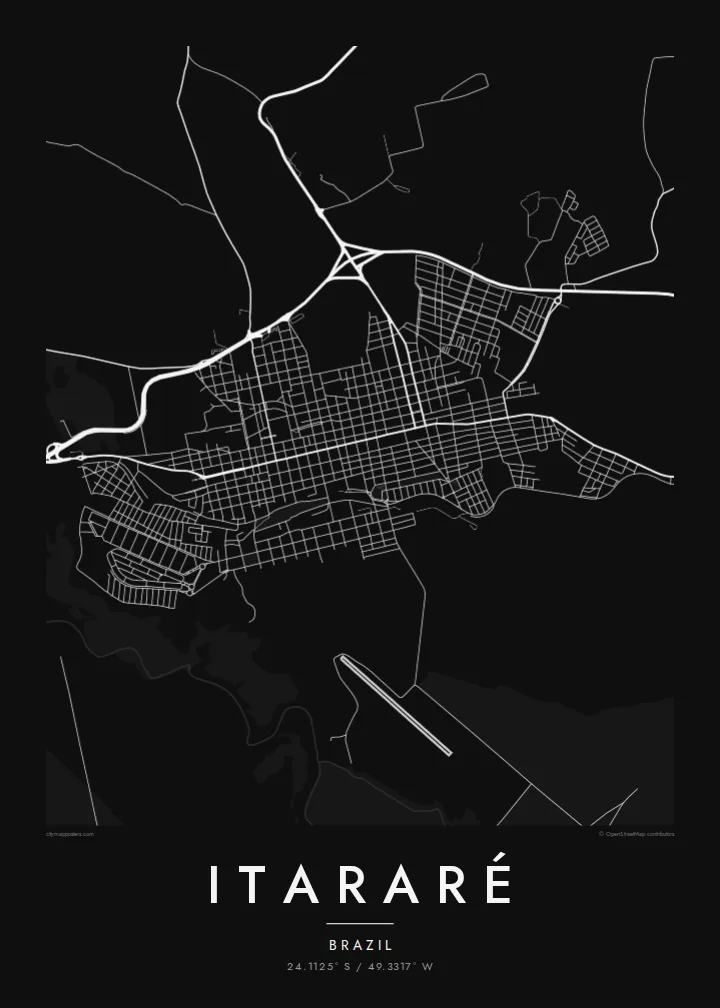
The Itararé river runs along the state line and gives the map a natural western edge between São Paulo and Paraná.
Minimalist map poster · Brazil
24.1125° S / 49.3317° W
A frontier town on the São Paulo–Paraná border, laid out in a grid beside the river that gave it its name



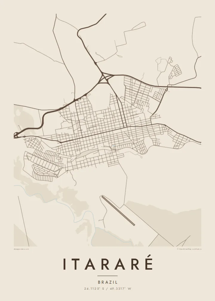
One city, five moods
Ekamowa emwit style ouga bwe ouga ekamowa e dedaña ñan bwega. Style otata a kor eangan — eprint, eframe ke HD files.
 Pixel ekwan · 24 × 36″ print file
Print-sharp
Enin 100% crop eo mai print file eo elango. Poster otata — eprint, eframe ke edownload — erender iaan server bwir e 300 DPI, dedaña ñan 7,200 × 10,800 pixels, bwe lane ekekedik ekwan ebwe crisp iaan print 24 × 36″.
Ituro


The map
Itararé sits in the far south of São Paulo state, right at the border with Paraná. The Itararé river marks the boundary between the two states. On the map, the town forms a fairly regular grid of blocks on rolling upland, with roads leaving in several directions towards farmland and neighbouring towns. The river valley to the west is cut into the landscape.
The name comes from Tupi and is usually translated as stone carved by water, which fits the eroded river gorges in the region. Itararé is also famous in Brazilian history for the battle that never happened. In 1930, government and revolutionary forces were expected to clash near the town, but the fighting was called off before it started.
An Itararé map poster shows a border town in its simplest form: a compact grid, a few long approach roads and the line of a river that divides two states. The humorist Apparício Torelly took his pen name, Barão de Itararé, from the non-battle, and that story gives this quiet map a wry footnote.
The Itararé river runs along the state line and gives the map a natural western edge between São Paulo and Paraná.
The central blocks are laid out regularly on gently rolling ground, and a small number of main roads carry traffic in and out of town.
Highways leave the town towards both São Paulo and Paraná, drawing long lines that show its position as a crossing point.
Make it yours
Add a date, a name or a line of your own, switch style, size or orientation.
Preview ededa low-resolution im watermark. Print im HD files erender iaan 300 DPI, dedaña ñan 7,200 × 10,800 px, ededa watermark.
Why Itararé
People hang Itararé for family ties, for a childhood in the interior or for its odd place in the history of 1930. The simple grid next to the border river makes a clean, balanced picture on the wall.
The title, subtitle and coordinates line are all editable, so the poster can carry a name, a date or a private joke about the battle that never was. Pick from five styles: Classic black & white, Noir, Paper, Blueprint or Sand.
Oder poster Itararé| Print size | Resolution | Files |
|---|---|---|
| 30 × 40 cm (11.8 × 15.7″) | 3,543 × 4,724 px | PNG · PDF |
| 29.7 × 42 cm (A3, 11.7 × 16.5″) | 3,508 × 4,961 px | PNG · PDF |
| 42 × 59.4 cm (A2, 16.5 × 23.4″) | 4,961 × 7,016 px | PNG · PDF |
| 45.7 × 61 cm (18 × 24″) | 5,400 × 7,200 px | PNG · PDF |
| 50 × 70 cm (19.7 × 27.6″) | 5,906 × 8,268 px | PNG · PDF |
| 61 × 91.4 cm (24 × 36″) | 7,200 × 10,800 px | PNG · PDF |
For comparison, the free preview is 900 px wide, watermarked and meant for screens. The HD files have up to 8× the resolution in each direction and print cleanly at full poster size.
Emwit style iaan capña page, im dogen Printed Poster — size eo, im framme ouga tomwin — ke Digital HD Files. Checkout eaer sit step, im order page bwira eupdate iaan payment eo emej.
Eprint iaan matte paper 200 gsm, iaan size eo eo, mai 30 × 40 cm ñan 24 × 36″. Poster eprint eo emeja iaan $39, shipping ededo.
Eko. Emwit frame wood solid iaan black, white, oak natural ke wood dark. Etaña shatterproof glazing im ready ñan hang. Poster eframe emeja iaan $99, shipping ededo.
Eaeoen e ngaaba ngeni ouwa age ngaabe. Ngaeo poster e ibiyaneo ibon e print partner eg ibom ngaen ingi ngae 30+ eben, e naeo e yan ngaae e 3–7 aon wan ewa. Kom ngaa e eain ingi tracking ibon My Orders. Tauweo ebe 2–5 wik, ingi ibon ngaen ibun e ngaeo ngaeigie, e saet e sooe nuwe kom e pae.
Kabun photo bwira iaan 14 aean mai delivery, im bwira ereprint ededo ke erefund.
Eko. Iaan editor page eanin, ouga change title, subtitle, im coordinates line ñan tomwin ouga koda, im emwit style im size. Order eprint, eframe im digital otata ekamowa design ouga tomwin.
Iaan $9 ouga ereub 300 DPI PNG im PDF print-ready iaan size otata eo, ededa watermark, ñan print ekamowa tomwin. Ouga aewedik? Download preview ededa watermarked kabun.
