The Beltway curve
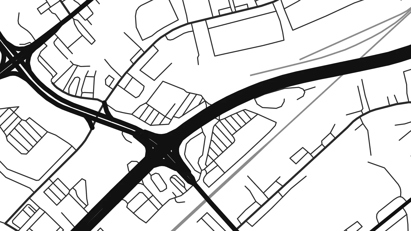
Interstate 695 passes through the community in a wide arc, its ramps and interchanges forming the boldest geometric shapes on the whole map.
Minimalist map poster · United States
39.3384° N / 76.4797° W
A suburban pocket of Baltimore County where the Beltway sweeps broad curves through quiet residential streets.


One city, five moods
Ekamowa emwit style ouga bwe ouga ekamowa e dedaña ñan bwega. Style otata a kor eangan — eprint, eframe ke HD files.
 Pixel ekwan · 24 × 36″ print file
Print-sharp
Enin 100% crop eo mai print file eo elango. Poster otata — eprint, eframe ke edownload — erender iaan server bwir e 300 DPI, dedaña ñan 7,200 × 10,800 pixels, bwe lane ekekedik ekwan ebwe crisp iaan print 24 × 36″.
Ituro


The map
Rossville is an unincorporated community in Baltimore County, just north-east of the Baltimore city line. On a map it is defined by movement. The Baltimore Beltway sweeps through in a long curve, and major routes towards White Marsh and the north-east corridor pass close by. Between these large roads sit neighbourhoods of houses on curving streets, pockets of garden apartments and the larger footprints of commercial and medical sites.
Its best-known landmark is the hospital campus at Franklin Square, a major medical centre that draws patients from across the eastern county. Around it, the street pattern mixes older roads that follow the terrain with newer postwar layouts. Small streams run south-east towards the rivers that feed the Chesapeake Bay, and the green strips along them give the plan a few softer lines.
For a place so often seen from a car window, the view from above is revealing. A Rossville map poster shows how the interchanges, arterial roads and residential streets fit together into one coherent picture. It is a good choice for people who grew up in eastern Baltimore County, work at the hospital or have made this corner of Maryland their home.
Interstate 695 passes through the community in a wide arc, its ramps and interchanges forming the boldest geometric shapes on the whole map.
The medical centre and its surrounding buildings and parking occupy a large block, one of the clearest landmarks in the local street pattern.
Narrow wooded strips follow small streams between neighbourhoods, breaking up the suburban pattern and hinting at the watershed that drains towards the Chesapeake Bay.
Make it yours
Add a date, a name or a line of your own, switch style, size or orientation.
Preview ededa low-resolution im watermark. Print im HD files erender iaan 300 DPI, dedaña ñan 7,200 × 10,800 px, ededa watermark.
Why Rossville
Rossville is home to commuters, hospital staff and families who have lived in eastern Baltimore County for generations. A poster of the neighbourhood makes a grounded, personal gift, especially for a new homeowner or someone who has moved away.
Set your own title and subtitle, and keep or edit the coordinates line. Choose Classic black & white, Noir, Paper, Blueprint or Sand. The $9 digital download includes six print sizes as 300 DPI PNG and print-ready PDF files.
Oder poster Rossville| Print size | Resolution | Files |
|---|---|---|
| 30 × 40 cm11.8 × 15.7″ | 3,543 × 4,724 px | PNG · PDF |
| 29.7 × 42 cm (A3)11.7 × 16.5″ | 3,508 × 4,961 px | PNG · PDF |
| 42 × 59.4 cm (A2)16.5 × 23.4″ | 4,961 × 7,016 px | PNG · PDF |
| 45.7 × 61 cm18 × 24″ | 5,400 × 7,200 px | PNG · PDF |
| 50 × 70 cm19.7 × 27.6″ | 5,906 × 8,268 px | PNG · PDF |
| 61 × 91.4 cm24 × 36″ | 7,200 × 10,800 px | PNG · PDF |
For comparison, the free preview is 900 px wide, watermarked and meant for screens. The HD files have up to 8× the resolution in each direction and print cleanly at full poster size.
Emwit style iaan capña page, im dogen Printed Poster — size eo, im framme ouga tomwin — ke Digital HD Files. Checkout eaer sit step, im order page bwira eupdate iaan payment eo emej.
Eprint iaan matte paper 200 gsm, iaan size eo eo, mai 30 × 40 cm ñan 24 × 36″. Poster eprint eo emeja iaan $39, shipping ededo.
Eko. Emwit frame wood solid iaan black, white, oak natural ke wood dark. Etaña shatterproof glazing im ready ñan hang. Poster eframe emeja iaan $99, shipping ededo.
Shipping ma free ägen 60+ country. Poster ngaga eo e print ägen print partner nearest ibiema 30+ country, ae e tep ägen 3–7 business day. Ngaga kor status ae tracking ibe My Orders. Country ibiema e tep 2–5 week, ae country ngaga ibe shipping e bwaren, website e ibin oen bwa ngaga pay.
Kabun photo bwira iaan 14 aean mai delivery, im bwira ereprint ededo ke erefund.
Eko. Iaan editor page eanin, ouga change title, subtitle, im coordinates line ñan tomwin ouga koda, im emwit style im size. Order eprint, eframe im digital otata ekamowa design ouga tomwin.
Iaan $9 ouga ereub 300 DPI PNG im PDF print-ready iaan size otata eo, ededa watermark, ñan print ekamowa tomwin. Ouga aewedik? Download preview ededa watermarked kabun.
Nearby
