Railway line
The railway crosses the district in a long, steady line, one of the few perfectly straight features among the curving village roads and field boundaries.
Minimalist map poster · Indonesia
8.1058° S / 112.0159° E
A town in East Java's Tulungagung area, where village roads, rice fields and a railway line form a patient rural pattern.

One city, five moods
Tap a style to see it on the wall. Every style costs the same — printed, framed or as HD files.
 Actual pixels · 24 × 36″ print file
Print-sharp
This is a 100% crop of the real print file. Every poster — printed, framed or downloaded — is rendered on our servers at 300 DPI, up to 7,200 × 10,800 pixels, so even the smallest lanes stay crisp on a 24 × 36″ print.
On the wall


The map
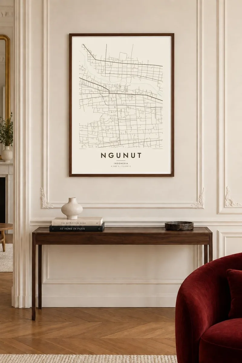
Ngunut is a district town in Tulungagung Regency, East Java, set in the broad agricultural lowlands of the Brantas river basin. The land here is flat and intensively farmed, and on a map the town appears as a concentration of streets and houses surrounded by a fine network of rice fields, irrigation channels and village roads.
A railway line connecting the towns of the regency with Blitar runs through the area, adding a long, straight line to an otherwise irregular pattern. Settlements across this part of Java tend to string along roads and blend into one another, so the edges of Ngunut are defined less by a clear boundary than by the gradual thinning of houses into fields.
A Ngunut map poster shows the quiet order of Javanese farmland alongside the denser core of the town. Rendered in black and white, the small parcels of rice fields and the threads of village lanes become a delicate texture, a portrait of a place shaped by agriculture, water and the everyday movement between neighbouring villages.
The railway crosses the district in a long, steady line, one of the few perfectly straight features among the curving village roads and field boundaries.
Irrigated paddies surround the town, dividing the land into small parcels that create a fine, dense texture across much of the poster.
Houses line the roads between neighbouring settlements, so the built-up area forms connecting threads rather than a single compact block.
Make it yours
Add a date, a name or a line of your own, switch style, size or orientation.
The free preview is low-resolution with a watermark. Prints and HD files are rendered at 300 DPI, up to 7,200 × 10,800 px, without a watermark.
Why Ngunut
For families from Tulungagung and people who have moved from East Java to larger cities or overseas, a map of Ngunut is a reminder of home at a human scale: the road to the market, the station, the fields on the way to relatives.
The title, subtitle and coordinates can be set however you like, with a name, a date or a short phrase. Choose one of five styles, download the $9 HD files in six sizes, or order a printed matte poster with an optional wooden frame.
Order the Ngunut poster| Print size | Resolution | Files |
|---|---|---|
| 30 × 40 cm11.8 × 15.7″ | 3,543 × 4,724 px | PNG · PDF |
| 29.7 × 42 cm (A3)11.7 × 16.5″ | 3,508 × 4,961 px | PNG · PDF |
| 42 × 59.4 cm (A2)16.5 × 23.4″ | 4,961 × 7,016 px | PNG · PDF |
| 45.7 × 61 cm18 × 24″ | 5,400 × 7,200 px | PNG · PDF |
| 50 × 70 cm19.7 × 27.6″ | 5,906 × 8,268 px | PNG · PDF |
| 61 × 91.4 cm24 × 36″ | 7,200 × 10,800 px | PNG · PDF |
For comparison, the free preview is 900 px wide, watermarked and meant for screens. The HD files have up to 8× the resolution in each direction and print cleanly at full poster size.
Pick a style at the top of the page, then choose Printed Poster — a size and, if you like, a frame — or Digital HD Files. Checkout takes one step, and your order page updates as soon as the payment goes through.
It is printed on premium 200 gsm matte paper in one of six sizes, from 30 × 40 cm to 24 × 36″. Printed posters start at $39, shipping included.
Yes. Choose a solid wood frame in black, white, natural oak or dark wood. It comes with shatterproof glazing and is ready to hang. Framed posters start at $99, shipping included.
Shipping is free to 60+ countries. Each poster is printed by the nearest of our print partners in 30+ countries and usually arrives in 3–7 business days. You can follow the status and tracking under My Orders. A few countries take 2–5 weeks, and where we don't ship yet, the site tells you before you pay.
Send us a photo within 14 days of delivery and we will reprint it for free or refund you.
Yes. In the editor on this page, change the title, the subtitle and the coordinates line to anything you like, and pick a style and size. Printed, framed and digital orders all use exactly your design.
For $9 you get 300 DPI PNG and print-ready PDF files in all six sizes, without a watermark, to print anywhere. Not sure yet? Download a free watermarked preview first.
Nearby
