Køge Bay shoreline
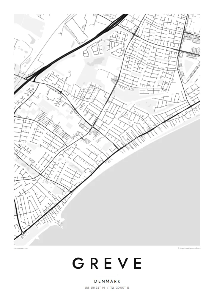
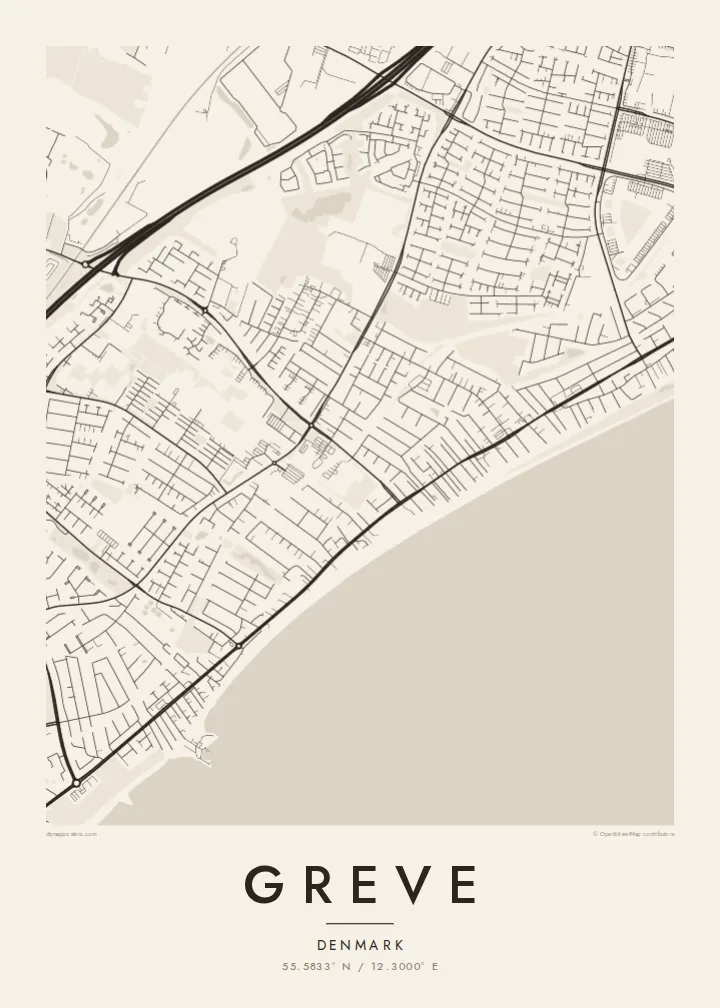
The eastern edge of the map is one long, gently curving coastline. The open water of Køge Bay takes up the side of the frame and gives the composition a calm, horizontal weight.
Fakatino mape mukamuka · Denmark
55.5833° N / 12.3000° E
A long, straight shoreline on Køge Bay, with a railway and a motorway running beside it and low suburban streets filling the land between



Taha e taone, lima e onoonoaga
Tapaki e taha puhala ke kitia ai ki luga he puipui. Kua tatai e totogi he tau puhala oti — pete he lolomi, poloka, po ke faila HD.
 Tau pikselo mooli · faila lolomi 24 × 36″
Maama mitaki ke lolomi
Ko e 100% e fahi mooli mai he faila lolomi. Ko e tau poster oti — pete kua lolomi, poloka, po ke utu hifo — kua taute ke he ha mautolu a tau tokoluga (server) ke he 300 DPI, hokotia ke he 7,200 × 10,800 piksela, ke maeke ai e tau ala ikiiki tote ke maaliali fakamitaki he lolomi 24 × 36″.
He Pā


Ko e mape
Seen from above, Greve is shaped by lines that run side by side. The coast of Køge Bay runs roughly north to south along its eastern edge. Just inland, a railway follows the same direction, and further west a motorway does too. Between these parallel strokes, the town fills in with residential streets, cul-de-sacs and small green pockets. The result is a pattern that is long and narrow and clearly tied to the water.
Much of Greve's shoreline is part of Køge Bugt Strandpark, a man-made beach park built along the bay in the late twentieth century. It brought sand, dunes and sheltered lagoons to a coast that had been flat and marshy. On the map, this shows up as a smooth outer edge of beach with a thin band of enclosed water behind it. It is one of the most distinctive shapes around Copenhagen's southern suburbs.
A Greve map poster shows how the town grew up as a coastal suburb of the capital. Denser pieces of street pattern gather around the stations. Older village cores sit a little further inland, and newer housing spreads in loops and branches between them. Printed in plain black and white, the drawing reads like a cross-section of Zealand's east coast, running from open water through beach and rail to farmland at the far edge.
The eastern edge of the map is one long, gently curving coastline. The open water of Køge Bay takes up the side of the frame and gives the composition a calm, horizontal weight.
Behind the reshaped beach, narrow lagoons and dunes form a second, inner line parallel to the sea. This double edge is easy to spot and sets Greve apart from neighbouring stretches of coast.
A suburban railway and a major motorway both run north to south through the municipality. They divide the town into long bands, with residential streets tucked between them and bridges or underpasses stitching the sides together.
Taute ke ha hau
Lafi e aho, taha higoa po ke taha kupu haau, hiki e fakatino, lahi po ke tuaga.
Ko e kitiaaga nakai totogi kua tote e maaliali mo e fakamailoga vai. Ko e tau lolomi mo e tau faila HD kua taute ke he 300 DPI, hokotia ke he 7,200 × 10,800 px, nakai fai fakamailoga vai.
Ko e ha Greve
Greve is where many people have their first home outside Copenhagen, or their summer mornings on the beach. For them, this map is a quiet reminder of walks along the bay and train rides into the city. It also marks the part of the coast they still think of as theirs.
You can personalise the title, subtitle and coordinates line with a street name, a date or a family name. Then choose one of five styles: Classic black & white, Noir, Paper, Blueprint or Sand. Download the HD files for $9, or order a printed poster with an optional wooden frame.
Talaage e poster Greve| Lahi he lolomi | Maama | Tau faila |
|---|---|---|
| 30 × 40 cm11.8 × 15.7″ | 3,543 × 4,724 px | PNG · PDF |
| 29.7 × 42 cm (A3)11.7 × 16.5″ | 3,508 × 4,961 px | PNG · PDF |
| 42 × 59.4 cm (A2)16.5 × 23.4″ | 4,961 × 7,016 px | PNG · PDF |
| 45.7 × 61 cm18 × 24″ | 5,400 × 7,200 px | PNG · PDF |
| 50 × 70 cm19.7 × 27.6″ | 5,906 × 8,268 px | PNG · PDF |
| 61 × 91.4 cm24 × 36″ | 7,200 × 10,800 px | PNG · PDF |
Ke fakatatai, ko e fakatino noa kua 900 px e laulahi, fai fakamailoga mo e mo e tau mata komipiuta ni. Ko e tau faila HD kua ato hoko ke he 8× e maama ke he tau faahi takitaha mo e lolomi mitaki he lahi katoa he fakatino.
Fifili e taha puhala i luga he kupega, ti fifili e Poster Lolomi — e lahi mo e, kaeke ke manako ai koe, taha poloka — po ke Tau Faila HD Fakaeletonika. Ko e fakaotiaga totogi ko e taha gahua ni, ti ko e kupega he hau a talaaga ka fakafou fakahaga i mua he fakaotiaga e totogi.
Kua lolomi ai ke he pepa mitaki 200 gsm matte he taha he tau lahi ono, mai he 30 × 40 cm ke hoko ke he 24 × 36″. Kamata e tau poster lolomi mai he $39, kua putoia ai e utaaga.
E. Fifili e poloka akau malolō ke he lanu uli, tea, akau oki mooli, po ke akau pouli. Kua fakalataha mo e sioga malolō nakai malepe ti kua mautali ke tautau. Kamata e tau poster poloka mai he $99, kua putoia ai e utaaga.
Nakai totogi e fakafano ke he motu 60+. Ko e fakatino taha kua lolomi he fenoga lolomi ha mautolu kua tata mo e tau motu 30+, kua hoko mai he tau aho gahua 3–7. Maeke ia koe ke kikite e tuaga mo e fakamuitua he lalo he Haku Tau Fakatonu. Ke he falu motu kua 2–5 e tau tapu, ti ka nakai fakafano a mautolu ki ai, to fakaha he api tupe ia ki mua he totogi.
Fakafano mai e taha ata ki a mautolu he loto he 14 e tau aho tali mai he hokoaga, ti to lolomi foki e mautolu nakai totogi po ke liu atu e totogi ki a koe.
E. He editor i luga he kupega nei, hikihiki e matakupu, e matakupu lalo mo e laini coordinates ke he taha mena kua manako a koe ki ai, ti fifili e puhala mo e lahi. Ko e tau talaaga lolomi, poloka mo e fakaeletonika oti kua fakaaoga tonu e hau a fakatino.
Ma e $9 ka moua e koe e tau faila PNG 300 DPI mo e PDF kua mautali ke lolomi he tau lahi ono oti, nakai fai fakamailoga vai, ke lolomi i fe mena. Nakai maopoopo agaia? Utu hifo fakamua e kitiaaga nakai totogi ne fai fakamailoga vai.
Tata mai
