Skyride tramway line
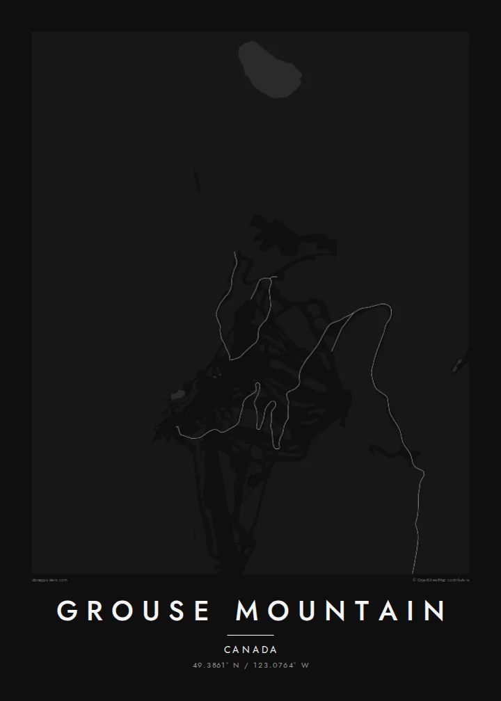
The aerial tramway runs in a straight line up the mountain's south face. It links the base area on the edge of the suburbs to the summit plateau.
Fakatino mape mukamuka · Canada
49.3861° N / 123.0764° W
A mountain summit looking straight down on Vancouver, with the city grid, Burrard Inlet and the North Shore spread below



Taha e taone, lima e onoonoaga
Tapaki e taha puhala ke kitia ai ki luga he puipui. Kua tatai e totogi he tau puhala oti — pete he lolomi, poloka, po ke faila HD.
 Tau pikselo mooli · faila lolomi 24 × 36″
Maama mitaki ke lolomi
Ko e 100% e fahi mooli mai he faila lolomi. Ko e tau poster oti — pete kua lolomi, poloka, po ke utu hifo — kua taute ke he ha mautolu a tau tokoluga (server) ke he 300 DPI, hokotia ke he 7,200 × 10,800 piksela, ke maeke ai e tau ala ikiiki tote ke maaliali fakamitaki he lolomi 24 × 36″.
He Pā


Ko e mape
Grouse Mountain rises directly above North Vancouver, and very few ski areas sit this close to a major city. On a map the mountain's forested slopes run straight into the suburban streets of the North Shore. Beyond them, across Burrard Inlet, lie the tight grid of downtown Vancouver and the green block of Stanley Park. The Capilano River cuts down along the western side of the mountain.
Most visitors ride the Skyride aerial tramway, whose line climbs straight up the slope from the base. Hikers take the Grouse Grind, a steep trail famous for its punishing climb. The runs are lit in the evening, so on winter nights the mountain can be seen from across the city. That relationship between mountain and city is what the map captures.
A Grouse Mountain map poster frames a rare kind of place, where alpine terrain and a dense harbour city share the same view. The contour lines of the summit give way to cul-de-sacs, arterial roads and the bridges over the inlet. The result reads as both a mountain map and a Vancouver map, which suits anyone with ties to the region.
The aerial tramway runs in a straight line up the mountain's south face. It links the base area on the edge of the suburbs to the summit plateau.
The inlet's shoreline separates the North Shore from downtown Vancouver. It shows the city's harbour and bridges in a single sweep beneath the slopes.
The Capilano valley runs down the mountain's western flank toward the inlet. It adds a deep, winding line to the forested terrain.
Taute ke ha hau
Lafi e aho, taha higoa po ke taha kupu haau, hiki e fakatino, lahi po ke tuaga.
Ko e kitiaaga nakai totogi kua tote e maaliali mo e fakamailoga vai. Ko e tau lolomi mo e tau faila HD kua taute ke he 300 DPI, hokotia ke he 7,200 × 10,800 px, nakai fai fakamailoga vai.
Ko e ha Grouse Mountain
For Vancouverites this is the mountain on the skyline, visible from office windows and beaches. For visitors it is the first real view of the city. A print keeps both perspectives together, with the peak and the streets on one sheet.
Add your own title, a subtitle such as a year or a trail time, and edit the coordinates line. Then pick from Classic black and white, Noir, Paper, Blueprint or Sand. Noir and Blueprint work especially well with the fine suburban street pattern.
Talaage e poster Grouse Mountain| Lahi he lolomi | Maama | Tau faila |
|---|---|---|
| 30 × 40 cm11.8 × 15.7″ | 3,543 × 4,724 px | PNG · PDF |
| 29.7 × 42 cm (A3)11.7 × 16.5″ | 3,508 × 4,961 px | PNG · PDF |
| 42 × 59.4 cm (A2)16.5 × 23.4″ | 4,961 × 7,016 px | PNG · PDF |
| 45.7 × 61 cm18 × 24″ | 5,400 × 7,200 px | PNG · PDF |
| 50 × 70 cm19.7 × 27.6″ | 5,906 × 8,268 px | PNG · PDF |
| 61 × 91.4 cm24 × 36″ | 7,200 × 10,800 px | PNG · PDF |
Ke fakatatai, ko e fakatino noa kua 900 px e laulahi, fai fakamailoga mo e mo e tau mata komipiuta ni. Ko e tau faila HD kua ato hoko ke he 8× e maama ke he tau faahi takitaha mo e lolomi mitaki he lahi katoa he fakatino.
Fifili e taha puhala i luga he kupega, ti fifili e Poster Lolomi — e lahi mo e, kaeke ke manako ai koe, taha poloka — po ke Tau Faila HD Fakaeletonika. Ko e fakaotiaga totogi ko e taha gahua ni, ti ko e kupega he hau a talaaga ka fakafou fakahaga i mua he fakaotiaga e totogi.
Kua lolomi ai ke he pepa mitaki 200 gsm matte he taha he tau lahi ono, mai he 30 × 40 cm ke hoko ke he 24 × 36″. Kamata e tau poster lolomi mai he $39, kua putoia ai e utaaga.
E. Fifili e poloka akau malolō ke he lanu uli, tea, akau oki mooli, po ke akau pouli. Kua fakalataha mo e sioga malolō nakai malepe ti kua mautali ke tautau. Kamata e tau poster poloka mai he $99, kua putoia ai e utaaga.
Nakai totogi e fakafano ke he motu 60+. Ko e fakatino taha kua lolomi he fenoga lolomi ha mautolu kua tata mo e tau motu 30+, kua hoko mai he tau aho gahua 3–7. Maeke ia koe ke kikite e tuaga mo e fakamuitua he lalo he Haku Tau Fakatonu. Ke he falu motu kua 2–5 e tau tapu, ti ka nakai fakafano a mautolu ki ai, to fakaha he api tupe ia ki mua he totogi.
Fakafano mai e taha ata ki a mautolu he loto he 14 e tau aho tali mai he hokoaga, ti to lolomi foki e mautolu nakai totogi po ke liu atu e totogi ki a koe.
E. He editor i luga he kupega nei, hikihiki e matakupu, e matakupu lalo mo e laini coordinates ke he taha mena kua manako a koe ki ai, ti fifili e puhala mo e lahi. Ko e tau talaaga lolomi, poloka mo e fakaeletonika oti kua fakaaoga tonu e hau a fakatino.
Ma e $9 ka moua e koe e tau faila PNG 300 DPI mo e PDF kua mautali ke lolomi he tau lahi ono oti, nakai fai fakamailoga vai, ke lolomi i fe mena. Nakai maopoopo agaia? Utu hifo fakamua e kitiaaga nakai totogi ne fai fakamailoga vai.
Tata mai
