Terraced hillsides
Centuries-old agricultural terraces wrap the slopes, and at detailed scales they give the island a layered, contour-like texture unlike any map built around roads.
Fakatino mape mukamuka · Bolivia
16.0181° S / 69.1781° W
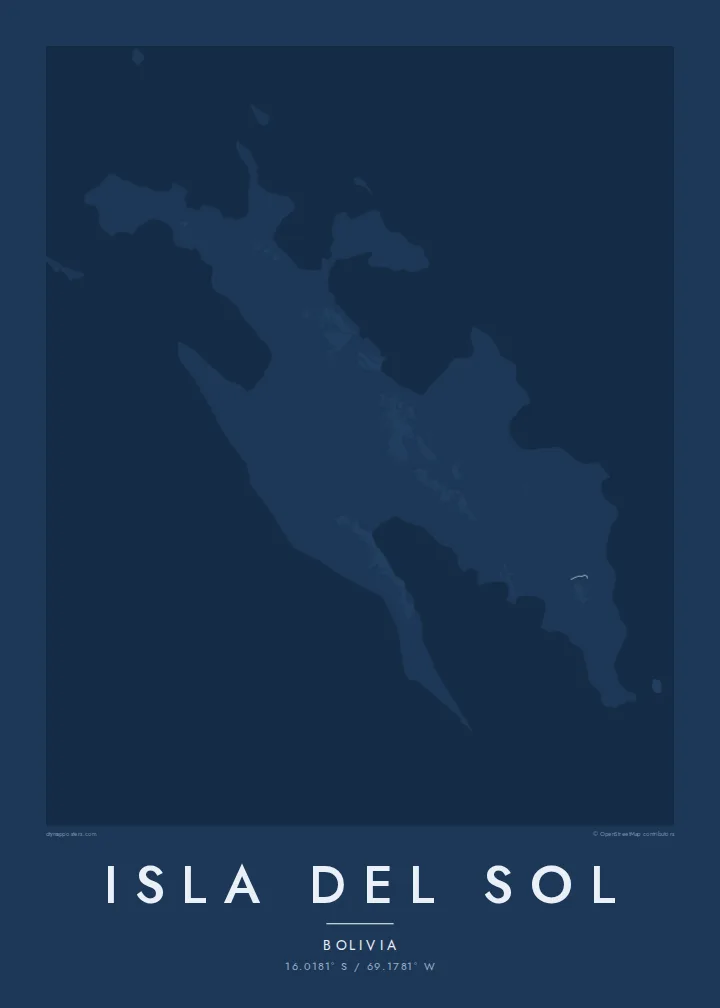
A long, ridged island in Lake Titicaca, its terraced slopes and stone paths running between bays on the Bolivian side.



Taha e taone, lima e onoonoaga
Tapaki e taha puhala ke kitia ai ki luga he puipui. Kua tatai e totogi he tau puhala oti — pete he lolomi, poloka, po ke faila HD.
 Tau pikselo mooli · faila lolomi 24 × 36″
Maama mitaki ke lolomi
Ko e 100% e fahi mooli mai he faila lolomi. Ko e tau poster oti — pete kua lolomi, poloka, po ke utu hifo — kua taute ke he ha mautolu a tau tokoluga (server) ke he 300 DPI, hokotia ke he 7,200 × 10,800 piksela, ke maeke ai e tau ala ikiiki tote ke maaliali fakamitaki he lolomi 24 × 36″.
He Pā


Ko e mape
Isla del Sol lies in the southern part of Lake Titicaca, a short boat ride from the Bolivian town of Copacabana. From above it is a long, narrow island with a knobbly outline, its shores broken into small bays and points. A ridge runs along much of its length, and the slopes on either side are covered in agricultural terraces that follow the contours like fingerprints.
There are no cars on the island, so the map is drawn in footpaths and stone stairways rather than roads. A main trail links the villages at the northern and southern ends, with smaller paths dropping to landing places on the shore. At roughly 3,800 metres above sea level, the lake around it is one of the highest navigable bodies of water in the world.
In Inca belief the island was the birthplace of the sun, and ruins from that period remain along its paths. An Isla del Sol map poster keeps the island surrounded by the wide, blank surface of the lake, with the neighbouring Isla de la Luna and the Copacabana peninsula framing the scene.
Centuries-old agricultural terraces wrap the slopes, and at detailed scales they give the island a layered, contour-like texture unlike any map built around roads.
A walking route along the spine of the island connects its main villages, drawn as a single thread that ties the whole composition together from one end to the other.
Lake Titicaca surrounds the island on every side, so the frame is mostly calm open water, with the Copacabana peninsula and Isla de la Luna close by.
Taute ke ha hau
Lafi e aho, taha higoa po ke taha kupu haau, hiki e fakatino, lahi po ke tuaga.
Ko e kitiaaga nakai totogi kua tote e maaliali mo e fakamailoga vai. Ko e tau lolomi mo e tau faila HD kua taute ke he 300 DPI, hokotia ke he 7,200 × 10,800 px, nakai fai fakamailoga vai.
Ko e ha Isla del Sol
This is a poster for travellers who crossed from Copacabana and walked the island end to end, and for anyone drawn to the high Andes. The simple lake-and-island composition reads well in a living room or above a desk.
You can set the title, a subtitle and the coordinates line to mark your own trip, then pick Classic black & white, Noir, Paper, Blueprint or Sand. Each $9 purchase includes 300 DPI PNG and print-ready PDF files in six sizes, without a watermark.
Talaage e poster Isla del Sol| Lahi he lolomi | Maama | Tau faila |
|---|---|---|
| 30 × 40 cm11.8 × 15.7″ | 3,543 × 4,724 px | PNG · PDF |
| 29.7 × 42 cm (A3)11.7 × 16.5″ | 3,508 × 4,961 px | PNG · PDF |
| 42 × 59.4 cm (A2)16.5 × 23.4″ | 4,961 × 7,016 px | PNG · PDF |
| 45.7 × 61 cm18 × 24″ | 5,400 × 7,200 px | PNG · PDF |
| 50 × 70 cm19.7 × 27.6″ | 5,906 × 8,268 px | PNG · PDF |
| 61 × 91.4 cm24 × 36″ | 7,200 × 10,800 px | PNG · PDF |
Ke fakatatai, ko e fakatino noa kua 900 px e laulahi, fai fakamailoga mo e mo e tau mata komipiuta ni. Ko e tau faila HD kua ato hoko ke he 8× e maama ke he tau faahi takitaha mo e lolomi mitaki he lahi katoa he fakatino.
Fifili e taha puhala i luga he kupega, ti fifili e Poster Lolomi — e lahi mo e, kaeke ke manako ai koe, taha poloka — po ke Tau Faila HD Fakaeletonika. Ko e fakaotiaga totogi ko e taha gahua ni, ti ko e kupega he hau a talaaga ka fakafou fakahaga i mua he fakaotiaga e totogi.
Kua lolomi ai ke he pepa mitaki 200 gsm matte he taha he tau lahi ono, mai he 30 × 40 cm ke hoko ke he 24 × 36″. Kamata e tau poster lolomi mai he $39, kua putoia ai e utaaga.
E. Fifili e poloka akau malolō ke he lanu uli, tea, akau oki mooli, po ke akau pouli. Kua fakalataha mo e sioga malolō nakai malepe ti kua mautali ke tautau. Kamata e tau poster poloka mai he $99, kua putoia ai e utaaga.
Nakai totogi e fakafano ke he motu 60+. Ko e fakatino taha kua lolomi he fenoga lolomi ha mautolu kua tata mo e tau motu 30+, kua hoko mai he tau aho gahua 3–7. Maeke ia koe ke kikite e tuaga mo e fakamuitua he lalo he Haku Tau Fakatonu. Ke he falu motu kua 2–5 e tau tapu, ti ka nakai fakafano a mautolu ki ai, to fakaha he api tupe ia ki mua he totogi.
Fakafano mai e taha ata ki a mautolu he loto he 14 e tau aho tali mai he hokoaga, ti to lolomi foki e mautolu nakai totogi po ke liu atu e totogi ki a koe.
E. He editor i luga he kupega nei, hikihiki e matakupu, e matakupu lalo mo e laini coordinates ke he taha mena kua manako a koe ki ai, ti fifili e puhala mo e lahi. Ko e tau talaaga lolomi, poloka mo e fakaeletonika oti kua fakaaoga tonu e hau a fakatino.
Ma e $9 ka moua e koe e tau faila PNG 300 DPI mo e PDF kua mautali ke lolomi he tau lahi ono oti, nakai fai fakamailoga vai, ke lolomi i fe mena. Nakai maopoopo agaia? Utu hifo fakamua e kitiaaga nakai totogi ne fai fakamailoga vai.
Tata mai
